

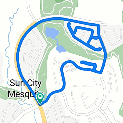
Sun City Bike Club Hard Ride 1 Out and Back Through Bunkerville to the I-15 Interchange
Eine Fahrradroute, die in Mesquite, Nevada, Vereinigte Staaten beginnt.
Übersicht
Über diese Route
This rides starts at the corner of Flat Top Mesa Drive and Falcon Ridge Parkway; continues on a downhill run South through the two roundabouts; then turns right off the second roundabout, crossing Leavett Lane to Hafen Lane; the ride continues by turning left (East) on Hafen Lane and riding to the intersection of NV 170 (Riverside Drive); riders now turn right onto Riverside Drive and continue on a lengthy ride of rollers through Bunkerville all the way to the I-15 interchange - there is a lengthy grade that begins passed the bridge that crosses the Virgin River all the way to the I-15 interchange; here the riders turn around and trace the same route along Riverside Drive back into Mesquite; at the corner of Riverside Drive and West Mesquite Boulevard, riders turn left (West) onto West Mesquite Boulevard and ride through the two roundabouts, bearing right on both of them onto Falcon Ridge Parkway; the ride ends with the climb along Falcon Ridge Parkway back to the starting point at the corner of Flat Top Mesa Drive and Falcon Ridge Parkway. Total Ride Distance: 30.13 Miles.
Notes: 1. If you open the route in Google Roadmap or Google Hybrid (pulled down from the "Relief Map" tab) you will get a more up-to-date view of the roads and paths. Some of the other maps are dated. 2. This mapping program tends to under-compute the total ride mileage by roughly 10%, based on mileage for this ride when it has been actually ridden. - -:--
- Dauer
- 48,5 km
- Distanz
- 288 m
- Aufstieg
- 287 m
- Abstieg
- ---
- Ø-Tempo
- ---
- Max. Höhe
Routenqualität
Wegtypen und Untergründe entlang der Route
Wegtypen
Radweg
6,8 km
(14 %)
Straße
2,4 km
(5 %)
Untergründe
Befestigt
43,7 km
(90 %)
Asphalt
37,8 km
(78 %)
Beton
5,8 km
(12 %)
Undefiniert
4,9 km
(10 %)
Weiter mit Bikemap
Diese Radroute verwenden, bearbeiten oder herunterladen
Du möchtest Sun City Bike Club Hard Ride 1 Out and Back Through Bunkerville to the I-15 Interchange fahren oder sie für deine eigene Reise anpassen? Folgendes kannst du mit dieser Bikemap-Route machen:
Gratis Funktionen
- Speichere diese Route als Favorit oder in einer Sammlung
- Kopiere & plane deine eigene Version dieser Route
- Synchronisiere deine Route mit Garmin oder Wahoo
Premium-Funktionen
Kostenlose Testversion für 3 Tage oder einmalige Zahlung. Mehr über Bikemap Premium.
- Navigiere diese Route auf iOS & Android
- Exportiere eine GPX / KML-Datei dieser Route
- Erstelle deinen individuellen Ausdruck (Jetzt kostenlos ausprobieren)
- Lade diese Route für die Offline-Navigation herunter
Entdecke weitere Premium-Funktionen.
Bikemap Premium aktivierenVon unserer Community
Mesquite: Andere beliebte Routen, die hier beginnen
 Sun City Bike Club Easy Ride 4 (Wagon Wheel, Overland Trail and Frontier Pass Neighborhoods)
- Distanz
- 5 km
- Aufstieg
- 91 m
- Abstieg
- 89 m
- Standort
- Mesquite, Nevada, Vereinigte Staaten
 Mesquite, NV - Mount Charleston, NV
- Distanz
- 182,8 km
- Aufstieg
- 2.261 m
- Abstieg
- 464 m
- Standort
- Mesquite, Nevada, Vereinigte Staaten
 Mesquite, NV - Dolan Springs, NV
- Distanz
- 238,4 km
- Aufstieg
- 1.600 m
- Abstieg
- 1.046 m
- Standort
- Mesquite, Nevada, Vereinigte Staaten
 Mesquite half loop.
- Distanz
- 17,6 km
- Aufstieg
- 253 m
- Abstieg
- 256 m
- Standort
- Mesquite, Nevada, Vereinigte Staaten
 Crescent Moon Crossing 830, Mesquite to Crescent Moon Bend 829, Mesquite
- Distanz
- 3,4 km
- Aufstieg
- 44 m
- Abstieg
- 45 m
- Standort
- Mesquite, Nevada, Vereinigte Staaten
 Sun City Bike Club Easy Ride 2 Out and Back Around Mesquite (With Some Climbs)
- Distanz
- 20,1 km
- Aufstieg
- 81 m
- Abstieg
- 82 m
- Standort
- Mesquite, Nevada, Vereinigte Staaten
 Recovered Route
- Distanz
- 12,1 km
- Aufstieg
- 278 m
- Abstieg
- 231 m
- Standort
- Mesquite, Nevada, Vereinigte Staaten
 Sun City Bike Club Easy Ride 3 (Tannery Cove)
- Distanz
- 4,5 km
- Aufstieg
- 114 m
- Abstieg
- 114 m
- Standort
- Mesquite, Nevada, Vereinigte Staaten
In der App öffnen