

Palud sur Verdon - Saint Auban
Eine Fahrradroute, die in Castellane, Provence-Alpes-Côte d'Azur Region, France beginnt.
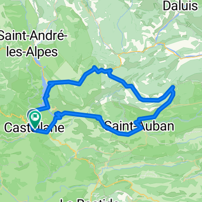
Übersicht
Über diese Route
- Etappe meiner Frankreich-Reise '08: <table style="border-collapse: collapse; width: 98pt;" border="0" cellspacing="0" cellpadding="0" width="131"> <tbody> <tr style="height: 12.75pt;" height="17"> <td style="height: 12.75pt; width: 98pt;" width="131" height="17">
Palud sur Verdon
</td> </tr> </tbody> </table> <table style="border-collapse: collapse; width: 98pt;" border="0" cellspacing="0" cellpadding="0" width="131"> <tbody> <tr style="height: 12.75pt;" height="17"> <td class="xl24" style="height: 12.75pt;" height="17">
Routes de Cretes
</td> </tr> </tbody> </table> <table style="border-collapse: collapse; width: 98pt;" border="0" cellspacing="0" cellpadding="0" width="131"> <tbody> <tr style="height: 12.75pt;" height="17"> <td class="xl24" style="height: 12.75pt;" height="17">
Pas de l'Aubac
</td> </tr> </tbody> </table> <table style="border-collapse: collapse; width: 98pt;" border="0" cellspacing="0" cellpadding="0" width="131"> <tbody> <tr style="height: 12.75pt;" height="17"> <td style="height: 12.75pt;" height="17">
Brans
</td> </tr> </tbody> </table> <table style="border-collapse: collapse; width: 98pt;" border="0" cellspacing="0" cellpadding="0" width="131"> <tbody> <tr style="height: 12.75pt;" height="17"> <td style="height: 12.75pt;" height="17">
Castellane
</td> </tr> </tbody> </table> <table style="border-collapse: collapse; width: 98pt;" border="0" cellspacing="0" cellpadding="0" width="131"> <tbody> <tr style="height: 12.75pt;" height="17"> <td style="height: 12.75pt;" height="17">
Le Cheiron
</td> </tr> </tbody> </table> <table style="border-collapse: collapse; width: 98pt;" border="0" cellspacing="0" cellpadding="0" width="131"> <tbody> <tr style="height: 12.75pt;" height="17"> <td class="xl24" style="height: 12.75pt;" height="17">
Col de la Blache
</td> </tr> </tbody> </table> <table style="border-collapse: collapse; width: 98pt;" border="0" cellspacing="0" cellpadding="0" width="131"> <tbody> <tr style="height: 12.75pt;" height="17"> <td style="height: 12.75pt;" height="17">
Demandolx
</td> </tr> </tbody> </table> <table style="border-collapse: collapse; width: 98pt;" border="0" cellspacing="0" cellpadding="0" width="131"> <tbody> <tr style="height: 12.75pt;" height="17"> <td style="height: 12.75pt;" height="17">
Chaudanne
</td> </tr> </tbody> </table> <table style="border-collapse: collapse; width: 98pt;" border="0" cellspacing="0" cellpadding="0" width="131"> <tbody> <tr style="height: 12.75pt;" height="17"> <td style="height: 12.75pt;" height="17">
La Garde
</td> </tr> </tbody> </table> <table style="border-collapse: collapse; width: 98pt;" border="0" cellspacing="0" cellpadding="0" width="131"> <tbody> <tr style="height: 12.75pt;" height="17"> <td class="xl24" style="height: 12.75pt;" height="17">
Col du Luens
</td> </tr> </tbody> </table> <table style="border-collapse: collapse; width: 98pt;" border="0" cellspacing="0" cellpadding="0" width="131"> <tbody> <tr style="height: 12.75pt;" height="17"> <td style="height: 12.75pt;" height="17">
La Batie
</td> </tr> </tbody> </table> <table style="border-collapse: collapse; width: 98pt;" border="0" cellspacing="0" cellpadding="0" width="131"> <tbody> <tr style="height: 12.75pt;" height="17"> <td style="height: 12.75pt;" height="17">
Peyroules
</td> </tr> </tbody> </table> <table style="border-collapse: collapse; width: 98pt;" border="0" cellspacing="0" cellpadding="0" width="131"> <tbody> <tr style="height: 12.75pt;" height="17"> <td style="height: 12.75pt;" height="17">
Malamaires
</td> </tr> </tbody> </table> <table style="border-collapse: collapse; width: 98pt;" border="0" cellspacing="0" cellpadding="0" width="131"> <tbody> <tr style="height: 12.75pt;" height="17"> <td style="height: 12.75pt;" height="17">
Valderoure
</td> </tr> </tbody> </table> <table style="border-collapse: collapse; width: 98pt;" border="0" cellspacing="0" cellpadding="0" width="131"> <tbody> <tr style="height: 12.75pt;" height="17"> <td style="height: 12.75pt;" height="17">
La Ferièrre
</td> </tr> </tbody> </table> <table style="border-collapse: collapse; width: 98pt;" border="0" cellspacing="0" cellpadding="0" width="131"> <tbody> <tr style="height: 13.5pt;" height="18"> <td style="height: 13.5pt;" height="18">
Thorenc
</td> </tr> </tbody> </table> <table style="border-collapse: collapse; width: 98pt;" border="0" cellspacing="0" cellpadding="0" width="131"> <tbody> <tr style="height: 12.75pt;" height="17"> <td class="xl24" style="height: 12.75pt;" height="17">
Col de Bleine
</td> </tr> </tbody> </table> <table style="border-collapse: collapse; width: 98pt;" border="0" cellspacing="0" cellpadding="0" width="131"> <tbody> <tr style="height: 12.75pt;" height="17"> <td style="height: 12.75pt;" height="17">
Saint Aubain
</td> </tr> </tbody> </table>
- -:--
- Dauer
- 116,1 km
- Distanz
- 2.064 m
- Aufstieg
- 1.959 m
- Abstieg
- ---
- Ø-Tempo
- ---
- Ø-Tempo

Weiter mit Bikemap
Diese Radroute verwenden, bearbeiten oder herunterladen
Du möchtest Palud sur Verdon - Saint Auban fahren oder sie für deine eigene Reise anpassen? Folgendes kannst du mit dieser Bikemap-Route machen:
Gratis Funktionen
- Speichere diese Route als Favorit oder in einer Sammlung
- Kopiere & plane deine eigene Version dieser Route
- Synchronisiere deine Route mit Garmin oder Wahoo
Premium-Funktionen
Kostenlose Testversion für 3 Tage oder einmalige Zahlung. Mehr über Bikemap Premium.
- Navigiere diese Route auf iOS & Android
- Exportiere eine GPX / KML-Datei dieser Route
- Erstelle deinen individuellen Ausdruck (Jetzt kostenlos ausprobieren)
- Lade diese Route für die Offline-Navigation herunter
Entdecke weitere Premium-Funktionen.
Bikemap Premium aktivierenVon unserer Community
Castellane: Andere beliebte Routen, die hier beginnen
 Tour du Verdon
- Distanz
- 84,8 km
- Aufstieg
- 1.726 m
- Abstieg
- 1.732 m
- Standort
- Castellane, Provence-Alpes-Côte d’Azur, Frankreich
 Allauch 9. Etappe
- Distanz
- 122,8 km
- Aufstieg
- 1.204 m
- Abstieg
- 1.660 m
- Standort
- Castellane, Provence-Alpes-Côte d’Azur, Frankreich
 RR Dingo Castel D2 110k
- Distanz
- 115,4 km
- Aufstieg
- 4.983 m
- Abstieg
- 4.986 m
- Standort
- Castellane, Provence-Alpes-Côte d’Azur, Frankreich
 Verdon - Kammroute Aussicht
- Distanz
- 23,3 km
- Aufstieg
- 1.743 m
- Abstieg
- 1.741 m
- Standort
- Castellane, Provence-Alpes-Côte d’Azur, Frankreich
 La Palud-sur-Verdon - Les Salles-sur-Verdon
- Distanz
- 19,7 km
- Aufstieg
- 354 m
- Abstieg
- 797 m
- Standort
- Castellane, Provence-Alpes-Côte d’Azur, Frankreich
 Verdonrunde groß
- Distanz
- 100,8 km
- Aufstieg
- 1.498 m
- Abstieg
- 1.498 m
- Standort
- Castellane, Provence-Alpes-Côte d’Azur, Frankreich
 2016 Ride Day 78 - Castellane to Puget-Théniers
- Distanz
- 49,9 km
- Aufstieg
- 441 m
- Abstieg
- 749 m
- Standort
- Castellane, Provence-Alpes-Côte d’Azur, Frankreich
 RR Dingo Castel D1 81k
- Distanz
- 81,7 km
- Aufstieg
- 2.305 m
- Abstieg
- 2.299 m
- Standort
- Castellane, Provence-Alpes-Côte d’Azur, Frankreich
In der App öffnen