

-Short Steep climbs & fast descents in the Beach
Eine Fahrradroute, die in Toronto, Ontario, Kanada beginnt.
Übersicht
Über diese Route
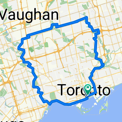
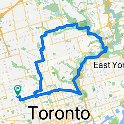
Nicht schnell oder lang, aber eine Serie ziemlich steiler Hügel und langer Abfahrten, die darauf abzielen, deine Kletterbeine (und Bremsen) zu trainieren. Pine Crescent (die S-Schleife) ist eine Kopfsteinpflasterstraße, die ein schönes Kopfsteinpflastergefühl vermittelt.
Pine Crescent und Scarborough Rd. sind die steilsten. Es gibt mehrere Varianten; wenn du Scarborough zu steil findest, fahre den Silver Birch hinauf. Willow (Süden) und Beech (Norden) sind Einbahnstraßen.
- -:--
- Dauer
- 5,2 km
- Distanz
- 98 m
- Aufstieg
- 108 m
- Abstieg
- ---
- Ø-Tempo
- ---
- Max. Höhe
Weiter mit Bikemap
Diese Radroute verwenden, bearbeiten oder herunterladen
Du möchtest -Short Steep climbs & fast descents in the Beach fahren oder sie für deine eigene Reise anpassen? Folgendes kannst du mit dieser Bikemap-Route machen:
Gratis Funktionen
- Speichere diese Route als Favorit oder in einer Sammlung
- Kopiere & plane deine eigene Version dieser Route
- Synchronisiere deine Route mit Garmin oder Wahoo
Premium-Funktionen
Kostenlose Testversion für 3 Tage oder einmalige Zahlung. Mehr über Bikemap Premium.
- Navigiere diese Route auf iOS & Android
- Exportiere eine GPX / KML-Datei dieser Route
- Erstelle deinen individuellen Ausdruck (Jetzt kostenlos ausprobieren)
- Lade diese Route für die Offline-Navigation herunter
Entdecke weitere Premium-Funktionen.
Bikemap Premium aktivierenVon unserer Community
Toronto: Andere beliebte Routen, die hier beginnen
 City Loop Humber Bay Arch Bridge – Don valley
- Distanz
- 77,3 km
- Aufstieg
- 664 m
- Abstieg
- 665 m
- Standort
- Toronto, Ontario, Kanada
 TCBC to Highland Creek (Morrish & Ellesmere) and beyond
- Distanz
- 67,2 km
- Aufstieg
- 413 m
- Abstieg
- 399 m
- Standort
- Toronto, Ontario, Kanada
 От Queens Quay East 25R до McClintock Crescent
- Distanz
- 25,3 km
- Aufstieg
- 211 m
- Abstieg
- 62 m
- Standort
- Toronto, Ontario, Kanada
 Long Toronto Loop
- Distanz
- 76,9 km
- Aufstieg
- 374 m
- Abstieg
- 370 m
- Standort
- Toronto, Ontario, Kanada
 Lighthouse Loop, Toronto
- Distanz
- 6,5 km
- Aufstieg
- 34 m
- Abstieg
- 4 m
- Standort
- Toronto, Ontario, Kanada
 Pan Am Path (East) Lower Don
- Distanz
- 8,8 km
- Aufstieg
- 48 m
- Abstieg
- 64 m
- Standort
- Toronto, Ontario, Kanada
 Lengthy bike tour through Toronto
- Distanz
- 36,1 km
- Aufstieg
- 124 m
- Abstieg
- 123 m
- Standort
- Toronto, Ontario, Kanada
 commute to class
- Distanz
- 29,6 km
- Aufstieg
- 252 m
- Abstieg
- 253 m
- Standort
- Toronto, Ontario, Kanada
In der App öffnen