- 80 km
- 108 m
- 125 m
- Hoole, England, Vereinigtes Königreich
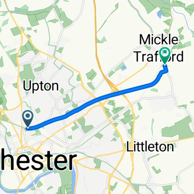
LEJOG Day7 Premier Inn Chester to Belmont
Eine Fahrradroute, die in Hoole, England, Vereinigtes Königreich beginnt.
Übersicht
Über diese Route
<span style='font-family: Arial,sans-serif;'>Das Verlassen von Chester auf der vielbefahrenen A51 und dann der A54 war nicht angenehm, aber die Situation verbesserte sich, sobald ich auf die B5393 nach Ashton kam. An einer T-Kreuzung bei Lymm bog ich irrtümlich rechts ab und fuhr von der Grappenhall Lane B5356 auf die Barleycastle Lane. Rückblickend – obwohl es etwas länger ist und das Überqueren der A50 beinhaltet – gab es wenig Verkehr und es werden vier Kreisverkehre meiner ursprünglichen Route vermieden. In Lymm habe ich jetzt erkannt, dass ich von der A56 auf die Rectory Lane hätte abbiegen und eine Ecke hätte abkürzen können. Ich habe meine GPX-Datei so bearbeitet, dass diese Änderungen enthalten sind. In Leigh gibt es eine unangenehme Rechtsabbiegung, bei der man über drei Fahrspuren von der A572 Spinning Jenny Way auf die B5215 King Street fahren muss. Ich empfehle, den Fußgängerüberweg zu nutzen, um die King Street zu erreichen. Eine weitere unangenehme Rechtsabbiegung gab es an der Lockstock Junction, wo die A58 Beaumont Road die A673 Chorley New Road kreuzt. Anstatt über mehrere Spuren schnellen Verkehrs zu radeln, bin ich abgestiegen und zu Fuß gegangen. Ich denke, ich habe eine sicherere Alternative gefunden und habe meine Radfahranweisungen und GPX-Datei bearbeitet, um diese gefährliche Kreuzung zu vermeiden. Ich schlage vor, kurz nach dem Bahnhof links auf die Lockstock Junction Lane abzubiegen, dann an der T-Kreuzung rechts auf die A673. An der nächsten Ampel links auf die Victoria Road A58 abbiegen, um weiterzufahren.</span>
<span style='font-family: Arial,sans-serif;'>Abseits von Westhoughton verläuft die aktuelle LEJOG CTC YHA Chester-Slaidburn Etappe über Chorley; meine Route führte stattdessen über Belmont und Blackburn. Nachdem ich die Berichte anderer gelesen hatte, entschied ich mich bei der Planung, einen zusätzlichen Tag zwischen Chester und Slaidburn einzubauen und in Belmont zu übernachten. Ich habe den Wert des Chorsley-Wegs gegenüber Belmont nicht vollständig bewertet, aber er sieht attraktiv aus. Wahrscheinlich würde ich mich beim nächsten Mal für die Chorley-Route entscheiden.</span>
<span style='font-family: Arial,sans-serif;'>Belmont war unsere schlechteste Übernachtungsmöglichkeit während meiner LEJOG-Tour, das Abendessen war akzeptabel, doch das Frühstück wurde erst ab 9 Uhr serviert. Es geht hinauf und über Belmont, dann weiter rauf und runter nach Blackburn. Sollte ich mich beim nächsten Mal für die Route über Chorley entscheiden, möchte ich vielleicht trotzdem irgendwo zwischen Chester und Slaidburn übernachten.</span>
- -:--
- Dauer
- 82,5 km
- Distanz
- 464 m
- Aufstieg
- 243 m
- Abstieg
- ---
- Ø-Tempo
- ---
- Max. Höhe
Erstellt vor 10 Jahren
Weiter mit Bikemap
Diese Radroute verwenden, bearbeiten oder herunterladen
Du möchtest LEJOG Day7 Premier Inn Chester to Belmont fahren oder sie für deine eigene Reise anpassen? Folgendes kannst du mit dieser Bikemap-Route machen:
Gratis Funktionen
- Speichere diese Route als Favorit oder in einer Sammlung
- Kopiere & plane deine eigene Version dieser Route
- Teile sie in Etappen ein, um eine mehrtägige Tour zu erstellen
- Synchronisiere deine Route mit Garmin oder Wahoo
Premium-Funktionen
Kostenlose Testversion für 3 Tage oder einmalige Zahlung. Mehr über Bikemap Premium.
- Navigiere diese Route auf iOS & Android
- Exportiere eine GPX / KML-Datei dieser Route
- Erstelle deinen individuellen Ausdruck (Jetzt kostenlos ausprobieren)
- Lade diese Route für die Offline-Navigation herunter
Entdecke weitere Premium-Funktionen.
Bikemap Premium aktivierenVon unserer Community
Hoole: Andere beliebte Routen, die hier beginnen
- Cymru North Coast - DAY 2.zz
- Day 2, June 9, Chester - Birmingham
- 124,8 km
- 801 m
- 715 m
- Hoole, England, Vereinigtes Königreich
- LEJOG Day7 Premier Inn Chester to Belmont
- 82,5 km
- 445 m
- 223 m
- Hoole, England, Vereinigtes Königreich
- Kingsway West to Firbank
- 10,6 km
- 51 m
- 118 m
- Hoole, England, Vereinigtes Königreich
- Boughton Heath / Great Boughton
- 4 km
- 16 m
- 17 m
- Hoole, England, Vereinigtes Königreich
- 80km G&Gs, Winsford, Bickerton and Saighton
- 81,1 km
- 306 m
- 304 m
- Hoole, England, Vereinigtes Königreich
- Chester-North Wales Coast and Anglesey
- 252,5 km
- 2.595 m
- 2.583 m
- Hoole, England, Vereinigtes Königreich
- Route in Chester
- 5,3 km
- 24 m
- 33 m
- Hoole, England, Vereinigtes Königreich
In der App öffnen


