

Sečovce - Vranov nad Topľou - Herľany - Sečovce
Eine Fahrradroute, die in Sečovce, Košický kraj, Slowakei beginnt.
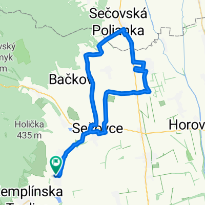
Übersicht
Über diese Route
Überwiegend hügelige Route. Besonders in der Umgebung von Banský und Dargov.
- -:--
- Dauer
- 70,5 km
- Distanz
- 709 m
- Aufstieg
- 712 m
- Abstieg
- ---
- Ø-Tempo
- ---
- Max. Höhe
Weiter mit Bikemap
Diese Radroute verwenden, bearbeiten oder herunterladen
Du möchtest Sečovce - Vranov nad Topľou - Herľany - Sečovce fahren oder sie für deine eigene Reise anpassen? Folgendes kannst du mit dieser Bikemap-Route machen:
Gratis Funktionen
- Speichere diese Route als Favorit oder in einer Sammlung
- Kopiere & plane deine eigene Version dieser Route
- Synchronisiere deine Route mit Garmin oder Wahoo
Premium-Funktionen
Kostenlose Testversion für 3 Tage oder einmalige Zahlung. Mehr über Bikemap Premium.
- Navigiere diese Route auf iOS & Android
- Exportiere eine GPX / KML-Datei dieser Route
- Erstelle deinen individuellen Ausdruck (Jetzt kostenlos ausprobieren)
- Lade diese Route für die Offline-Navigation herunter
Entdecke weitere Premium-Funktionen.
Bikemap Premium aktivierenVon unserer Community
Sečovce: Andere beliebte Routen, die hier beginnen
 Route in Veľké Ozorovce
- Distanz
- 40,3 km
- Aufstieg
- 193 m
- Abstieg
- 192 m
- Standort
- Sečovce, Košický kraj, Slowakei
 Certovica po cervenej
- Distanz
- 46 km
- Aufstieg
- 1.063 m
- Abstieg
- 1.088 m
- Standort
- Sečovce, Košický kraj, Slowakei
 Ruskov-Bogota-Herlany-Bohd-THC
- Distanz
- 63,5 km
- Aufstieg
- 971 m
- Abstieg
- 1.025 m
- Standort
- Sečovce, Košický kraj, Slowakei
 Jarková 6, Malé Ozorovce cez Plechotice do Jarková 6, Malé Ozorovce
- Distanz
- 27,3 km
- Aufstieg
- 269 m
- Abstieg
- 313 m
- Standort
- Sečovce, Košický kraj, Slowakei
 Košický Klečenov do Košický Klečenov
- Distanz
- 16,6 km
- Aufstieg
- 465 m
- Abstieg
- 432 m
- Standort
- Sečovce, Košický kraj, Slowakei
 Jarková 4, Malé Ozorovce do Jarková 4, Malé Ozorovce
- Distanz
- 7 km
- Aufstieg
- 119 m
- Abstieg
- 158 m
- Standort
- Sečovce, Košický kraj, Slowakei
 Izra
Izra- Distanz
- 26 km
- Aufstieg
- 632 m
- Abstieg
- 637 m
- Standort
- Sečovce, Košický kraj, Slowakei
 okruh okolo Makovice
- Distanz
- 66,1 km
- Aufstieg
- 1.423 m
- Abstieg
- 1.458 m
- Standort
- Sečovce, Košický kraj, Slowakei
In der App öffnen