Premium Badge Aus dem App Store herunterladen Hol dir Bikemap auf Google Play Turn-by-Turn-Navigation Offline Maps Bike Type Optimized Routing Premium Maps Individueller Fahrradcomputer Routen-Export Route Previews Sturzerkennung Premium Support

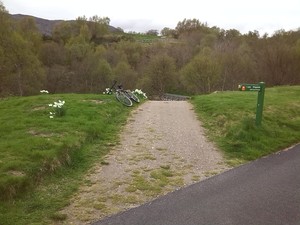
Radroute in Kingussie, Schottland, Vereinigtes Königreich

Kingussie, Loch Gynack and Newtonmore

2
Route in der Bikemap App öffnen

Route in der Bikemap App öffnen

Diese Route in Bikemap Web öffnen

Diese Route in Bikemap Web öffnen

12 km
Distanz
138 m
Aufstieg
136 m
Abstieg
-:-- h
Dauer
-- km/h
ø-Tempo
--- m
Max. Höhe

Über diese Route

This is a relatively short route of 12km / 7.5 miles suitable for mountain bikes. Some sections are on tarmac but others are on rough paths and for one section the bike will need to be carried. Allow 2 hours. Ordinance Survey sheet 35 Kingussie and Monadliath Mountains. Refreshments: Cafes and bars in Kingussie and Newtonmore. Start in the centre of Kingussie by taking the Ardbroilach Road opposite the Star Hotel. Follow the road for about a mile following the waymarks for the Golf Course walk. When the waymarks turn left continue to follow this route and cross the Gynack over a bridge. The path at this point becomes steep with steps for a short section when the bike will have to be carried. Continue to follow the path and pass an abandoned cottage. Pass through a gate and enter woodland. The next section is a rough unsurfaced path but mostly navigable by mountain bike.   As the path emerges out of the wood Loch Gynack now comes into view. Pass though another gate and follow the trail to the left uphill for a short incline. There is a junction here for the Kingussie paths network maintained by the Kingussie Community Development Company (KCDC). Follow the waymark to Newtonmore and from here the route leads through birchwoods alongside the loch. The surface is now much better. When the route emerges into the open again continue to follow the waymarks for Newtonmore and bear to the right onto a well-surfaced gravel track running alongside a plantation of pine. As the trees come to an end, pass through a gate and follow the waymark downhill to the left on a Land Rover track. When the track meets a tarmac road, turn left to go downhill and down to the Newtonmore Main Street. Turn left and on Main Street for 50 metres and pass the Highland  Folk Museum. Just after the museum turn right to take the off-road cycle path back to Kingussie. Cycle Friendly Kingussie

Diese Fahrradroute ist ideal für: MTB

Du fährst auf folgendem Untergrund: Unbefestigt

Highlights entlang der Route

POI Foto 1: Cycle Friendly Kingussie

Foto

Loch Gynack

POI Foto 2: Cycle Friendly Kingussie

Foto

Bridge over Gynack Burn

POI Foto 3: Cycle Friendly Kingussie

Foto

steps

Mehr Highlights gibt es mit Bikemap für iOS und Android.

Passe diese Fahrradroute mit dem Bikemap-Routenplaner an.

Passe diese Route an!

Wusstest du schon? Du kannst diese Route als Vorlage in unserem Routenplaner verwenden, und sie ganz einfach nach deinen Bedürfnissen anpassen. So planst du noch schneller deine perfekte Radtour.

In der App öffnen