

Akuna bike trip
Eine Fahrradroute, die in Cremorne, New South Wales, Australien beginnt.
Übersicht
Über diese Route
10
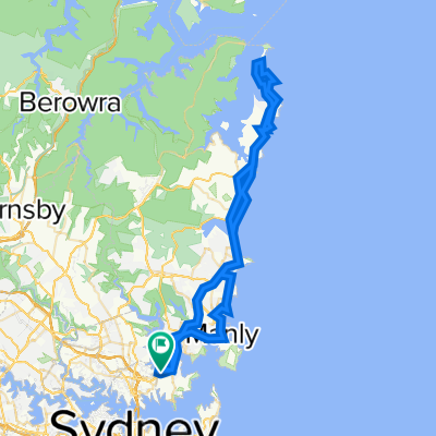
Akuna Bay is one of the best areas in Sydney to ride. With technical climbs and descents, experienced cyclists will enjoy switchback after switchback on this beautiful loop that winds along the coast and through Ku-Ring-Gai Chase Regional Park, Terrey Hills, and Frenchs Forest. Expect bike friendly roads and green bushland scenery as you either cruise and enjoy the view or race against your mates up the steep ascents. Whether you take it easy or go all out, no doubt you'll enjoy this fantastic ride.
- -:--
- Dauer
- 72,4 km
- Distanz
- 619 m
- Aufstieg
- 619 m
- Abstieg
- ---
- Ø-Tempo
- ---
- Max. Höhe
Jukes75
Erstellt vor 10 Jahren
Routenqualität
Wegtypen und Untergründe entlang der Route
Wegtypen
Ruhige Straße
20,3 km
28 %
Radweg
20,3 km
28 %
Untergründe
Befestigt
65,9 km
(91 %)
Unbefestigt
2,2 km
(3 %)
Befestigt (undefiniert)
31,1 km
43 %
Asphalt
29 km
40 %
Weiter mit Bikemap
Diese Radroute verwenden, bearbeiten oder herunterladen
Du möchtest Akuna bike trip fahren oder sie für deine eigene Reise anpassen? Folgendes kannst du mit dieser Bikemap-Route machen:
Gratis Funktionen
- Speichere diese Route als Favorit oder in einer Sammlung
- Kopiere & plane deine eigene Version dieser Route
- Synchronisiere deine Route mit Garmin oder Wahoo
Premium-Funktionen
Kostenlose Testversion für 3 Tage oder einmalige Zahlung. Mehr über Bikemap Premium.
- Navigiere diese Route auf iOS & Android
- Exportiere eine GPX / KML-Datei dieser Route
- Erstelle deinen individuellen Ausdruck (Jetzt kostenlos ausprobieren)
- Lade diese Route für die Offline-Navigation herunter
Entdecke weitere Premium-Funktionen.
Bikemap Premium aktivierenVon unserer Community
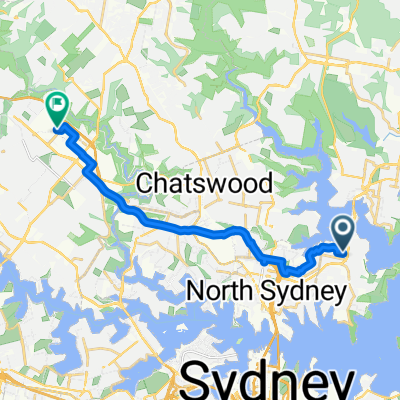
Cremorne: Andere beliebte Routen, die hier beginnen
- Awaba St, Mosman to Research Park Dr, Macquarie Park0
- 17,6 km
- 294 m
- 322 m
- Cremorne, New South Wales, Australien


In der App öffnen