Length of Japan part 1 Nikko to Tokyo Edit
- 192,5 km
- ---
- ---
- Nikkō, Präfektur Tochigi, Japan
Eine Fahrradroute, die in Nikkō, Präfektur Tochigi, Japan beginnt.
Übersicht
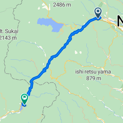
Backcountry in Japan.
(cloned from Route 3376457)
Erstellt vor 10 Jahren
Highlights der Route

Ouchi-juku Ōuchi-juku (大内宿 Ōuchi-juku) was a small post station in Japan's Edo period and part of the Aizu Nishi Kaidō. It is now located in the town of Shimogō, Fukushima|Shimogō in Minamiaizu District, Fukushima Prefecture, and is famous for the numerous traditional thatched buildings from the Edo Period that line its main street.

Lake Inawashiro

Bandai Highland. Steepy road to get to this highland but worth visiting. Many camping site are available.

Fukushima City. Just after the explosion of Fukushima Nuclear Plant, 56km east from the city, radioactive substances are fallen in wide area especially in Fukushima Prefecture. Now, decontamination is proceeding on schedule and you don't have to worry too much when you are in city area. Please note, there may be much higher radiation level spots in a suburb and mountain area.I don't recommend to pitch a tent in a bush to avoid unknown hot spots. A camping ground or a park that is open means it has already finished decontamination so choose these places as a one night tent site. Fukushima City is very beautiful. Beautiful mountains, trees, fruits and flowers... Enjoy staying this peaceful city.

Abukuma River Cycling Road

Sendai City. Biggest urban city in Tohoku Area. Between Sendai and Morioka City , it is hard to find shops which sell bicycle parts or outdoor equipments. Enjoy urban city night life, then ride to seaside area!!

Japanese restrant "New Konori" is excellent. Just a few minutes to ride up hill from center of town and worth visiting. Sashimi and Tempura are great and resonable price !! This route guide shows another route, it is because of error of this application, so I recommend to choose seaside route and visit Onagawacho (女川町).

Hiraizumi World Heritage. From Ishinomaki to Hiraizumi, It is a good idea to use a Bicycle Path along Kitakami River.
Visitors to Minamisanriku may also wish to visit Kaminoyama Park on the hilltop at the center of town from where they can survey the extent of the damage caused by the disaster. The small, grassy park lies on the grounds of a former castle and served as a refuge during the tsunami. Other casualties of the tsunami include Shizugawa Station, Minamisanriku's former train station, and the railway line that ran through the town. A Bus Rapid Transit (BRT) system has since been set up with the new Shizugawa BRT Station further inland. Next to the bus station is the Sun Sun Shopping Village, a recovery market of about 30 shops and restaurants set up in temporary buildings, which serve both locals and tourists. {article from japan guide com}

Rikuzentakata (陸前高田) in southern Iwate Prefecture was one of the cities hardest hit by the 2011 Tsunami. Caught unprepared for an event of such magnitude, the city center was virtually wiped off the map as the 13 meter high waves swept away the majority of the buildings and homes. Today the former city center remains empty, however a new city hall and new shopping centers were set up in temporary buildings further inland. By Japan-guide.com

Kurosaki Hot Spring. 500 yen for adult. 10:00~20:00 Close(usually) Wednesday. Noodle or Japanese style lunch 500~800 yen. Beer 500 Yen. Thiz peninsula is famous for its one of the most tasty seeweed and oister in Japan !!

Encounter the traditions of a farming village Tono Furusato Village This facility was built with the intent of preserving symbols of Tono's culture,such as the Nambu Magariya and techniques developed from everyday life.Many structures dating from the end of the Edo period have been reconstructed here.At Tono Furusato Village you can enjoy the charms of the four seasons through various seasonal events as well as hands-on farming activities.The village guides are called Maburitto,a word meaning,"to play a protecting role." Thus their title designates them as protectors of culture and tradition. Opening hours 9:00 - 17:00(April-December)(Last admission time:16:00) 9:00 - 16:00(November-February)(Last admission time:15:00) Admission fee Adult-----540yen

The hot springs located to the west of Hanamaki City are together called the Hanamaki Hot Springs. There are many types of facilities such as large hotels and traditional inns. Daytime bathing admission ranges from 200 yen to 1,200 yen. <Osawa Hot Spring> Osawa Hot Spring has three buildings: a modern inn, a thatched-roof inn, and a building with a kitchen where guests can cook for themselves.. There is a great outdoor bath facing a river. The Konsei Festival on April 29 is a unique Shinto ritual in which women wash a phallic figure in the hot spring. Simple alkaline spring: effective for neuralgia, joint pain, bruises, digestive disorders, poor circulation, etc

Hachimantai Aspite Line (Alpine Route) Hachimantai spreads out between Iwate and Akita prefectures. Visitors can view untouched wilderness, virgin forests of Aomori white fir and beech trees, wetlands, and volcanic steam area. In Hachimantai the year beings in mid-April, when the Aspite Line is opened. Both sides of the road are bordered with huge walls of snow, making it into a snow corridor that can only be experienced this time of year. Hachimantai is also distinguished as being a treasure trove of alpine plants. In the spring flowers bud everywhere, as if they had been waiting impatiently for the snow to melt. As summer arrives flowers of all sorts continue to bloom one after another. There are more than 500 different types, and on the walking path around the peak of Hachimantai you can see 150 different species of alpine plants. The Hachimantai peak walking course takes about an hour to complete. It starts at a rest house, snakes around Hachiman lake and Mikaeri pass in a ciruit. The walking path is well made, and no special equipment is needed. You can walk the course casually, and during the green season it is popular among the elderly.

Sukayu hot spring. Entrance fee : 500 yens Bathing time from 07:00 to 21:00

Mt. Osore-zan is where it is said that the souls of the dead gather. The whole area smells of sulfur, and there are few signs of vegetation. Everywhere you look, it is gray. Therefore, the area has become an imaginary hell. There are many make-believe items from hell that are created in the precincts of Osore-zan Bodai-ji Temple, such as Sai-no-kawara (shores of the river to hell), where the smell of sulfur steaming up from the ground fills the air.

Okuyagen open air hot spring. Worth visiting. 200 yen for adult

Yagen Camp Site. Beutiful and peaceful site.

Oma Port heading to Hakodate, Hokkaido. Known as tuna fishing village. 90 minuets to get to Hakodate. Ferry departs 1~2 a day. Cost about 2500 yen (depends on season)
Weiter mit Bikemap
Du möchtest Length of Japan, Tohoku fahren oder sie für deine eigene Reise anpassen? Folgendes kannst du mit dieser Bikemap-Route machen:
Kostenlose Testversion für 3 Tage oder einmalige Zahlung. Mehr über Bikemap Premium.
Entdecke weitere Premium-Funktionen.
Bikemap Premium aktivierenVon unserer Community
In der App öffnen