Slovakia Detail 2016
Eine Fahrradroute, die in Ilava, Nitriansky kraj, Slowakei beginnt.
Übersicht
Über diese Route
Mit dem Zug nach Ilava, dann Horna Poruba, Homolka-Pass, Valaska Bela, Liestany, Nitrianske Rudno, Bojnice (Schloss), Prievidza, Nitianske Pravno, Klacno, Kláštor pod Znievom (dort gibt es den Pass Vricke sedlo), Turcianske Teplice, hier gibt es ein schönes felsiges Tal, Gaderska dolina (Beginn in Blatnica). Theoretisch kann man hier auch das Gebirge überqueren, aber man muss die Fahrräder schieben (2 Stunden auf einem steilen Pfad) zur Kralova studna, danach gibt es eine Schotterabfahrt nach Harmanec und Banska Bystrica. Oder man kehrt um und fährt weiter zum Sturec-Pass (Richtung Harmanec). Ich würde zur Kralova studna fahren, auch wenn es anspruchsvoller und steiler ist (man muss das Fahrrad schieben oder tragen). Man kann dort sogar in einem Hotel übernachten, es gibt eine schöne Aussicht, Wiesen usw. (Höhe 1300 m).
Zwischen Harmanec und Banska Bystrica gibt es ein schönes Dorf, Spania dolina, mit alten Minen. Es liegt etwas höher in den Bergen. Dann Banska Bystrica, Lucatin, Lubietova (Schotter) - Chata pod Hrbom (mögliche Unterkunft), Tri vody, Osrblie, Brezno (günstige Unterkunft in der Nähe der Eishockeyarena), Helpa, dann hinauf zu den Niederen Tatra durch den Priehyba-Pass, Abfahrt nach Cierny Vah. Dort ist ein Wasserkraftwerk, es lohnt sich, zum Oberbecken hinaufzusteigen, von dort hat man einen schönen Blick auf die Tatra. Dann weiter nach Liptovska Teplicka und Strba, Poprad, Richtung Süden nach Hranovnica und zum Vernar-Pass und Statena, dort gibt es Schluchten und Höhlen. Es lohnt sich hier, den Slowakischen Paradies-Nationalpark (zu Fuß) zu besuchen, dort gibt es Schluchten, Wasserfälle usw. Lass einfach dein Fahrrad in der Pension oder fahre besser den Schotterweg Glacka cesta und verstecke das Fahrrad im Wald. Von hier aus Spisska Nova Ves und Spisske Podhradie mit einer wirklich großen Burg. Von hier würde ich überlegen, nach Süden abzubiegen, aber den Nationalpark Slowakischer Karst (Höhlen und Tafelberge) würde ich nicht verpassen.
- -:--
- Dauer
- 1.053,7 km
- Distanz
- 2.229 m
- Aufstieg
- 2.289 m
- Abstieg
- ---
- Ø-Tempo
- ---
- Max. Höhe
Highlights der Route
POIs entlang der Route
Interessanter Ort nach 96,3 km
If you prefer old cities I would insert e.g. Banska stiavnica, Kremnica
Interessanter Ort nach 109,2 km
If you prefer old cities I would insert e.g. Banska stiavnica, Kremnica
Interessanter Ort nach 405,8 km
I would not miss the national park Slovensky kras(caves and table mountains)
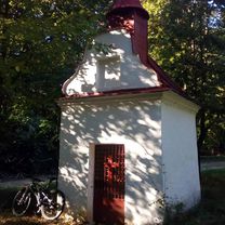
Interessanter Ort nach 841 km
Weiter mit Bikemap
Diese Radroute verwenden, bearbeiten oder herunterladen
Du möchtest Slovakia Detail 2016 fahren oder sie für deine eigene Reise anpassen? Folgendes kannst du mit dieser Bikemap-Route machen:
Gratis Funktionen
- Speichere diese Route als Favorit oder in einer Sammlung
- Kopiere & plane deine eigene Version dieser Route
- Teile sie in Etappen ein, um eine mehrtägige Tour zu erstellen
- Synchronisiere deine Route mit Garmin oder Wahoo
Premium-Funktionen
Kostenlose Testversion für 3 Tage oder einmalige Zahlung. Mehr über Bikemap Premium.
- Navigiere diese Route auf iOS & Android
- Exportiere eine GPX / KML-Datei dieser Route
- Erstelle deinen individuellen Ausdruck (Jetzt kostenlos ausprobieren)
- Lade diese Route für die Offline-Navigation herunter
Entdecke weitere Premium-Funktionen.
Bikemap Premium aktivierenVon unserer Community
Ilava: Andere beliebte Routen, die hier beginnen
 Kameň - Lednica
- Distanz
- 43,5 km
- Aufstieg
- 1.109 m
- Abstieg
- 1.109 m
- Standort
- Ilava, Nitriansky kraj, Slowakei
 Vrchol č. 12 VKT 2019 - Sedlo Lúčky
- Distanz
- 27 km
- Aufstieg
- 352 m
- Abstieg
- 55 m
- Standort
- Ilava, Nitriansky kraj, Slowakei
 Vrchol č. 15 VKT 2019 - Svätý Vendelín
- Distanz
- 47,9 km
- Aufstieg
- 642 m
- Abstieg
- 405 m
- Standort
- Ilava, Nitriansky kraj, Slowakei
 Stožiar
- Distanz
- 60,6 km
- Aufstieg
- 1.362 m
- Abstieg
- 1.157 m
- Standort
- Ilava, Nitriansky kraj, Slowakei
 Vrchol č. 8 VKT 2019 - Ostrý vrch
- Distanz
- 48,5 km
- Aufstieg
- 783 m
- Abstieg
- 136 m
- Standort
- Ilava, Nitriansky kraj, Slowakei
 JMJ Madrid
- Distanz
- 2.451 km
- Aufstieg
- 4.598 m
- Abstieg
- 4.771 m
- Standort
- Ilava, Nitriansky kraj, Slowakei
 49.087, 18.182 až 49.088, 18.180
- Distanz
- 16,5 km
- Aufstieg
- 1.396 m
- Abstieg
- 1.402 m
- Standort
- Ilava, Nitriansky kraj, Slowakei
 Vrchol č. 14 VKT 2019 - Stratenec
- Distanz
- 56,6 km
- Aufstieg
- 861 m
- Abstieg
- 80 m
- Standort
- Ilava, Nitriansky kraj, Slowakei
In der App öffnen


