

St Ninian's Way - Wigtown to Garlieston
Eine Fahrradroute, die in Newton Stewart, Schottland, Vereinigtes Königreich beginnt.
Übersicht
Über diese Route
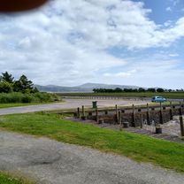
The 11th section of St Ninian’s Way takes Bike Route 73 from Wigtown, crosses the bridge at Bladnoch, and then another 300m to Y junction. Here the Way goes left and south (BR 73 goes west) along minor road ( A746) to T junction (1 km). Turn left onto minor road and track, pass Mains of Baldoon (1 km) and continue to junction before wood overlooking Baldoon Sands (1 km). Turn right (south) along track to South Balfern ((2 km) and continue to junction on B7004 (1 km). Turn left along B7004 to junction with track (3 km) Turn left onto track to Culscadden (1 km) and branch onto minor road to coast (1 km). Continue along coastal track to Garlieston (6 km).
Mainly flatish and great views across Wigtown Bay and beyond to Cumbria and the Lake District.
For a map overview of Part 1 and Part 2 of St Ninian’s Way please go to https://www.bikemap.net/en/route/3548129-st-ninians-way-carlisle-to-st-andrews-part-1-carlisle-to-whithorn/
St Ninian’s Way is one of the great pilgrim routes in Scotland to St Andrews - The Way of St Andrews - For other routes see http://www.thewayofstandrews.com
- -:--
- Dauer
- 20,4 km
- Distanz
- 94 m
- Aufstieg
- 126 m
- Abstieg
- ---
- Ø-Tempo
- ---
- Max. Höhe

Routenqualität
Wegtypen und Untergründe entlang der Route
Wegtypen
Pfad
14,7 km
(72 %)
Vielbefahrene Straße
2,7 km
(13 %)
Untergründe
Befestigt
0,6 km
(3 %)
Unbefestigt
0,1 km
(<1 %)
Asphalt
0,6 km
(3 %)
Schotter
0,1 km
(<1 %)
Undefiniert
19,8 km
(97 %)
Weiter mit Bikemap
Diese Radroute verwenden, bearbeiten oder herunterladen
Du möchtest St Ninian's Way - Wigtown to Garlieston fahren oder sie für deine eigene Reise anpassen? Folgendes kannst du mit dieser Bikemap-Route machen:
Gratis Funktionen
- Speichere diese Route als Favorit oder in einer Sammlung
- Kopiere & plane deine eigene Version dieser Route
- Synchronisiere deine Route mit Garmin oder Wahoo
Premium-Funktionen
Kostenlose Testversion für 3 Tage oder einmalige Zahlung. Mehr über Bikemap Premium.
- Navigiere diese Route auf iOS & Android
- Exportiere eine GPX / KML-Datei dieser Route
- Erstelle deinen individuellen Ausdruck (Jetzt kostenlos ausprobieren)
- Lade diese Route für die Offline-Navigation herunter
Entdecke weitere Premium-Funktionen.
Bikemap Premium aktivierenVon unserer Community
Newton Stewart: Andere beliebte Routen, die hier beginnen
 Newton Stewart-Whauphill-Wigton Circular
- Distanz
- 46,4 km
- Aufstieg
- 178 m
- Abstieg
- 182 m
- Standort
- Newton Stewart, Schottland, Vereinigtes Königreich
 Tag 14: Newton Stewart - Prestwick
- Distanz
- 87,5 km
- Aufstieg
- 747 m
- Abstieg
- 773 m
- Standort
- Newton Stewart, Schottland, Vereinigtes Königreich
 Loch Trool Loop.
- Distanz
- 10,5 km
- Aufstieg
- 225 m
- Abstieg
- 227 m
- Standort
- Newton Stewart, Schottland, Vereinigtes Königreich
 Glentrool Blue
- Distanz
- 9,5 km
- Aufstieg
- 173 m
- Abstieg
- 174 m
- Standort
- Newton Stewart, Schottland, Vereinigtes Königreich
 loch chatteringshaw
- Distanz
- 23,1 km
- Aufstieg
- 264 m
- Abstieg
- 259 m
- Standort
- Newton Stewart, Schottland, Vereinigtes Königreich
 Newton Stewart to Wigtown Circular 2
- Distanz
- 47,3 km
- Aufstieg
- 272 m
- Abstieg
- 274 m
- Standort
- Newton Stewart, Schottland, Vereinigtes Königreich
 From Creetown to the viaduct
- Distanz
- 21,7 km
- Aufstieg
- 313 m
- Abstieg
- 312 m
- Standort
- Newton Stewart, Schottland, Vereinigtes Königreich
 Home to Wigtown return
- Distanz
- 32,2 km
- Aufstieg
- 289 m
- Abstieg
- 287 m
- Standort
- Newton Stewart, Schottland, Vereinigtes Königreich
In der App öffnen