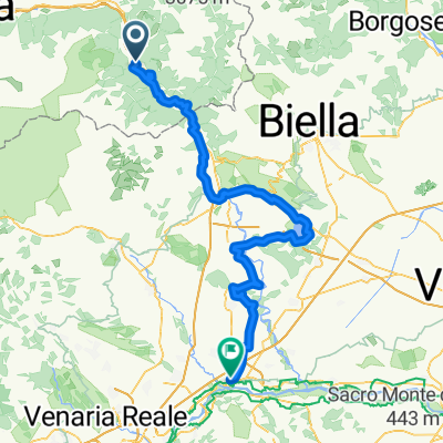
- 21,8 km
- 1.024 m
- 1.025 m
- Verrès, Aostatal, Italien
Colle Vert Enduro (Verres Aosta)
Eine Fahrradroute, die in Verrès, Aostatal, Italien beginnt.
Übersicht
Über diese Route
Abschnitt nach Champurney unsicher
Strecke: (Verrès –) Omens – Champore – Colle Vert – Fornelle – Barmelongue – Avieil – Champurney – Prouve Ville – Arnad – Verrès
Tourbeschreibung:
Die Tour beginnt in Omens, wohin man mit dem Auto fahren kann. Dann geht es gleich bergauf, zunächst ein paar Meter auf Asphalt, dann viele Haarnadelkurven auf Schotter 630 Höhenmeter den Hügel hinauf. Der Colle Vert ist erreicht, wenn man bei der Rechtskurve auf den Schotterweg Richtung Fornelle abbiegt. Übrigens ist auf dem Anstieg immer ein schöner Blick auf das Matterhorn möglich. Die Abfahrt beginnt dann ungefährlich auf dem Schotterweg nach Fornelle. Gleich nach der letzten Rechtskurve vor den ersten Häusern links beginnt der 2-Trail. Der schmale Pfad schlängelt sich durch den steilen Wald, abwechselnd Serpentinen mit Abschnitten und Scooters-Passagen, alles super flüssig aber mit der notwendigen Konzentration. Es passiert eine kleine Straße, dann wird der Trail etwas ruppiger, unten erreicht man den Weiler Avieil. Hier biegt man links ab und fährt auf der kleinen Straße Richtung Champurney. Die direkte Abfahrt von hier nach Arnad ist etwas langweilig. Spannender ist der 3-Trail, der bald rechts abzweigt und trickreich rupplig und flüssig zu den Häusern von Prouve Ville hinunterwindet. Er verläuft parallel zur Hauptstraße und führt dann zurück nach Verrès.
- -:--
- Dauer
- 21,8 km
- Distanz
- 1.024 m
- Aufstieg
- 1.025 m
- Abstieg
- ---
- Ø-Tempo
- ---
- Max. Höhe
Erstellt vor 9 Jahren
Weiter mit Bikemap
Diese Radroute verwenden, bearbeiten oder herunterladen
Du möchtest Colle Vert Enduro (Verres Aosta) fahren oder sie für deine eigene Reise anpassen? Folgendes kannst du mit dieser Bikemap-Route machen:
Gratis Funktionen
- Speichere diese Route als Favorit oder in einer Sammlung
- Kopiere & plane deine eigene Version dieser Route
- Synchronisiere deine Route mit Garmin oder Wahoo
Premium-Funktionen
Kostenlose Testversion für 3 Tage oder einmalige Zahlung. Mehr über Bikemap Premium.
- Navigiere diese Route auf iOS & Android
- Exportiere eine GPX / KML-Datei dieser Route
- Erstelle deinen individuellen Ausdruck (Jetzt kostenlos ausprobieren)
- Lade diese Route für die Offline-Navigation herunter
Entdecke weitere Premium-Funktionen.
Bikemap Premium aktivierenVon unserer Community
Verrès: Andere beliebte Routen, die hier beginnen
- Colle Vert Enduro (Verres Aosta)
- 2/6) Verrès- Cavaglià
- 62 km
- 648 m
- 761 m
- Verrès, Aostatal, Italien
- Verrès - Roppolo - Vercelli - Mortara km 120,8
- 120,8 km
- 152 m
- 436 m
- Verrès, Aostatal, Italien
- Tappa B03 - Da Verres a Roppolo
- 61,3 km
- 306 m
- 368 m
- Verrès, Aostatal, Italien
- 7b) Fénis + hotel
- 49 km
- 1.242 m
- 1.028 m
- Verrès, Aostatal, Italien
- Vall d'Ayas e Vall di Gressoney
- 94,3 km
- 2.267 m
- 2.267 m
- Verrès, Aostatal, Italien
- Verres-Ivrea.Viverone-Chivasso
- 113,3 km
- 441 m
- 624 m
- Verrès, Aostatal, Italien
- Zuccore, san pantaleone e Joux
- 108,1 km
- 3.543 m
- 3.551 m
- Verrès, Aostatal, Italien
In der App öffnen


