Premium Badge Aus dem App Store herunterladen Hol dir Bikemap auf Google Play Turn-by-Turn-Navigation Offline Maps Bike Type Optimized Routing Premium Maps Individueller Fahrradcomputer Routen-Export Route Previews Sturzerkennung Premium Support

Radroute in Morzine, Auvergne-RhĂ´ne-Alpes, Frankreich

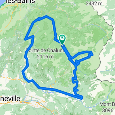
Ardent - Avoriaz - Samoens - Tanninges - Les Gets - Montriond

0
Route in der Bikemap App öffnen

Route in der Bikemap App öffnen

Diese Route in Bikemap Web öffnen

Diese Route in Bikemap Web öffnen

73 km
Distanz
2072 m
Aufstieg
2070 m
Abstieg
-:-- h
Dauer
-- km/h
ø-Tempo
--- m
Max. Höhe

Ăśber diese Route

This twin peak epic will see you climb the epic Col du Joue Verte, before enjoying the panoramic descent into Morzine to then tackle the Col du Joue Plane which climbs steadily to a lake hanging in the col above the pituresque Village of Samoens descend the route into the Village and either we'll pick you up here or if you stil have plently in the legs, you can practice your drefting technique along to Tanninges and climb again To Les Gets, glide along the valley to Morzine and enjoy the short sting in the tail back to the chalet where you will have well and truely earnt you're cup of tea and relax in the Hot Tub with the sound of cow bells in your ears! Well done you!! 

Passe diese Fahrradroute mit dem Bikemap-Routenplaner an.

Passe diese Route an!

Wusstest du schon? Du kannst diese Route als Vorlage in unserem Routenplaner verwenden, und sie ganz einfach nach deinen BedĂĽrfnissen anpassen. So planst du noch schneller deine perfekte Radtour.

In der App öffnen