

B2B00088 55411 > 55111 via downtown, Light Rail trail, and Minnehaha park
Eine Fahrradroute, die in Golden Valley, Minnesota, Vereinigte Staaten beginnt.
Übersicht
Über diese Route
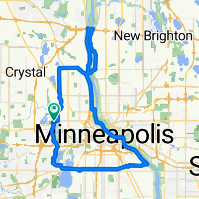
Beginne deine Fahrt, indem du nach Osten auf der 26th Avenue North fährst. Fahr die 26th bis zur North 2nd Street. Biege nach rechts (südlich) auf die North 2nd. An der 8th Avenue North springe (überquere einen Block) nach links zur North 1st Street. Nimm die North 1st bis zur 5th Avenue South. An der 5th South biege nach rechts ab und jogge zurück zur South 2nd Street. Fahre auf der South 2nd bis zur 11th Avenue South. An der 11th, biege rechts ab, überquere die Washington, gehe ein paar Blocks und steige auf die Straßenbahngleise. Dieser Weg verläuft entlang der Bahngleise und bringt dich bis zum Minnehaha Park. An der East 46th Street überquere die Hiawatha (Richtung Osten) zur Minnehaha Avenue. Du nimmst die Minnehaha Avenue in den Park und bis zur südwestlichen Ecke, wo du auf den Radweg gelangst, der dich nach Fort Snelling führt. Wenn der Weg zur Pike Island kommt, halte dich rechts (nach Westen) und folge dem Weg / der Straße zum Snelling Lake.
- -:--
- Dauer
- 18,8 km
- Distanz
- 39 m
- Aufstieg
- 95 m
- Abstieg
- ---
- Ø-Tempo
- ---
- Max. Höhe

Highlights der Route
POIs entlang der Route
Interessanter Ort nach 7,2 km
Look for the Light Rail Trail here.
Interessanter Ort nach 16,1 km
Get on the bike trail here. It will take you to Fort Snelling.
Weiter mit Bikemap
Diese Radroute verwenden, bearbeiten oder herunterladen
Du möchtest B2B00088 55411 > 55111 via downtown, Light Rail trail, and Minnehaha park fahren oder sie für deine eigene Reise anpassen? Folgendes kannst du mit dieser Bikemap-Route machen:
Gratis Funktionen
- Speichere diese Route als Favorit oder in einer Sammlung
- Kopiere & plane deine eigene Version dieser Route
- Synchronisiere deine Route mit Garmin oder Wahoo
Premium-Funktionen
Kostenlose Testversion für 3 Tage oder einmalige Zahlung. Mehr über Bikemap Premium.
- Navigiere diese Route auf iOS & Android
- Exportiere eine GPX / KML-Datei dieser Route
- Erstelle deinen individuellen Ausdruck (Jetzt kostenlos ausprobieren)
- Lade diese Route für die Offline-Navigation herunter
Entdecke weitere Premium-Funktionen.
Bikemap Premium aktivierenVon unserer Community
Golden Valley: Andere beliebte Routen, die hier beginnen
 edina route66
- Distanz
- 46,2 km
- Aufstieg
- 116 m
- Abstieg
- 117 m
- Standort
- Golden Valley, Minnesota, Vereinigte Staaten
 Trip to Wayzata
- Distanz
- 18,8 km
- Aufstieg
- 108 m
- Abstieg
- 76 m
- Standort
- Golden Valley, Minnesota, Vereinigte Staaten
 B2B00649 55411>55344 via Luce Line, Plymouth Rd, Baker Rd
- Distanz
- 28,3 km
- Aufstieg
- 155 m
- Abstieg
- 160 m
- Standort
- Golden Valley, Minnesota, Vereinigte Staaten
 Wirth-Mtka-North 41k
- Distanz
- 41,1 km
- Aufstieg
- 192 m
- Abstieg
- 201 m
- Standort
- Golden Valley, Minnesota, Vereinigte Staaten
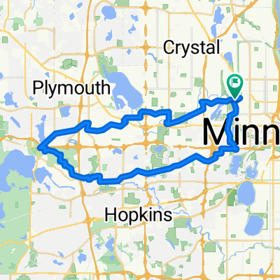
 Luce around Minnetonka
- Distanz
- 80 km
- Aufstieg
- 145 m
- Abstieg
- 138 m
- Standort
- Golden Valley, Minnesota, Vereinigte Staaten
 B2B00088 55411 > 55111 via downtown, Light Rail trail, and Minnehaha park
- Distanz
- 18,8 km
- Aufstieg
- 39 m
- Abstieg
- 95 m
- Standort
- Golden Valley, Minnesota, Vereinigte Staaten
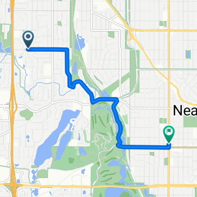 B2B00321 55442>55411 via Culver Rd, Kyle Ave, Theo Wirth Pkwy & Plymouth Ave
- Distanz
- 5 km
- Aufstieg
- 37 m
- Abstieg
- 37 m
- Standort
- Golden Valley, Minnesota, Vereinigte Staaten
 Loop 5/20/20
- Distanz
- 14,8 km
- Aufstieg
- 95 m
- Abstieg
- 93 m
- Standort
- Golden Valley, Minnesota, Vereinigte Staaten
In der App öffnen