Circuit des Cageux - facile/easy
Eine Fahrradroute, die in Hudson, Québec, Kanada beginnt.
Übersicht
Über diese Route
Ausgehend von der Stadt Hudson fahren Sie westlich in Richtung Pointe-Fortune entlang eines malerischen Weges, der am Ufer des Ottawa-Flusses verläuft. Vor Jahrhunderten war dieser Flussabschnitt der einzige Weg für Fallensteller, Siedler und Missionare, die nach Oberkanada reisen wollten. Wenn Sie an einem Samstag starten, machen Sie einen Stopp am berühmten Finnegan's Market in Hudson, einem freundlichen, lebhaften Flohmarkt, auf dem Sie fantastische Antiquitäten und vieles mehr finden können.
Nach einem kurzen Stück über die Grenze nach Ontario beachten Sie bitte, dass Ihre Rückkehr nach Québec eine 500 m lange unbefestigte Schotterstraße umfasst. Zurück in Rigaud machen Sie einen kurzen Abstecher zum Heiligtum Unserer Lieben Frau von Lourdes, wo Sie das berühmte "Kartoffelfeld" bewundern können.
Ab diesem Punkt haben Sie zwei Optionen. Wenn Sie abenteuerlustig sind, können Sie über den Berg zurück nach Hudson fahren. Die spektakuläre Aussicht auf die Region von der Spitze lohnt den Aufwand wirklich! Wenn Sie es lieber gemütlich nehmen möchten, können Sie den Chemin J.-René-Gauthier nehmen, der den Berg umgeht.
Diese Route bietet spektakuläre Ausblicke entlang des Ottawa-Flusses. Nutzen Sie die Gelegenheit für ein Picknick und dehnen Sie Ihre Beine in einem der entlang der Strecke gelegenen Parks. Auf dem Rückweg sollten Sie unbedingt einige der leckeren lokalen Produkte der Region einkaufen, um sie nach einem großartigen Tag auf dem Fahrrad zu Hause zu genießen!
- -:--
- Dauer
- 60,5 km
- Distanz
- 136 m
- Aufstieg
- 138 m
- Abstieg
- ---
- Ø-Tempo
- ---
- Max. Höhe
Routenqualität
Wegtypen und Untergründe entlang der Route
Wegtypen
Straße
37,5 km
(62 %)
Ruhige Straße
4,2 km
(7 %)
Untergründe
Befestigt
45,3 km
(75 %)
Unbefestigt
1,8 km
(3 %)
Asphalt
39,9 km
(66 %)
Befestigt (undefiniert)
5,4 km
(9 %)
Highlights der Route
POIs entlang der Route

Interessanter Ort nach 25,3 km
La Boulangerie de Marie
Trinkwasser nach 43,5 km
Stationnement + Point d'eau + Toilette

Interessanter Ort nach 43,6 km
Parc Chartier-de-Lotbinière
Interessanter Ort nach 60,2 km
Stationnement

Interessanter Ort nach 60,2 km
Parc Jack Layton

Interessanter Ort nach 60,5 km
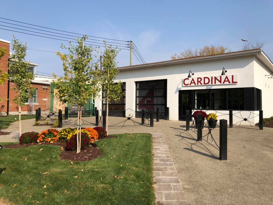
Microbrasserie Cardinal Brewing
Weiter mit Bikemap
Diese Radroute verwenden, bearbeiten oder herunterladen
Du möchtest Circuit des Cageux - facile/easy fahren oder sie für deine eigene Reise anpassen? Folgendes kannst du mit dieser Bikemap-Route machen:
Gratis Funktionen
- Speichere diese Route als Favorit oder in einer Sammlung
- Kopiere & plane deine eigene Version dieser Route
- Synchronisiere deine Route mit Garmin oder Wahoo
Premium-Funktionen
Kostenlose Testversion für 3 Tage oder einmalige Zahlung. Mehr über Bikemap Premium.
- Navigiere diese Route auf iOS & Android
- Exportiere eine GPX / KML-Datei dieser Route
- Erstelle deinen individuellen Ausdruck (Jetzt kostenlos ausprobieren)
- Lade diese Route für die Offline-Navigation herunter
Entdecke weitere Premium-Funktionen.
Bikemap Premium aktivierenVon unserer Community
Hudson: Andere beliebte Routen, die hier beginnen
 Oka to Hawkesbury and Back
- Distanz
- 110,6 km
- Aufstieg
- 289 m
- Abstieg
- 325 m
- Standort
- Hudson, Québec, Kanada
 Circuit des Cageux - difficile/difficult
- Distanz
- 62,7 km
- Aufstieg
- 318 m
- Abstieg
- 317 m
- Standort
- Hudson, Québec, Kanada
 Hudson G.P. 2010
- Distanz
- 18,2 km
- Aufstieg
- 134 m
- Abstieg
- 134 m
- Standort
- Hudson, Québec, Kanada
 Oka / Carillon
- Distanz
- 59,9 km
- Aufstieg
- 181 m
- Abstieg
- 194 m
- Standort
- Hudson, Québec, Kanada
 Hudson Loop
- Distanz
- 45,5 km
- Aufstieg
- 184 m
- Abstieg
- 194 m
- Standort
- Hudson, Québec, Kanada
 Circuit des Cageux - facile/easy
- Distanz
- 60,5 km
- Aufstieg
- 136 m
- Abstieg
- 138 m
- Standort
- Hudson, Québec, Kanada
 CD-QC Gatineau to Quebec City 3.0 - Rigault to St.Lambert
- Distanz
- 77,9 km
- Aufstieg
- 143 m
- Abstieg
- 189 m
- Standort
- Hudson, Québec, Kanada
 Hudson G.P. 2011
- Distanz
- 18,4 km
- Aufstieg
- 130 m
- Abstieg
- 131 m
- Standort
- Hudson, Québec, Kanada
In der App öffnen


