

St Ninian's Way- Ayr to Troon
Eine Fahrradroute, die in Ayr, Schottland, Vereinigtes Königreich beginnt.
Übersicht
Über diese Route
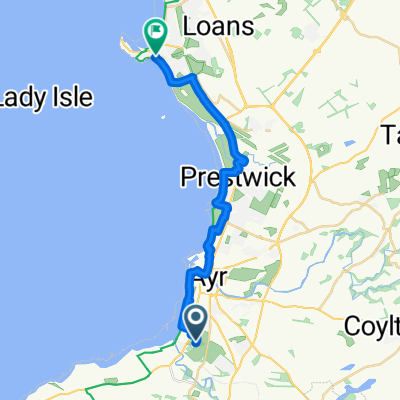
This 21th section of St Ninian’s Way starts in the centre of Ayr at the south end of the Auld Brig. Cross over the river and then go left to join the A719 (50 m). Pick up the signposts for Ayrshire Coastal Path (ACP) and National Cycle Route 7. Proceed north through town to sea (1 km), then along the coast to Woodfield (500m) where cyclists can split off and continue along NCR 7 to Troon. Walkers can continue along the coast on the ACP past St Ninian’s Chapel (1 km), past Prestwick and the international airport (1 km), the Royal Troon golf course to the centre of Troon and Troon Old Parish Church.(8km).
Flat. Following a coastal path in Burns country.
Also part of the Whithorn Way - http://www.whithornway.org . courtesy of the WWSG where a detailed route description with grid references is available.
For a map overview of Part 1 and Part 2 of St Ninian’s Way please go to https://www.bikemap.net/en/route/3548129-st-ninians-way-carlisle-to-st-andrews-part-1-carlisle-to-whithorn/
St Ninian’s Way is one of the great pilgrim routes in Scotland to St Andrews - The Way of St Andrews - For other routes see http://www.thewayofstandrews.com
- -:--
- Dauer
- 10,5 km
- Distanz
- 12 m
- Aufstieg
- 20 m
- Abstieg
- ---
- Ø-Tempo
- ---
- Max. Höhe

Weiter mit Bikemap
Diese Radroute verwenden, bearbeiten oder herunterladen
Du möchtest St Ninian's Way- Ayr to Troon fahren oder sie für deine eigene Reise anpassen? Folgendes kannst du mit dieser Bikemap-Route machen:
Gratis Funktionen
- Speichere diese Route als Favorit oder in einer Sammlung
- Kopiere & plane deine eigene Version dieser Route
- Synchronisiere deine Route mit Garmin oder Wahoo
Premium-Funktionen
Kostenlose Testversion für 3 Tage oder einmalige Zahlung. Mehr über Bikemap Premium.
- Navigiere diese Route auf iOS & Android
- Exportiere eine GPX / KML-Datei dieser Route
- Erstelle deinen individuellen Ausdruck (Jetzt kostenlos ausprobieren)
- Lade diese Route für die Offline-Navigation herunter
Entdecke weitere Premium-Funktionen.
Bikemap Premium aktivierenVon unserer Community
Ayr: Andere beliebte Routen, die hier beginnen
 reverse straiton loop
- Distanz
- 47,5 km
- Aufstieg
- 353 m
- Abstieg
- 362 m
- Standort
- Ayr, Schottland, Vereinigtes Königreich
 Route 1 - Doonfoot - Fisherton - Dunure - Maybole - Alloway - Doonfoot
- Distanz
- 35,7 km
- Aufstieg
- 364 m
- Abstieg
- 367 m
- Standort
- Ayr, Schottland, Vereinigtes Königreich
 Belleisle Park, Doonfoot Road, Ayr to Municipal Buildings, South Beach, Troon
- Distanz
- 17 km
- Aufstieg
- 35 m
- Abstieg
- 47 m
- Standort
- Ayr, Schottland, Vereinigtes Königreich
 Slow ride in Ayr
- Distanz
- 12,4 km
- Aufstieg
- 43 m
- Abstieg
- 45 m
- Standort
- Ayr, Schottland, Vereinigtes Königreich
 blitz
blitz- Distanz
- 21,2 km
- Aufstieg
- 11 m
- Abstieg
- 17 m
- Standort
- Ayr, Schottland, Vereinigtes Königreich
 The Allwrong LEJOG Tour Day 8
- Distanz
- 198,4 km
- Aufstieg
- 850 m
- Abstieg
- 852 m
- Standort
- Ayr, Schottland, Vereinigtes Königreich
 Ayr to Maybole and Back
- Distanz
- 43,4 km
- Aufstieg
- 432 m
- Abstieg
- 435 m
- Standort
- Ayr, Schottland, Vereinigtes Königreich
 Ayr loop
- Distanz
- 17,6 km
- Aufstieg
- 116 m
- Abstieg
- 161 m
- Standort
- Ayr, Schottland, Vereinigtes Königreich
In der App öffnen