
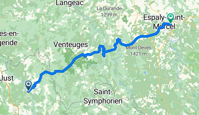
2016 Ride Day 138 - Le Malzieu-Ville to Le-Puy-en-Velay
Eine Fahrradroute, die in Le Malzieu-Ville, Occitanie, Frankreich beginnt.
Übersicht
Über diese Route
1
Tolle Fahrt. Der erste Teil fand auf Straßen mit Nullverkehr statt. Aufgrund des Regens haben wir die zweite Hälfte auf einer 'gelben' Straße gemacht, die nicht schlecht war. Sie hatte oft einen Seitenstreifen und nicht zu viel Verkehr.
- -:--
- Dauer
- 70,5 km
- Distanz
- 1.221 m
- Aufstieg
- 1.457 m
- Abstieg
- ---
- Ø-Tempo
- ---
- Max. Höhe
Jeff Kadet
Erstellt vor 9 Jahren
Fotos von der Route


Routenqualität
Wegtypen und Untergründe entlang der Route
Wegtypen
Straße
24 km
34 %
Ruhige Straße
1,4 km
2 %
Untergründe
Befestigt
29,6 km
(42 %)
Unbefestigt
0,7 km
(1 %)
Asphalt
29,6 km
42 %
Unbefestigt (undefiniert)
0,7 km
1 %
Undefiniert
40,2 km
57 %
Weiter mit Bikemap
Diese Radroute verwenden, bearbeiten oder herunterladen
Du möchtest 2016 Ride Day 138 - Le Malzieu-Ville to Le-Puy-en-Velay fahren oder sie für deine eigene Reise anpassen? Folgendes kannst du mit dieser Bikemap-Route machen:
Gratis Funktionen
- Speichere diese Route als Favorit oder in einer Sammlung
- Kopiere & plane deine eigene Version dieser Route
- Synchronisiere deine Route mit Garmin oder Wahoo
Premium-Funktionen
Kostenlose Testversion für 3 Tage oder einmalige Zahlung. Mehr über Bikemap Premium.
- Navigiere diese Route auf iOS & Android
- Exportiere eine GPX / KML-Datei dieser Route
- Erstelle deinen individuellen Ausdruck (Jetzt kostenlos ausprobieren)
- Lade diese Route für die Offline-Navigation herunter
Entdecke weitere Premium-Funktionen.
Bikemap Premium aktivierenVon unserer Community
Le Malzieu-Ville: Andere beliebte Routen, die hier beginnen
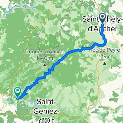
- tape 5 : St Chély d'Apcher-St Germain de Calberte0
- 188,8 km
- 2.321 m
- 2.816 m
- Le Malzieu-Ville, Occitanie, Frankreich
- 2016 Ride Day 138 - Le Malzieu-Ville to Le-Puy-en-Velay1
- 70,5 km
- 1.221 m
- 1.457 m
- Le Malzieu-Ville, Occitanie, Frankreich
- 8.etapa Le Malzieu-Ville - Le Puy-en-Velay0
- 72,4 km
- 1.233 m
- 1.432 m
- Le Malzieu-Ville, Occitanie, Frankreich


In der App öffnen