

Campbeltown - Oban - Outer Hebrides (Scotland)
Eine Fahrradroute, die in Campbeltown, Schottland, Vereinigtes Königreich beginnt.
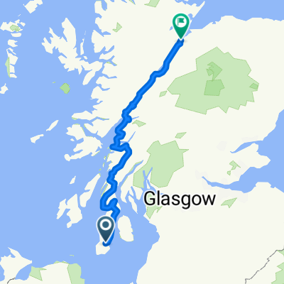
Übersicht
Über diese Route
From Campbeltown (Kintyre) to Oban, alternately on main road and Cycle Route 78. Then across the Outer Hebrides, from Barra in the south to Stornoway on the Isle of Lewis, followed by a half-day ride from Ullapool to Garve on the mainland to catch the train to Inverness.
Strong touring bike with wide puncture-proof tyres highly recommended.
Total distance : 441 km
Total climb : 4000 m
Number of days : 6 (23 hours)
More information on www.europebybike.info and www.sustrans.org.uk
- -:--
- Dauer
- 422,4 km
- Distanz
- 1.095 m
- Aufstieg
- 1.025 m
- Abstieg
- ---
- Ø-Tempo
- ---
- Max. Höhe

Routenqualität
Wegtypen und Untergründe entlang der Route
Wegtypen
Radweg
142,3 km
(34 %)
Straße
109,9 km
(26 %)
Untergründe
Befestigt
105,2 km
(25 %)
Unbefestigt
6,5 km
(2 %)
Asphalt
78,2 km
(19 %)
Befestigt (undefiniert)
26,9 km
(6 %)
Highlights der Route
POIs entlang der Route
Unterkunft nach 1,5 km
Campbeltown SYHA Youth Hostel, Big Kiln, Campbeltown, Argyll PA28 6JF, Tel: +44 (0) 1586 551188, Email: info@campbeltownbunkhouse.co.uk, Website: https://www.syha.org.uk/where-to-stay/lowlands/campbeltown.aspx
Unterkunft nach 259,2 km
Ford House, B&B, Ford PA31 8RH
Unterkunft nach 362,9 km
Broomfield Holiday Park (Camping), West Lane, Ullapool IV26 2UT, Ross Shire, Tel 1: (+44) 01854 612020, Tel 2: (+44) 01854 612664, Email : sross@broomfieldhp.com, Website : http://www.broomfieldhp.com/index.htm
Weiter mit Bikemap
Diese Radroute verwenden, bearbeiten oder herunterladen
Du möchtest Campbeltown - Oban - Outer Hebrides (Scotland) fahren oder sie für deine eigene Reise anpassen? Folgendes kannst du mit dieser Bikemap-Route machen:
Gratis Funktionen
- Speichere diese Route als Favorit oder in einer Sammlung
- Kopiere & plane deine eigene Version dieser Route
- Teile sie in Etappen ein, um eine mehrtägige Tour zu erstellen
- Synchronisiere deine Route mit Garmin oder Wahoo
Premium-Funktionen
Kostenlose Testversion für 3 Tage oder einmalige Zahlung. Mehr über Bikemap Premium.
- Navigiere diese Route auf iOS & Android
- Exportiere eine GPX / KML-Datei dieser Route
- Erstelle deinen individuellen Ausdruck (Jetzt kostenlos ausprobieren)
- Lade diese Route für die Offline-Navigation herunter
Entdecke weitere Premium-Funktionen.
Bikemap Premium aktivierenVon unserer Community
Campbeltown: Andere beliebte Routen, die hier beginnen
 ESC 116: Campbeltown - Isle of Arran - Campbeltown
- Distanz
- 135,5 km
- Aufstieg
- 518 m
- Abstieg
- 518 m
- Standort
- Campbeltown, Schottland, Vereinigtes Königreich
 Small Route
- Distanz
- 18,5 km
- Aufstieg
- 41 m
- Abstieg
- 44 m
- Standort
- Campbeltown, Schottland, Vereinigtes Königreich
 The Caledonia Way (sustrans.org.uk)
- Distanz
- 390,6 km
- Aufstieg
- 5.388 m
- Abstieg
- 5.379 m
- Standort
- Campbeltown, Schottland, Vereinigtes Königreich
 Caledonia Way Day 1
- Distanz
- 60,8 km
- Aufstieg
- 687 m
- Abstieg
- 685 m
- Standort
- Campbeltown, Schottland, Vereinigtes Königreich
 Campbeltown to Inverness
- Distanz
- 385,2 km
- Aufstieg
- 1.191 m
- Abstieg
- 1.181 m
- Standort
- Campbeltown, Schottland, Vereinigtes Königreich
 Campbeltown à Port- Askaig
- Distanz
- 52,7 km
- Aufstieg
- 659 m
- Abstieg
- 662 m
- Standort
- Campbeltown, Schottland, Vereinigtes Königreich
 Scotland day three part two
- Distanz
- 2,8 km
- Aufstieg
- 22 m
- Abstieg
- 9 m
- Standort
- Campbeltown, Schottland, Vereinigtes Königreich
 01 - Oban to Campbelltown UK
- Distanz
- 193,4 km
- Aufstieg
- 1.186 m
- Abstieg
- 1.184 m
- Standort
- Campbeltown, Schottland, Vereinigtes Königreich
In der App öffnen