

Etape du Tour 2017?
Eine Fahrradroute, die in Briançon, Provence-Alpes-Côte d'Azur Region, France beginnt.
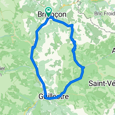
Übersicht
Über diese Route
This is more or less the most direct route that connects the points that are expected to feature in the stage. There are a number of 'detours' available to ASO that would add extra climbing in the first 80kms if that's what they want. Col de Pontis starting at around 60km would be a possibility as well as going west around the lake after Embrun and then back over the bridge to Savine.. Early in the ride there would also be scope to use the 'back' road south of Briançon that runs on the west of the Durance river passing through Les Vigneaux, also adding a bit of climbing.
- -:--
- Dauer
- 184,2 km
- Distanz
- 2.946 m
- Aufstieg
- 1.812 m
- Abstieg
- ---
- Ø-Tempo
- ---
- Ø-Tempo
Routenqualität
Wegtypen und Untergründe entlang der Route
Wegtypen
Vielbefahrene Straße
142,9 km
(78 %)
Ruhige Straße
16,4 km
(9 %)
Untergründe
Befestigt
124,5 km
(68 %)
Unbefestigt
1,1 km
(<1 %)
Asphalt
124,2 km
(67 %)
Natürlicher Untergrund
0,9 km
(<1 %)
Weiter mit Bikemap
Diese Radroute verwenden, bearbeiten oder herunterladen
Du möchtest Etape du Tour 2017? fahren oder sie für deine eigene Reise anpassen? Folgendes kannst du mit dieser Bikemap-Route machen:
Gratis Funktionen
- Speichere diese Route als Favorit oder in einer Sammlung
- Kopiere & plane deine eigene Version dieser Route
- Synchronisiere deine Route mit Garmin oder Wahoo
Premium-Funktionen
Kostenlose Testversion für 3 Tage oder einmalige Zahlung. Mehr über Bikemap Premium.
- Navigiere diese Route auf iOS & Android
- Exportiere eine GPX / KML-Datei dieser Route
- Erstelle deinen individuellen Ausdruck (Jetzt kostenlos ausprobieren)
- Lade diese Route für die Offline-Navigation herunter
Entdecke weitere Premium-Funktionen.
Bikemap Premium aktivierenVon unserer Community
Briançon: Andere beliebte Routen, die hier beginnen
 Col du Galibier via the old road
- Distanz
- 52 km
- Aufstieg
- 1.387 m
- Abstieg
- 1.239 m
- Standort
- Briançon, Provence-Alpes-Côte d’Azur, Frankreich
 Col du Granon, Five Gravel Cols, Two Perched Forts
- Distanz
- 72,6 km
- Aufstieg
- 1.887 m
- Abstieg
- 1.892 m
- Standort
- Briançon, Provence-Alpes-Côte d’Azur, Frankreich
 Colle dell Izoard
- Distanz
- 84,5 km
- Aufstieg
- 1.581 m
- Abstieg
- 1.579 m
- Standort
- Briançon, Provence-Alpes-Côte d’Azur, Frankreich
 Westalpen Etappe 09 - Briancon
- Distanz
- 83,5 km
- Aufstieg
- 1.633 m
- Abstieg
- 1.633 m
- Standort
- Briançon, Provence-Alpes-Côte d’Azur, Frankreich
 p27 Col du Lautaret
- Distanz
- 54 km
- Aufstieg
- 867 m
- Abstieg
- 1.190 m
- Standort
- Briançon, Provence-Alpes-Côte d’Azur, Frankreich
![Briançon [Col d'Izoard] loop](https://media.bikemap.net/routes/4330868/staticmaps/in_dc7e89bc-1ec1-4a7f-a59e-af212601d962_400x400_bikemap-2021-3D-static.png) Briançon [Col d'Izoard] loop
Briançon [Col d'Izoard] loop- Distanz
- 94,2 km
- Aufstieg
- 1.814 m
- Abstieg
- 1.814 m
- Standort
- Briançon, Provence-Alpes-Côte d’Azur, Frankreich
 Col de Granon
- Distanz
- 49,5 km
- Aufstieg
- 1.442 m
- Abstieg
- 1.442 m
- Standort
- Briançon, Provence-Alpes-Côte d’Azur, Frankreich
 briancon-izoard
- Distanz
- 20,4 km
- Aufstieg
- 1.201 m
- Abstieg
- 155 m
- Standort
- Briançon, Provence-Alpes-Côte d’Azur, Frankreich
In der App öffnen