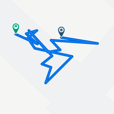
A nice gentle circular ride taking in Woodbury, Tipton St John, Otterton and Exmouth
Eine Fahrradroute, die in Topsham, England, United Kingdom beginnt.
Übersicht
Über diese Route
A nice round trip that's perfect for an evening ride. All on lanes's except for the bit from Knowle to Exmouth that uses the Cycle route. THis incorporatres the new NCR2 along the Exe Estuary from Exmouth to Lympstone. Follow the signs.
Mainly paved but gravel/cinder for Knowle to Exmouth
Convenience stores on route exist at Woodbury, Tipton St John, Exmouth and Lympstone, check for opening times should you need them. Pubs at Woodbury, Woodbury Salterton, Aylesbeare,Tipton St John, Otterton, Exmouth and Lympstone
- -:--
- Dauer
- 39,6 km
- Distanz
- 304 m
- Aufstieg
- 323 m
- Abstieg
- ---
- Ø-Tempo
- 127 m
- Ø-Tempo
Routenqualität
Wegtypen und Untergründe entlang der Route
Wegtypen
Ruhige Straße
20,4 km
(52 %)
Radweg
9,3 km
(24 %)
Untergründe
Befestigt
27,4 km
(69 %)
Asphalt
26,2 km
(66 %)
Befestigt (undefiniert)
1,2 km
(3 %)
Undefiniert
12,2 km
(31 %)
Highlights der Route
POIs entlang der Route
Interessanter Ort nach 28,6 km
This the off road cycle track between Knowle and Exmouth using the route of the olf railway line.
Interessanter Ort nach 31,2 km
The off-road cycle route winds it way off road through Exmouth and around the edge of Phear park.
Interessanter Ort nach 32,9 km
Exmouth railway station and a new off road cycle route (NCR2) makes its way to Lympstone alongside the Estuary / railway line.
Interessanter Ort nach 35,4 km
A new off-road cycle route (NCR2) makes its way from Lympstone to Exmouth railway station following the estuary and railway line.
Weiter mit Bikemap
Diese Radroute verwenden, bearbeiten oder herunterladen
Du möchtest A nice gentle circular ride taking in Woodbury, Tipton St John, Otterton and Exmouth fahren oder sie für deine eigene Reise anpassen? Folgendes kannst du mit dieser Bikemap-Route machen:
Gratis Funktionen
- Speichere diese Route als Favorit oder in einer Sammlung
- Kopiere & plane deine eigene Version dieser Route
- Synchronisiere deine Route mit Garmin oder Wahoo
Premium-Funktionen
Kostenlose Testversion für 3 Tage oder einmalige Zahlung. Mehr über Bikemap Premium.
- Navigiere diese Route auf iOS & Android
- Exportiere eine GPX / KML-Datei dieser Route
- Erstelle deinen individuellen Ausdruck (Jetzt kostenlos ausprobieren)
- Lade diese Route für die Offline-Navigation herunter
Entdecke weitere Premium-Funktionen.
Bikemap Premium aktivierenVon unserer Community
Topsham: Andere beliebte Routen, die hier beginnen
- Woodbury Salterton round via Ottery and Sidmouth
- Distanz
- 50,6 km
- Aufstieg
- 702 m
- Abstieg
- 702 m
- Standort
- Topsham, England, Vereinigtes Königreich
- Topsham loop
- Distanz
- 73,7 km
- Aufstieg
- 594 m
- Abstieg
- 594 m
- Standort
- Topsham, England, Vereinigtes Königreich
- LEJOG Day3 Topsham to Bridge Inn Yatton
- Distanz
- 124,3 km
- Aufstieg
- 302 m
- Abstieg
- 308 m
- Standort
- Topsham, England, Vereinigtes Königreich
- LEJOG Day3 Topsham to Bridge Inn Yatton
- Distanz
- 124,2 km
- Aufstieg
- 310 m
- Abstieg
- 313 m
- Standort
- Topsham, England, Vereinigtes Königreich
- topsham
- Distanz
- 4,3 km
- Aufstieg
- 32 m
- Abstieg
- 43 m
- Standort
- Topsham, England, Vereinigtes Königreich
- A nice gentle circular ride taking in Woodbury, Tipton St John, Otterton and Exmouth
- Distanz
- 39,6 km
- Aufstieg
- 304 m
- Abstieg
- 323 m
- Standort
- Topsham, England, Vereinigtes Königreich
- Westpoint
- Distanz
- 38,8 km
- Aufstieg
- 390 m
- Abstieg
- 391 m
- Standort
- Topsham, England, Vereinigtes Königreich
- 10.8. Topsham - Dartmoor Postbridge
- Distanz
- 42,7 km
- Aufstieg
- 709 m
- Abstieg
- 372 m
- Standort
- Topsham, England, Vereinigtes Königreich
In der App öffnen