

Minimize Stoplights - South Bay
LinkedIn/North Sunnyvale to Campbell
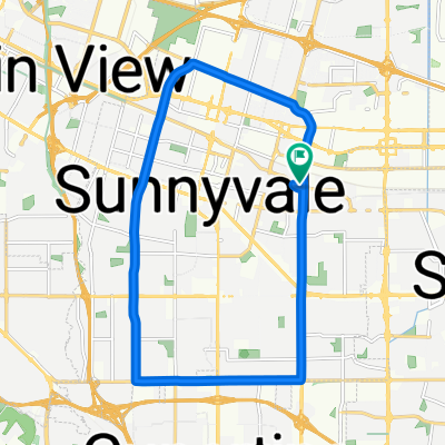
Eine Fahrradroute, die in Sunnyvale, Kalifornien, USA beginnt.
Übersicht
Über diese Route
Primary goal is to minimize number of stoplights, potentially adding 0.1 mi here and there in order to almost eliminate stops.
Avoiding major roads/significant traffic is NOT a goal.
Key points:
Use Central Expressway to avoid stoplights at:
Maude/Pastoria
Maude/Mathilda
Maude/Borregas
Maude/Sunnyvale
Maude/Fair Oaks
Worlfe/Arques
Arques/Commercial
Lawrence/Kifer
Cost: 0.6mi
Cut across from Pastoria to Soquel two buildings north of Central. Come out further from the Indio/Soquel/Central merge, which makes the left on Indio a little safer. Also saves 0.13mi
Avoid the stoplight at California/Mathilda with the California/Sobrante/Central merge. Cost: 0.21mi - This one is questionable. <!>
Exit before the Central/Lawrence merge. Use Commercial to avoid stoplight at Lawrence/Kifer and save 0.06mi
Turning left across Lawrence Expressway on Monroe is not fun - proceed with caution. But using Nobili avoids 3 stoplights and saves 0.35mi compared with Lawrence-El Camino Real - Pomeroy
Crowley/Wallace/Benton/White avoid a stoplight at Kiely/Benton and Kiely/Kaiser. Cost: 0.09mi
Unavoidable STOPLIGHT at Homestead
Use Tanoak to avoid stoplight at Forbes and Pruneridge Cost: 0.1mi
STOPLGIHTS at:
San Tomas/Saratoga
San Tomas/Stevens Creek
San Tomas/Moorpark
San Tomas/Left onto Williams
10.7 miles, 7 stoplights
- -:--
- Dauer
- 17,2 km
- Distanz
- 48 m
- Aufstieg
- 14 m
- Abstieg
- ---
- Ø-Tempo
- ---
- Max. Höhe

Teil von
Minimize Stoplights - South Bay
2 Etappen
Routenqualität
Wegtypen und Untergründe entlang der Route
Wegtypen
Ruhige Straße
7,5 km
(44 %)
Vielbefahrene Straße
4,3 km
(25 %)
Untergründe
Befestigt
11,9 km
(69 %)
Asphalt
10,9 km
(63 %)
Befestigt (undefiniert)
0,9 km
(5 %)
Weiter mit Bikemap
Diese Radroute verwenden, bearbeiten oder herunterladen
Du möchtest LinkedIn/North Sunnyvale to Campbell fahren oder sie für deine eigene Reise anpassen? Folgendes kannst du mit dieser Bikemap-Route machen:
Gratis Funktionen
- Speichere diese Route als Favorit oder in einer Sammlung
- Kopiere & plane deine eigene Version dieser Route
- Synchronisiere deine Route mit Garmin oder Wahoo
Premium-Funktionen
Kostenlose Testversion für 3 Tage oder einmalige Zahlung. Mehr über Bikemap Premium.
- Navigiere diese Route auf iOS & Android
- Exportiere eine GPX / KML-Datei dieser Route
- Erstelle deinen individuellen Ausdruck (Jetzt kostenlos ausprobieren)
- Lade diese Route für die Offline-Navigation herunter
Entdecke weitere Premium-Funktionen.
Bikemap Premium aktivierenVon unserer Community
Sunnyvale: Andere beliebte Routen, die hier beginnen
 Evelyn & Wolfe, Sunnyvale to South Wolfe Road 175, Sunnyvale
- Distanz
- 17,5 km
- Aufstieg
- 79 m
- Abstieg
- 79 m
- Standort
- Sunnyvale, Kalifornien, USA
 Sunnyvale - Saratoga loop through Big Basin Way
- Distanz
- 35,4 km
- Aufstieg
- 296 m
- Abstieg
- 293 m
- Standort
- Sunnyvale, Kalifornien, USA
 Stevens Creek - NASA - drive
- Distanz
- 24,8 km
- Aufstieg
- 90 m
- Abstieg
- 92 m
- Standort
- Sunnyvale, Kalifornien, USA
 Montebello Rd - Black mountain
- Distanz
- 19 km
- Aufstieg
- 815 m
- Abstieg
- 83 m
- Standort
- Sunnyvale, Kalifornien, USA
 Sunnyvale-Saratoga loop
- Distanz
- 41,5 km
- Aufstieg
- 445 m
- Abstieg
- 418 m
- Standort
- Sunnyvale, Kalifornien, USA
 Stevens Creek Canyon Road
- Distanz
- 54,2 km
- Aufstieg
- 1.463 m
- Abstieg
- 1.113 m
- Standort
- Sunnyvale, Kalifornien, USA
 From San Jose to Sunnyvale
- Distanz
- 22,1 km
- Aufstieg
- 58 m
- Abstieg
- 56 m
- Standort
- Sunnyvale, Kalifornien, USA
 To Rancho San Antonio Open Space Preserve
- Distanz
- 9,8 km
- Aufstieg
- 144 m
- Abstieg
- 64 m
- Standort
- Sunnyvale, Kalifornien, USA
In der App öffnen