

Getting high the easy way.
Eine Fahrradroute, die in Cruce de Arinaga, Kanarische Inseln, Spanien beginnt.
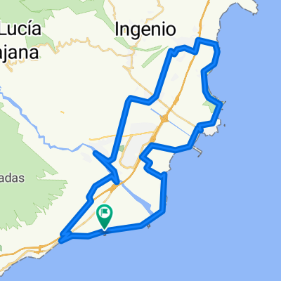
Übersicht
Über diese Route
Eine kurvenreiche, sanfte Steigung entlang eines ausgetrockneten Flussbettes, vorbei an Ziegenfarmen und traditionellen kanarischen Höhlenhäusern, gefolgt von einem recht intensiven, aber kurzen Anstieg nach El Sitio de Abajo, gefolgt von über 10 km nahezu totalem Abstieg entlang eines gut etablierten Bergpfades.
Unglaubliche Aussichten garantiert, dies ist eine großartige Nachmittagsrundfahrt und ein authentischer Einblick in die Geschichte Gran Canarias.
Was ich an dieser Route liebe, ist, dass die erste Hälfte zwar ganz nach oben führt, es aber sehr sanft und ziemlich hübsch ist - auf eine robuste Art und Weise. Der Anstieg wird nur für ein paar Kilometer am Ende ernsthaft (nahe dem als La Sorrueda bekannten See, wo Sie links abbiegen) - so gelangen Sie sehr schnell sehr hoch.
Lassen Sie sich nicht von dem auf Karten der Gegend markierten Fluss täuschen. Ich habe fast zwei Jahre in einem Haus gelebt, das über das Tal blickt, und habe nie einen Tropfen Wasser darin gesehen - nicht einmal an regnerischen Tagen - und ich muss die Route 20 Mal oder mehr gefahren sein.
Der Weg endet in Aldea Blanca und eine Straße führt Sie zurück zum Start.
Keine Geschäfte oder Wasser verfügbar, also decken Sie sich ein.
- -:--
- Dauer
- 26,2 km
- Distanz
- 674 m
- Aufstieg
- 673 m
- Abstieg
- ---
- Ø-Tempo
- ---
- Max. Höhe

Routenqualität
Wegtypen und Untergründe entlang der Route
Wegtypen
Forst- / Feldweg
17,3 km
(66 %)
Ruhige Straße
5 km
(19 %)
Untergründe
Befestigt
5 km
(19 %)
Unbefestigt
15,5 km
(59 %)
Natürlicher Untergrund
8,9 km
(34 %)
Schotter
6,6 km
(25 %)
Highlights der Route
POIs entlang der Route
Interessanter Ort nach 12 km
There's usually enough water in the lake for a refreshing dip if you fancy.
Interessanter Ort nach 12,2 km
Things only start to get tough from here...
Weiter mit Bikemap
Diese Radroute verwenden, bearbeiten oder herunterladen
Du möchtest Getting high the easy way. fahren oder sie für deine eigene Reise anpassen? Folgendes kannst du mit dieser Bikemap-Route machen:
Gratis Funktionen
- Speichere diese Route als Favorit oder in einer Sammlung
- Kopiere & plane deine eigene Version dieser Route
- Synchronisiere deine Route mit Garmin oder Wahoo
Premium-Funktionen
Kostenlose Testversion für 3 Tage oder einmalige Zahlung. Mehr über Bikemap Premium.
- Navigiere diese Route auf iOS & Android
- Exportiere eine GPX / KML-Datei dieser Route
- Erstelle deinen individuellen Ausdruck (Jetzt kostenlos ausprobieren)
- Lade diese Route für die Offline-Navigation herunter
Entdecke weitere Premium-Funktionen.
Bikemap Premium aktivierenVon unserer Community
Cruce de Arinaga: Andere beliebte Routen, die hier beginnen
 De Calle del Prof Sventenius, 44, Santa Lucía de Tirajana a Calle de Extremadura, Santa Lucía de Tirajana
- Distanz
- 18,5 km
- Aufstieg
- 232 m
- Abstieg
- 234 m
- Standort
- Cruce de Arinaga, Kanarische Inseln, Spanien
 Ruta Aldea Blanca - Santa Lucia
- Distanz
- 38,9 km
- Aufstieg
- 770 m
- Abstieg
- 778 m
- Standort
- Cruce de Arinaga, Kanarische Inseln, Spanien
 Getting high the easy way.
- Distanz
- 26,2 km
- Aufstieg
- 674 m
- Abstieg
- 673 m
- Standort
- Cruce de Arinaga, Kanarische Inseln, Spanien
 Vecindario-Sorrueda-Gallego-Aldea blanca
- Distanz
- 8,4 km
- Aufstieg
- 87 m
- Abstieg
- 88 m
- Standort
- Cruce de Arinaga, Kanarische Inseln, Spanien
 12-09-22- Castillo Romeral - Alcampo- Telde- C de Romeral
- Distanz
- 81,4 km
- Aufstieg
- 596 m
- Abstieg
- 596 m
- Standort
- Cruce de Arinaga, Kanarische Inseln, Spanien
 12-06- Cicular Castillo Romeral a El Burrero
- Distanz
- 54,4 km
- Aufstieg
- 341 m
- Abstieg
- 344 m
- Standort
- Cruce de Arinaga, Kanarische Inseln, Spanien
 Quick look at the valley
- Distanz
- 11,1 km
- Aufstieg
- 266 m
- Abstieg
- 259 m
- Standort
- Cruce de Arinaga, Kanarische Inseln, Spanien
 Getting away from it all and taking in the crocs
- Distanz
- 25,8 km
- Aufstieg
- 380 m
- Abstieg
- 379 m
- Standort
- Cruce de Arinaga, Kanarische Inseln, Spanien
In der App öffnen