

Round Trip 2020
Eine Fahrradroute, die in Toronto, Ontario, Canada beginnt.
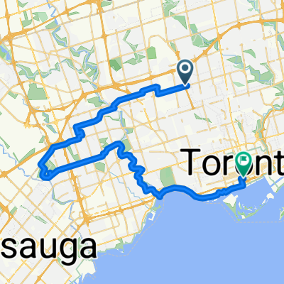
Übersicht
Über diese Route
The following describes a planned cycling trip longer than the Tour De France. This cycling trip essentially encompasses the northeastern seaboard of Canada and the United States.
To name the most important of involved stops, from beginning to end;
Toronto[C-ON], Niagara Falls [C-ON], Buffalo N.Y., Washington D.C., Baltimore [MD], Philidelphia PA, New York City, New Haven [CT], Boston [MA], Portland [ME], Bangor [ME], Saint John [C-NB], Moncton [C-NB], Halifax [C-NS], Moncton [C-NB], Fredericton [C-NB], Edmundston [C-NB], Quebec City [C-QC], Montreal [C-QC], Ottawa [C-ON], Kingston [C-ON], Belleville [C-ON], Cobourg [C-ON], Toronto [C-ON]. (Note: Belleville and Cobourg because of family importance in both places). The trip will both begin and end at the tallest building in the western hemisphere, the CN Tower in Toronto, Canada, and contains the possibility for a mountain climb should weather provide the luxury. This trip totals out to an approximate 10 days 3 hours biking and assuming appropriate lengths of sleep and sightseeing in each of the destinations, would make the entire trip calculable to approximately 30-35 days with 12 hours biking per day.
[Timing assumes 20km/h biking which has been proven sustainable with synthetic training tests at a local gym, more realistic distance tests are to be conducted during summer 2016 through 2019 to prepare].
- -:--
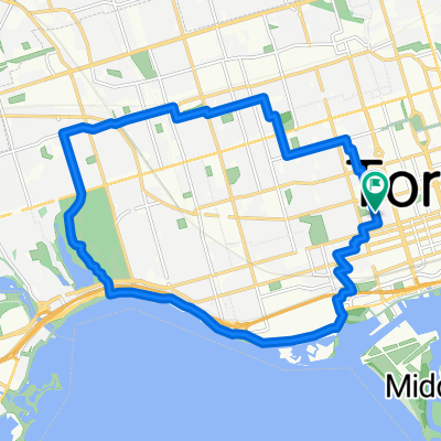
- Dauer
- 4.859 km
- Distanz
- 1.896 m
- Aufstieg
- 1.897 m
- Abstieg
- ---
- Ø-Tempo
- ---
- Ø-Tempo

Weiter mit Bikemap
Diese Radroute verwenden, bearbeiten oder herunterladen
Du möchtest Round Trip 2020 fahren oder sie für deine eigene Reise anpassen? Folgendes kannst du mit dieser Bikemap-Route machen:
Gratis Funktionen
- Speichere diese Route als Favorit oder in einer Sammlung
- Kopiere & plane deine eigene Version dieser Route
- Synchronisiere deine Route mit Garmin oder Wahoo
Premium-Funktionen
Kostenlose Testversion für 3 Tage oder einmalige Zahlung. Mehr über Bikemap Premium.
- Navigiere diese Route auf iOS & Android
- Exportiere eine GPX / KML-Datei dieser Route
- Erstelle deinen individuellen Ausdruck (Jetzt kostenlos ausprobieren)
- Lade diese Route für die Offline-Navigation herunter
Entdecke weitere Premium-Funktionen.
Bikemap Premium aktivierenVon unserer Community
Toronto: Andere beliebte Routen, die hier beginnen
 -Short Steep climbs & fast descents in the Beach
- Distanz
- 5,2 km
- Aufstieg
- 98 m
- Abstieg
- 108 m
- Standort
- Toronto, Ontario, Kanada
 - Short steep climbs & fast descents in the Beach
- Distanz
- 5,4 km
- Aufstieg
- 107 m
- Abstieg
- 110 m
- Standort
- Toronto, Ontario, Kanada
 Lawrence West to Union Station Via Centennial Park, Duck Pond, Humber River Trail,
- Distanz
- 45,5 km
- Aufstieg
- 285 m
- Abstieg
- 384 m
- Standort
- Toronto, Ontario, Kanada
 Thicc bike bois
- Distanz
- 61,3 km
- Aufstieg
- 173 m
- Abstieg
- 170 m
- Standort
- Toronto, Ontario, Kanada
 Cedarvale Park
- Distanz
- 5,9 km
- Aufstieg
- 39 m
- Abstieg
- 39 m
- Standort
- Toronto, Ontario, Kanada
 Route to Fit 4 Less
- Distanz
- 85,5 km
- Aufstieg
- 416 m
- Abstieg
- 417 m
- Standort
- Toronto, Ontario, Kanada
 High Park
- Distanz
- 18,4 km
- Aufstieg
- 63 m
- Abstieg
- 63 m
- Standort
- Toronto, Ontario, Kanada
 Cabana
- Distanz
- 13,1 km
- Aufstieg
- 91 m
- Abstieg
- 93 m
- Standort
- Toronto, Ontario, Kanada
In der App öffnen