

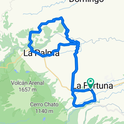
Into the clouds, La Fortuna - Monteverde XTREME ride
Eine Fahrradroute, die in La Fortuna, Provinz Alajuela, Costa Rica beginnt.
Übersicht
Über diese Route
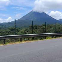
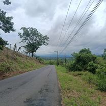
Costa Rica cycling, the perfect way to learn to know our beautiful country, for those riders who like tho challenge them selve this is a route you cannot mis out on. Beautiful far sights, rough climbs, river crossings, allone in the mountains crossing the transition area between Caribic and pacific coast!
Want to know more check out www.costaricacycling.com or send an email to info@costaricacycling.com to start your Costa Rica adventure on the right track!
- -:--
- Dauer
- 82,5 km
- Distanz
- 1.559 m
- Aufstieg
- 764 m
- Abstieg
- ---
- Ø-Tempo
- ---
- Max. Höhe

Routenqualität
Wegtypen und Untergründe entlang der Route
Wegtypen
Straße
34,9 km
(42 %)
Ruhige Straße
33,9 km
(41 %)
Untergründe
Befestigt
23,9 km
(29 %)
Unbefestigt
49,6 km
(60 %)
Asphalt
23,9 km
(29 %)
Schotter
19,5 km
(24 %)
Weiter mit Bikemap
Diese Radroute verwenden, bearbeiten oder herunterladen
Du möchtest Into the clouds, La Fortuna - Monteverde XTREME ride fahren oder sie für deine eigene Reise anpassen? Folgendes kannst du mit dieser Bikemap-Route machen:
Gratis Funktionen
- Speichere diese Route als Favorit oder in einer Sammlung
- Kopiere & plane deine eigene Version dieser Route
- Teile sie in Etappen ein, um eine mehrtägige Tour zu erstellen
- Synchronisiere deine Route mit Garmin oder Wahoo
Premium-Funktionen
Kostenlose Testversion für 3 Tage oder einmalige Zahlung. Mehr über Bikemap Premium.
- Navigiere diese Route auf iOS & Android
- Exportiere eine GPX / KML-Datei dieser Route
- Erstelle deinen individuellen Ausdruck (Jetzt kostenlos ausprobieren)
- Lade diese Route für die Offline-Navigation herunter
Entdecke weitere Premium-Funktionen.
Bikemap Premium aktivierenVon unserer Community
La Fortuna: Andere beliebte Routen, die hier beginnen
 RIDE ARENAL - 36k
- Distanz
- 36,8 km
- Aufstieg
- 613 m
- Abstieg
- 613 m
- Standort
- La Fortuna, Provinz Alajuela, Costa Rica
 De La Fortuna - El Castillo a El Fósforo-El Castillo
- Distanz
- 107,8 km
- Aufstieg
- 4.392 m
- Abstieg
- 4.394 m
- Standort
- La Fortuna, Provinz Alajuela, Costa Rica
 A09 SpringsResort Fortuna
- Distanz
- 27,4 km
- Aufstieg
- 555 m
- Abstieg
- 557 m
- Standort
- La Fortuna, Provinz Alajuela, Costa Rica
 Montana de fuego-Nvo arenal
- Distanz
- 38,2 km
- Aufstieg
- 649 m
- Abstieg
- 410 m
- Standort
- La Fortuna, Provinz Alajuela, Costa Rica
 la represa
- Distanz
- 34,9 km
- Aufstieg
- 586 m
- Abstieg
- 632 m
- Standort
- La Fortuna, Provinz Alajuela, Costa Rica
 De Alajuela Province a Calle Arenal Observatory Lodge
- Distanz
- 23,9 km
- Aufstieg
- 605 m
- Abstieg
- 143 m
- Standort
- La Fortuna, Provinz Alajuela, Costa Rica
 Ride Arenal 35k
- Distanz
- 33,6 km
- Aufstieg
- 654 m
- Abstieg
- 654 m
- Standort
- La Fortuna, Provinz Alajuela, Costa Rica
 chachagua
- Distanz
- 18,3 km
- Aufstieg
- 367 m
- Abstieg
- 376 m
- Standort
- La Fortuna, Provinz Alajuela, Costa Rica
In der App öffnen