Premium Badge Aus dem App Store herunterladen Hol dir Bikemap auf Google Play Turn-by-Turn-Navigation Offline Maps Bike Type Optimized Routing Premium Maps Individueller Fahrradcomputer Routen-Export Route Previews Sturzerkennung Premium Support

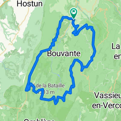
Radroute in Saint-Jean-en-Royans, Auvergne-Rhône-Alpes, Frankreich

Climbers Delight

0
Route in der Bikemap App öffnen

Route in der Bikemap App öffnen

Diese Route in Bikemap Web öffnen

Diese Route in Bikemap Web öffnen

81 km
Distanz
2270 m
Aufstieg
1900 m
Abstieg
-:-- h
Dauer
-- km/h
ø-Tempo
1086 m
Max. Höhe

Über diese Route

A steady climb via Leoncel to the Col de Limouche & its fabulous views of the Isere & Rhone Valleys. You can also see as far as the mountainous Ardeche & the further north Central Massiff.Within 2kms you will now fork left to Gigors. Here the landscape begins to change with a rise in temperature from greener to drier, tres provencal.At the classic small village of gigors you continue on down to the bigger village of Beaufort.Crossing the reknown Die white grape open vinyards. Here your climbing will recommence. Again long & stedy . Passing the Col du Bachus. As you rejoin the plateau into Leoncel, it will cool down before you ; with the help of a newspaper/ or plastic bag up your jersey descend. on a tempo descent back to base,& a well deserved coffee to St Jean.

Diese Fahrradroute ist ideal für: Rennrad

Du fährst auf folgendem Untergrund: Asphaltiert

Passe diese Fahrradroute mit dem Bikemap-Routenplaner an.

Passe diese Route an!

Wusstest du schon? Du kannst diese Route als Vorlage in unserem Routenplaner verwenden, und sie ganz einfach nach deinen Bedürfnissen anpassen. So planst du noch schneller deine perfekte Radtour.

In der App öffnen