

Laa/ Thaya - Lednice - Brno
Eine Fahrradroute, die in Laa an der Thaya, Lower Austria, Austria beginnt.
Übersicht
Über diese Route
I rode this route within two days while spending a night in Lednice. Riding the route is not too complicated as you can follow the signs of European and Czech bike routes during some parts of your journey. But in any case I would take maps with me!
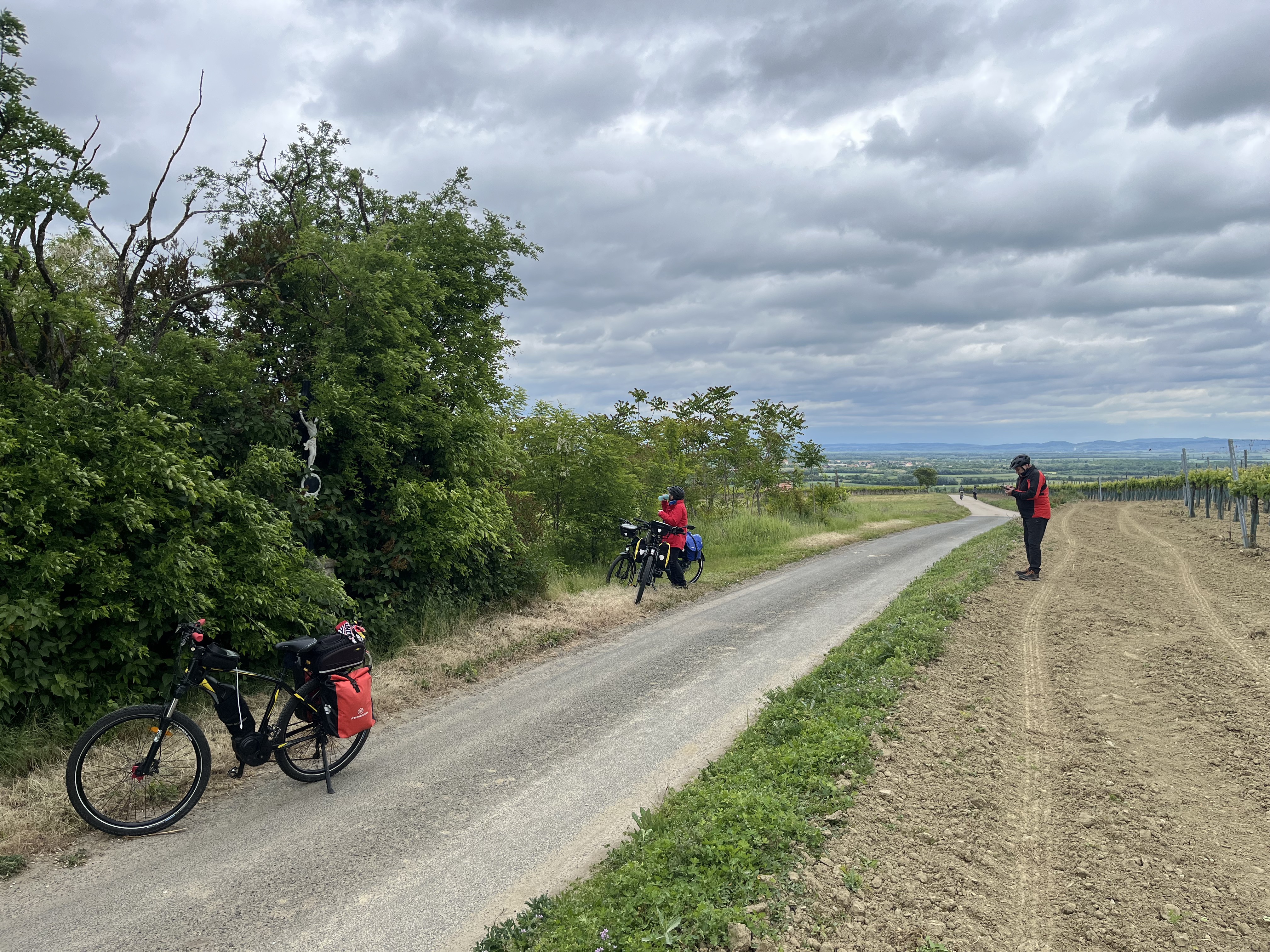
Ladscapes are heterogenious: between Laa until Mikulov there is mostly agricultural land (not much shadow or forests), followed by vine yards, a beautiful national park until Lednice. The castles and towns of Mikulov and Lednice are worth a visit!
The bike paths are in different conditions: from supreme asphalt to such bad condition that you can hardly ride there. I would recommend a mountain bike or solid trekking bike.
The landscape of the second part of the route after Lednice is also dominated by small villages and towns, vineyards and land in agricultural use. The route alongside the Novy Mlyny Lakes is beautiful but bike paths are in bad condition, between Ivan and Rajhrad you mostly ride by the street that is also used by car traffic (there is not too much traffic, so it seems safe). In Rajhradice you can have a break at the monastery. After Rajhrad you can mostly take the bike lane by the riverside that takes you quickly to Brno.
- -:--
- Dauer
- 114,8 km
- Distanz
- 225 m
- Aufstieg
- 186 m
- Abstieg
- ---
- Ø-Tempo
- ---
- Ø-Tempo

Routenqualität
Wegtypen und Untergründe entlang der Route
Wegtypen
Straße
32,4 km
(28 %)
Radweg
30,6 km
(27 %)
Untergründe
Befestigt
98,6 km
(86 %)
Unbefestigt
6,4 km
(6 %)
Asphalt
95,6 km
(83 %)
Natürlicher Untergrund
2,6 km
(2 %)
Weiter mit Bikemap
Diese Radroute verwenden, bearbeiten oder herunterladen
Du möchtest Laa/ Thaya - Lednice - Brno fahren oder sie für deine eigene Reise anpassen? Folgendes kannst du mit dieser Bikemap-Route machen:
Gratis Funktionen
- Speichere diese Route als Favorit oder in einer Sammlung
- Kopiere & plane deine eigene Version dieser Route
- Synchronisiere deine Route mit Garmin oder Wahoo
Premium-Funktionen
Kostenlose Testversion für 3 Tage oder einmalige Zahlung. Mehr über Bikemap Premium.
- Navigiere diese Route auf iOS & Android
- Exportiere eine GPX / KML-Datei dieser Route
- Erstelle deinen individuellen Ausdruck (Jetzt kostenlos ausprobieren)
- Lade diese Route für die Offline-Navigation herunter
Entdecke weitere Premium-Funktionen.
Bikemap Premium aktivierenVon unserer Community
Laa an der Thaya: Andere beliebte Routen, die hier beginnen
 Stadtplatz 32, Laa an der Thaya nach Thermenplatz 3, Laa an der Thaya
- Distanz
- 57 km
- Aufstieg
- 212 m
- Abstieg
- 221 m
- Standort
- Laa an der Thaya, Niederösterreich, Österreich
 Laa - Znaim lang
- Distanz
- 85,7 km
- Aufstieg
- 505 m
- Abstieg
- 503 m
- Standort
- Laa an der Thaya, Niederösterreich, Österreich
 Iron Curtain Trail 8
- Distanz
- 42,4 km
- Aufstieg
- 306 m
- Abstieg
- 285 m
- Standort
- Laa an der Thaya, Niederösterreich, Österreich
 Laa an der Thaya nach Ferdinand-Kurz-Gasse, Horn
- Distanz
- 121,6 km
- Aufstieg
- 1.145 m
- Abstieg
- 1.009 m
- Standort
- Laa an der Thaya, Niederösterreich, Österreich
 EV13 Etappe 8: Laa - Valtice
- Distanz
- 49,2 km
- Aufstieg
- 313 m
- Abstieg
- 288 m
- Standort
- Laa an der Thaya, Niederösterreich, Österreich
 Veltliner Radtour
- Distanz
- 85,7 km
- Aufstieg
- 888 m
- Abstieg
- 889 m
- Standort
- Laa an der Thaya, Niederösterreich, Österreich
 Laa a.d. Thaya -Pasohlávky- Bavory - Mikulov & Laa an der Thaya 🚴🇦🇹&🇨🇿🌞👌
- Distanz
- 92,9 km
- Aufstieg
- 400 m
- Abstieg
- 403 m
- Standort
- Laa an der Thaya, Niederösterreich, Österreich
 Hallo Nachbar
- Distanz
- 58,6 km
- Aufstieg
- 204 m
- Abstieg
- 202 m
- Standort
- Laa an der Thaya, Niederösterreich, Österreich
In der App öffnen