

Routes around Le Peyrat
Col du Montsegur et Col de la Lauze
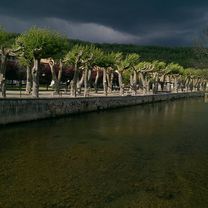
Eine Fahrradroute, die in Bélesta, Languedoc-Roussillon-Midi-Pyrénées, Frankreich beginnt.
Übersicht
Über diese Route
Beautiful route with a 9k climb up to the Col du Montesgur at 1059m with average of 7% and max of 9% in the last km, drop down into Montferrier and take the 4k climb up to the Col del la Lauze at 948m with an average of 5.6% and max of 7.6%.Then follow the the beautiful and quiet road that traverses the sides of the Armentiere valley at 900m for a technical descent down through Fretchenet to Celles, take the D117 back to Lavelanet for a croissant and cafe before heading back to Le Peyrat.
- -:--
- Dauer
- 80 km
- Distanz
- 1.201 m
- Aufstieg
- 1.203 m
- Abstieg
- ---
- Ø-Tempo
- ---
- Max. Höhe

Teil von
11 Etappen
Routenqualität
Wegtypen und Untergründe entlang der Route
Wegtypen
Vielbefahrene Straße
34,8 km
(43 %)
Straße
24,6 km
(31 %)
Untergründe
Befestigt
1,7 km
(2 %)
Unbefestigt
1,9 km
(2 %)
Schotter
1,4 km
(2 %)
Befestigt (undefiniert)
1,2 km
(2 %)
Weiter mit Bikemap
Diese Radroute verwenden, bearbeiten oder herunterladen
Du möchtest Col du Montsegur et Col de la Lauze fahren oder sie für deine eigene Reise anpassen? Folgendes kannst du mit dieser Bikemap-Route machen:
Gratis Funktionen
- Speichere diese Route als Favorit oder in einer Sammlung
- Kopiere & plane deine eigene Version dieser Route
- Teile sie in Etappen ein, um eine mehrtägige Tour zu erstellen
- Synchronisiere deine Route mit Garmin oder Wahoo
Premium-Funktionen
Kostenlose Testversion für 3 Tage oder einmalige Zahlung. Mehr über Bikemap Premium.
- Navigiere diese Route auf iOS & Android
- Exportiere eine GPX / KML-Datei dieser Route
- Erstelle deinen individuellen Ausdruck (Jetzt kostenlos ausprobieren)
- Lade diese Route für die Offline-Navigation herunter
Entdecke weitere Premium-Funktionen.
Bikemap Premium aktivierenVon unserer Community
Bélesta: Andere beliebte Routen, die hier beginnen
 Around Montbel
- Distanz
- 26,9 km
- Aufstieg
- 474 m
- Abstieg
- 475 m
- Standort
- Bélesta, Languedoc-Roussillon-Midi-Pyrénées, Frankreich
 44k Le Peyrat-Chalabre-Col du Tuquet - Puivert
- Distanz
- 44,3 km
- Aufstieg
- 612 m
- Abstieg
- 615 m
- Standort
- Bélesta, Languedoc-Roussillon-Midi-Pyrénées, Frankreich
 2014 Ride Day 46 - Bélesta Circle through Puivert, Castelreng, Chalabre, and Lesparrou
- Distanz
- 81,6 km
- Aufstieg
- 1.153 m
- Abstieg
- 1.157 m
- Standort
- Bélesta, Languedoc-Roussillon-Midi-Pyrénées, Frankreich
 Le Peyrat-Espezel-Puivert 50k
- Distanz
- 56,2 km
- Aufstieg
- 635 m
- Abstieg
- 632 m
- Standort
- Bélesta, Languedoc-Roussillon-Midi-Pyrénées, Frankreich
 Plateau de Sault et Port de Pailhères (Ariège 2017)
- Distanz
- 73,8 km
- Aufstieg
- 2.067 m
- Abstieg
- 2.067 m
- Standort
- Bélesta, Languedoc-Roussillon-Midi-Pyrénées, Frankreich
 Le Peyrat - Col du Pradel
- Distanz
- 108,3 km
- Aufstieg
- 1.823 m
- Abstieg
- 1.823 m
- Standort
- Bélesta, Languedoc-Roussillon-Midi-Pyrénées, Frankreich
 F/Espezel-Col du Pradel-Col de Pailheres-ret
- Distanz
- 75 km
- Aufstieg
- 2.170 m
- Abstieg
- 2.168 m
- Standort
- Bélesta, Languedoc-Roussillon-Midi-Pyrénées, Frankreich
 Etape 5 : Belesta - Ax-Les-Thermes direct
- Distanz
- 49,6 km
- Aufstieg
- 1.689 m
- Abstieg
- 1.463 m
- Standort
- Bélesta, Languedoc-Roussillon-Midi-Pyrénées, Frankreich
In der App öffnen