

Golfo Nicoya Montezuma- samara- San jose
Eine Fahrradroute, die in Paquera, Provinz Puntarenas, Costa Rica beginnt.
Übersicht
Über diese Route
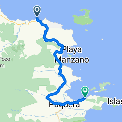
A beautiful road, small hils country side, gravel, beaches and see from Jicaral to Montezuma
One of the routes you can use to get the best experience out of your Costa Rica Cycling trip. Want to learn more just let us know at info@Costaricacycling.com or see our website www.costaricacycling.com
- -:--
- Dauer
- 505,9 km
- Distanz
- 2.016 m
- Aufstieg
- 863 m
- Abstieg
- ---
- Ø-Tempo
- ---
- Max. Höhe

Routenqualität
Wegtypen und Untergründe entlang der Route
Wegtypen
Ruhige Straße
237,8 km
(47 %)
Straße
86 km
(17 %)
Untergründe
Befestigt
207,4 km
(41 %)
Unbefestigt
60,7 km
(12 %)
Asphalt
202,4 km
(40 %)
Unbefestigt (undefiniert)
30,4 km
(6 %)
Weiter mit Bikemap
Diese Radroute verwenden, bearbeiten oder herunterladen
Du möchtest Golfo Nicoya Montezuma- samara- San jose fahren oder sie für deine eigene Reise anpassen? Folgendes kannst du mit dieser Bikemap-Route machen:
Gratis Funktionen
- Speichere diese Route als Favorit oder in einer Sammlung
- Kopiere & plane deine eigene Version dieser Route
- Teile sie in Etappen ein, um eine mehrtägige Tour zu erstellen
- Synchronisiere deine Route mit Garmin oder Wahoo
Premium-Funktionen
Kostenlose Testversion für 3 Tage oder einmalige Zahlung. Mehr über Bikemap Premium.
- Navigiere diese Route auf iOS & Android
- Exportiere eine GPX / KML-Datei dieser Route
- Erstelle deinen individuellen Ausdruck (Jetzt kostenlos ausprobieren)
- Lade diese Route für die Offline-Navigation herunter
Entdecke weitere Premium-Funktionen.
Bikemap Premium aktivierenVon unserer Community
Paquera: Andere beliebte Routen, die hier beginnen
 De 21 a 21
- Distanz
- 130 km
- Aufstieg
- 2.164 m
- Abstieg
- 2.169 m
- Standort
- Paquera, Provinz Puntarenas, Costa Rica
 21 to Calle Gomez, Tamarindo
- Distanz
- 123 km
- Aufstieg
- 1.352 m
- Abstieg
- 1.346 m
- Standort
- Paquera, Provinz Puntarenas, Costa Rica
 , Puntarenas to Ruta Nacional 169, San Ramón
- Distanz
- 87 km
- Aufstieg
- 2.239 m
- Abstieg
- 1.202 m
- Standort
- Paquera, Provinz Puntarenas, Costa Rica
 Naranjo - Montezuma
- Distanz
- 64,5 km
- Aufstieg
- 625 m
- Abstieg
- 595 m
- Standort
- Paquera, Provinz Puntarenas, Costa Rica
 ferry a ferry
- Distanz
- 28 km
- Aufstieg
- 710 m
- Abstieg
- 701 m
- Standort
- Paquera, Provinz Puntarenas, Costa Rica
 Recovered Route
- Distanz
- 32,9 km
- Aufstieg
- 754 m
- Abstieg
- 756 m
- Standort
- Paquera, Provinz Puntarenas, Costa Rica
 r128 ROAM
- Distanz
- 100,9 km
- Aufstieg
- 727 m
- Abstieg
- 719 m
- Standort
- Paquera, Provinz Puntarenas, Costa Rica
 9.736° N -85.019° W a 9.735° N -85.016° W
- Distanz
- 33,4 km
- Aufstieg
- 516 m
- Abstieg
- 521 m
- Standort
- Paquera, Provinz Puntarenas, Costa Rica
In der App öffnen