

Ślimak Ślimakiewicz
Eine Fahrradroute, die in Seville, Andalusia, Spain beginnt.
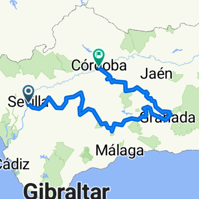
Übersicht
Über diese Route
- -:--
- Dauer
- 2.006,2 km
- Distanz
- 4.122 m
- Aufstieg
- 4.132 m
- Abstieg
- ---
- Ø-Tempo
- ---
- Ø-Tempo

Routenqualität
Wegtypen und Untergründe entlang der Route
Wegtypen
Vielbefahrene Straße
560,5 km
(28 %)
Straße
492,7 km
(25 %)
Untergründe
Befestigt
718,7 km
(36 %)
Unbefestigt
165,7 km
(8 %)
Asphalt
676,5 km
(34 %)
Schotter
59,5 km
(3 %)
Highlights der Route
POIs entlang der Route
Interessanter Ort nach 636,9 km
Interessanter Ort nach 687,9 km
Fahrrad-Service nach 1.097 km
Fahrrad-Service nach 1.123,6 km
Fahrrad-Service nach 1.152,3 km
DANGEROUS ROADS Alto de São Macário is a mountain pass at an elevation of 1.052m (3,451ft) above the sea level, located in the district of Viseu, in the Central Inland of Portugal. The road to the summit is called CM1123. It's asphalted, but narrow, unprotected by guardrails and very steep. There are 2 routes to reach the pass. Starting from Sul (Viseu), the ascent is 9.05 km long. Over this distance, the elevation gain is 820 meters. The average percentage is 9 %. And starting from Aldeia de Sul, the ascent is 9.2 km long. Over this distance, the elevation gain is 840 meters. The average percentage is 9.1 %. At the summit there’s a monastery called Santuario de São Macário and several communication towers.
Fahrrad-Service nach 1.156,1 km
DANGEROUS ROAD Covas do Monte track The track to Covas do Monte is a dangerous curvy mountainous road which rarely permit speeds over 15km/h, located in the mountain range of Serra da Gralheira, in the District of Viseu, Central Inland of Portugal. This dirt track has a total length of 4.2km to Covas do Monte, a small town in the municipality of São Pedro do Sul, District of Viseu.
Interessanter Ort nach 1.196,8 km
Interessanter Ort nach 1.292,7 km
Wpisane cośtam na UNESCO pirwsza stolyca miejsce, gdzie narodziło się państwo
Fahrrad-Service nach 1.365,5 km
Interessanter Ort nach 1.375,7 km
Ten taki park to go wychwalają niesamowicie, jakieś kamienne wioski zagubione gdzieś tam konie dzikie w galopie
Fahrrad-Service nach 1.391,7 km
Fahrrad-Service nach 1.514,2 km
Fahrrad-Service nach 1.553,9 km
Fahrrad-Service nach 1.603 km
Fahrrad-Service nach 1.613,5 km
Fahrrad-Service nach 1.633,2 km
Interessanter Ort nach 1.645,8 km
piekne miasteczko
Fahrrad-Service nach 1.728,5 km
Fahrrad-Service nach 1.823,2 km
Interessanter Ort nach 1.824,3 km
Gł miasteczko Picos de la Europa
Fahrrad-Service nach 1.845,3 km
Weiter mit Bikemap
Diese Radroute verwenden, bearbeiten oder herunterladen
Du möchtest Ślimak Ślimakiewicz fahren oder sie für deine eigene Reise anpassen? Folgendes kannst du mit dieser Bikemap-Route machen:
Gratis Funktionen
- Speichere diese Route als Favorit oder in einer Sammlung
- Kopiere & plane deine eigene Version dieser Route
- Synchronisiere deine Route mit Garmin oder Wahoo
Premium-Funktionen
Kostenlose Testversion für 3 Tage oder einmalige Zahlung. Mehr über Bikemap Premium.
- Navigiere diese Route auf iOS & Android
- Exportiere eine GPX / KML-Datei dieser Route
- Erstelle deinen individuellen Ausdruck (Jetzt kostenlos ausprobieren)
- Lade diese Route für die Offline-Navigation herunter
Entdecke weitere Premium-Funktionen.
Bikemap Premium aktivierenVon unserer Community
Seville: Andere beliebte Routen, die hier beginnen
 Rutas del Legado Andalusí (Sevilla-Granada-Córdoba).
- Distanz
- 625,2 km
- Aufstieg
- 2.977 m
- Abstieg
- 2.886 m
- Standort
- Sevilla, Andalusien, Spanien
 Vía de la Plata (Sevilla-Santiago).
- Distanz
- 936,3 km
- Aufstieg
- 3.201 m
- Abstieg
- 2.961 m
- Standort
- Sevilla, Andalusien, Spanien
 Sevilla - Matalascanas - Jerez - Cadiz
- Distanz
- 214,1 km
- Aufstieg
- 969 m
- Abstieg
- 968 m
- Standort
- Sevilla, Andalusien, Spanien
 De Avenida de la Paz 93, Sevilla a Calle Piel de Toro 6, Sevilla
- Distanz
- 36,9 km
- Aufstieg
- 458 m
- Abstieg
- 464 m
- Standort
- Sevilla, Andalusien, Spanien
 Sevilla - Mairena del Aljarafe - Sevilla
- Distanz
- 19,6 km
- Aufstieg
- 137 m
- Abstieg
- 137 m
- Standort
- Sevilla, Andalusien, Spanien
 Sevilla-Alcala de Guadaira-Parque Natural
- Distanz
- 26,9 km
- Aufstieg
- 132 m
- Abstieg
- 123 m
- Standort
- Sevilla, Andalusien, Spanien
 Séville-Cadix-Barcelone
- Distanz
- 1.658,5 km
- Aufstieg
- 890 m
- Abstieg
- 894 m
- Standort
- Sevilla, Andalusien, Spanien
 CORIA BARCAZA
- Distanz
- 49,8 km
- Aufstieg
- 143 m
- Abstieg
- 145 m
- Standort
- Sevilla, Andalusien, Spanien
In der App öffnen