

first alternative Sarajevo-milano
Eine Fahrradroute, die in Sarajevo, Föderation Bosnien und Herzegowina, Bosnien und Herzegowina beginnt.
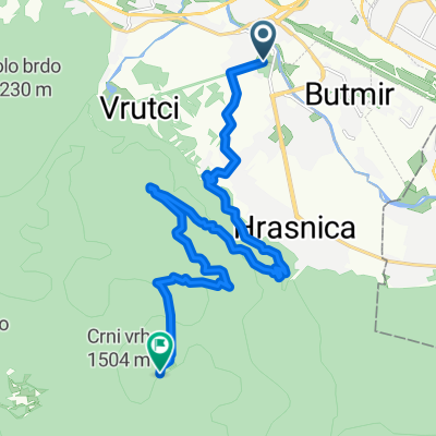
Übersicht
Über diese Route
ACTUALLY, more like 1150km and 5000m ascent
NOTE: elevation is not what it is in reality: bike maps won't let you plan a route across water, but there is a ferry that will take you from Rab island to Krk island in croatia, south of the Istrian peninsula, avoiding a long climb along the coast, saving you probably approx 150km and 1000m climb, but involving a fairly cheap ferry ride.
Secondly, we went all the way around Istria (the peninsula on the border between coastal croatia, slovenia and italy): firstly cause there are nice little towns there, and secondly because there's a wonderful bike path from Porec to Trieste (called the 'parenzana'), it's seriously beautiful, going through the slovenian salt marshes, and we have good hosts there. It would also reduce your climb by approx 700-800 metres incline, since you'd be circumventing the bordering mountain between trieste and Rijeka.
Also, depends on your intention, but on the italian part, we went further south than the route shown here: going through mantova and cremona - with really nice hosts and nice little towns (cremona is the european capital of violin making), which would be longer but flatter along the Pó plaine.
pros: I can help with hosting for most of the way starting at ploce, croatia, on the bosnian border.
- once out of bosnia, it's a fairly regular and gently slopeing road along the adriatic, with a few short exceptions, so a 60-70km daily average is quite realistic, again, more like 80-100km in italy, and 50km in bosnia.
you'd be next to the sea a lot of the time in august: so bathing whenever and wherever you want. BUT very touristy this time of year (hosting won't be as easy?) and veeery hot.
- -:--
- Dauer
- 1.264,6 km
- Distanz
- 2.281 m
- Aufstieg
- 2.685 m
- Abstieg
- ---
- Ø-Tempo
- ---
- Max. Höhe

Weiter mit Bikemap
Diese Radroute verwenden, bearbeiten oder herunterladen
Du möchtest first alternative Sarajevo-milano fahren oder sie für deine eigene Reise anpassen? Folgendes kannst du mit dieser Bikemap-Route machen:
Gratis Funktionen
- Speichere diese Route als Favorit oder in einer Sammlung
- Kopiere & plane deine eigene Version dieser Route
- Teile sie in Etappen ein, um eine mehrtägige Tour zu erstellen
- Synchronisiere deine Route mit Garmin oder Wahoo
Premium-Funktionen
Kostenlose Testversion für 3 Tage oder einmalige Zahlung. Mehr über Bikemap Premium.
- Navigiere diese Route auf iOS & Android
- Exportiere eine GPX / KML-Datei dieser Route
- Erstelle deinen individuellen Ausdruck (Jetzt kostenlos ausprobieren)
- Lade diese Route für die Offline-Navigation herunter
Entdecke weitere Premium-Funktionen.
Bikemap Premium aktivierenVon unserer Community
Sarajevo: Andere beliebte Routen, die hier beginnen
 From Sarajevo to Visoko
- Distanz
- 55,3 km
- Aufstieg
- 1.350 m
- Abstieg
- 1.441 m
- Standort
- Sarajevo, Föderation Bosnien und Herzegowina, Bosnien und Herzegowina
 Pofalići - Hum repetitor
- Distanz
- 5,6 km
- Aufstieg
- 299 m
- Abstieg
- 15 m
- Standort
- Sarajevo, Föderation Bosnien und Herzegowina, Bosnien und Herzegowina
 MTB City Road
- Distanz
- 14,6 km
- Aufstieg
- 270 m
- Abstieg
- 272 m
- Standort
- Sarajevo, Föderation Bosnien und Herzegowina, Bosnien und Herzegowina
 h stan
- Distanz
- 16,4 km
- Aufstieg
- 943 m
- Abstieg
- 131 m
- Standort
- Sarajevo, Föderation Bosnien und Herzegowina, Bosnien und Herzegowina
 first alternative Sarajevo-milano
- Distanz
- 1.264,6 km
- Aufstieg
- 2.281 m
- Abstieg
- 2.685 m
- Standort
- Sarajevo, Föderation Bosnien und Herzegowina, Bosnien und Herzegowina
 Alpasino - Krupac - Dejcici - Trnovo - Dobrinja
- Distanz
- 69,4 km
- Aufstieg
- 909 m
- Abstieg
- 919 m
- Standort
- Sarajevo, Föderation Bosnien und Herzegowina, Bosnien und Herzegowina
 Ive Andrića 17c to Ive Andrića 19j, Sarajevo
- Distanz
- 35,8 km
- Aufstieg
- 181 m
- Abstieg
- 174 m
- Standort
- Sarajevo, Föderation Bosnien und Herzegowina, Bosnien und Herzegowina
 Hilandarska 36, Lukavica to Hilandarska 20, Lukavica
- Distanz
- 30,5 km
- Aufstieg
- 264 m
- Abstieg
- 263 m
- Standort
- Sarajevo, Föderation Bosnien und Herzegowina, Bosnien und Herzegowina
In der App öffnen