

Le sorgenti del Rio Bianco
Eine Fahrradroute, die in Kobarid, Kobarid, Slowenien beginnt.
Übersicht
Über diese Route
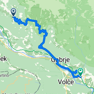
Questo itinerario, immerso nella natura selvaggia è adatto alle mountain bike. Si Parte da Prossenicco e si scende verso il con ne di Ponte Vittorio, si imbocca la strada bianca vicino al con ne che costeggia il ume, dopo poco si incontra la con uenza di due corsi d’acqua, il Rio Bianco e il Rio Nero; da qua nasce il ume Natisone. Si prosegue e dopo aver attraversato un piccolo guado si sale per la strada bianca a tratti dissestata e si raggiun- gono le bellissime sorgenti del Rio Bianco. Si prosegue per Montemaggiore e passato il paese al bivio si prende a destra. Si prosegue a sinistra e poi a destra in direzione Subit. Arrivati in paese si prosegue a sinistra in salita, si prende per Prossenicco e subito dopo la strada bianca a destra che ci porterà al Pian delle Farcadizze. Si prosegue a sinistra su asfalto e dopo circa 1,5 km in direzione Slo- venia si svolta a sinistra sulla strada bianca che indica la direzione Prossenicco da dove siamo partiti.
This in to the wild itinerary it’s suitable for moun- tain-bikes. It starts from the village of Prosenicco and goes down in the direction of Ponte Vittorio. Take the white road close to the border that goes along the river, after a while you reach the con uence of two rivers, Rio Bianco and Rio Nero, that’s where starts Natisone river. Con- tinue on the same path through a ford and go uphill bythe white road that on some points it’s a little bit rough, you will reach the beautiful source of the river Rio Bianco. Continue in the direction of Montemaggiore and after the village, at the crossroad, go on the right. Next go left and after right again, in the direction of Subit. When reached the village of Subit continue uphill on the left, follow the directions to Prossenicco and after the white road on the right will leads you to Pian delle Farcadizze. From this vil- lage take the paved road on the left and in about 1,5 km in the direction to Slovenia, turn left on the white road that gives the directions to Prossenicco, the starting point of this itinerary.
- -:--
- Dauer
- 39,3 km
- Distanz
- 909 m
- Aufstieg
- 908 m
- Abstieg
- ---
- Ø-Tempo
- ---
- Max. Höhe

Routenqualität
Wegtypen und Untergründe entlang der Route
Wegtypen
Forst- / Feldweg
21,5 km
(55 %)
Ruhige Straße
12,8 km
(33 %)
Untergründe
Befestigt
12 km
(30 %)
Unbefestigt
21,9 km
(56 %)
Schotter
17,3 km
(44 %)
Asphalt
12 km
(30 %)
Weiter mit Bikemap
Diese Radroute verwenden, bearbeiten oder herunterladen
Du möchtest Le sorgenti del Rio Bianco fahren oder sie für deine eigene Reise anpassen? Folgendes kannst du mit dieser Bikemap-Route machen:
Gratis Funktionen
- Speichere diese Route als Favorit oder in einer Sammlung
- Kopiere & plane deine eigene Version dieser Route
- Synchronisiere deine Route mit Garmin oder Wahoo
Premium-Funktionen
Kostenlose Testversion für 3 Tage oder einmalige Zahlung. Mehr über Bikemap Premium.
- Navigiere diese Route auf iOS & Android
- Exportiere eine GPX / KML-Datei dieser Route
- Erstelle deinen individuellen Ausdruck (Jetzt kostenlos ausprobieren)
- Lade diese Route für die Offline-Navigation herunter
Entdecke weitere Premium-Funktionen.
Bikemap Premium aktivierenVon unserer Community
Kobarid: Andere beliebte Routen, die hier beginnen
 MTB Slowenien Soca Tour 13
- Distanz
- 40,7 km
- Aufstieg
- 1.795 m
- Abstieg
- 1.795 m
- Standort
- Kobarid, Kobarid, Slowenien
 MTB Slowenien Soca - Tour 12
- Distanz
- 15,4 km
- Aufstieg
- 704 m
- Abstieg
- 704 m
- Standort
- Kobarid, Kobarid, Slowenien
 MTB Slowenien Soca Tour 18
- Distanz
- 41,7 km
- Aufstieg
- 1.237 m
- Abstieg
- 1.239 m
- Standort
- Kobarid, Kobarid, Slowenien
 MTB Slowenien Soca Tour 17
- Distanz
- 42,2 km
- Aufstieg
- 1.304 m
- Abstieg
- 1.307 m
- Standort
- Kobarid, Kobarid, Slowenien
 Breginjski krog (ob Nadiži)
- Distanz
- 26,9 km
- Aufstieg
- 554 m
- Abstieg
- 563 m
- Standort
- Kobarid, Kobarid, Slowenien
 Alpe-Adria Trail 4-5
- Distanz
- 24 km
- Aufstieg
- 901 m
- Abstieg
- 1.302 m
- Standort
- Kobarid, Kobarid, Slowenien
 Kobarid -> Bovec
- Distanz
- 23,1 km
- Aufstieg
- 776 m
- Abstieg
- 568 m
- Standort
- Kobarid, Kobarid, Slowenien
 MTB Slowenien Soca Tour 14
- Distanz
- 23,2 km
- Aufstieg
- 1.215 m
- Abstieg
- 1.222 m
- Standort
- Kobarid, Kobarid, Slowenien
In der App öffnen