

Times Up! Coney Island Ride summer Friday Nights for Fireworks
Eine Fahrradroute, die in Coney Island, New York, Vereinigte Staaten beginnt.
Übersicht
Über diese Route
2
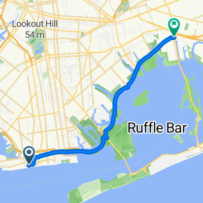
from city hall, over the brooklyn bridge, stopping at carroll street drawbridge, owl head park, and to coney island for the fireworks. NOTE: the route travels over heavy street traffic to reach the owl head park bike path, and again more heavy street traffic along shore blvd and cropsey ave to reach coney island.
Sunset in the summer time is around 8:30, and the Shore Parkway bike path will be full of people, and children at this time, please ride slow and responsibly, not a race.
- -:--
- Dauer
- 23 km
- Distanz
- 145 m
- Aufstieg
- 102 m
- Abstieg
- ---
- Ø-Tempo
- ---
- Max. Höhe
soothsayer
Erstellt vor 7 Jahren
Highlights der Route
POIs entlang der Route
Interessanter Ort nach 10,1 km
YIELD TO ALL PEDESTRIANS HERE, GO SLOW. NOT A RACE. there are a lot of children running around.
Interessanter Ort nach 10,3 km
Meeting Point #2
Interessanter Ort nach 17,3 km
Meeting Point #1
Weiter mit Bikemap
Diese Radroute verwenden, bearbeiten oder herunterladen
Du möchtest Times Up! Coney Island Ride summer Friday Nights for Fireworks fahren oder sie für deine eigene Reise anpassen? Folgendes kannst du mit dieser Bikemap-Route machen:
Gratis Funktionen
- Speichere diese Route als Favorit oder in einer Sammlung
- Kopiere & plane deine eigene Version dieser Route
- Synchronisiere deine Route mit Garmin oder Wahoo
Premium-Funktionen
Kostenlose Testversion für 3 Tage oder einmalige Zahlung. Mehr über Bikemap Premium.
- Navigiere diese Route auf iOS & Android
- Exportiere eine GPX / KML-Datei dieser Route
- Erstelle deinen individuellen Ausdruck (Jetzt kostenlos ausprobieren)
- Lade diese Route für die Offline-Navigation herunter
Entdecke weitere Premium-Funktionen.
Bikemap Premium aktivierenVon unserer Community
Coney Island: Andere beliebte Routen, die hier beginnen
- 402 Beach 169th St, New York to 121 Starr St, New York0
- 27,4 km
- 96 m
- 94 m
- Coney Island, New York, Vereinigte Staaten
- 2801–2895 Stillwell Ave, New York to 100–198 Avenue C, New York0
- 8,7 km
- 20 m
- 8 m
- Coney Island, New York, Vereinigte Staaten
- 701 Boardwalk E, New York to 117 Ninth St, New York0
- 13,6 km
- 44 m
- 42 m
- Coney Island, New York, Vereinigte Staaten
- 1002 Brighton Beach Ave, New York to 106-19 Shore Front Pkwy, New York0
- 16,2 km
- 36 m
- 40 m
- Coney Island, New York, Vereinigte Staaten
- 1310 Surf Ave, New York to 791 Hendrix St, New York1
- 17,3 km
- 0 m
- 3 m
- Coney Island, New York, Vereinigte Staaten


In der App öffnen