

Bottle Bay Loop
Eine Fahrradroute, die in Sandpoint, Idaho, United States of America beginnt.
Übersicht
Über diese Route
One of the scenic routes from Sandpoint.
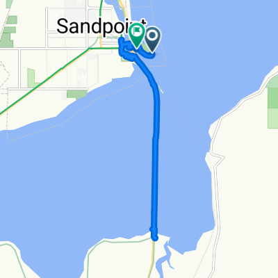
This map does not show the Sandpoint/Sagle bike paty. Please use it, NOT Hwy 95 south out of town.
As you head out of Sandpoint southbound, keep east to get on the "old" Long Bridge, which is no longer open to motorized traffic. The Bike Path is on the east side of Hwy 95 and down near water level --not up at highway level.
Cross the Bike/Blade/Pedestrian Long Bridge southbound.
Turn left onto Bottle Bay Road, and follow it to its "TEE" intersection with Sagle Road.
Turn right onto Sagle road and follow it back to Lignite Road, just before Sagle Road crosses the railroad tracks. Follow Lignite back to Bottle Bay road and return to Sandpoint.
A variation of the Bottle Bay Loop is to stay on the bike path past Bottle Bay Road and make the loop counterclockwise by turning left onto Sagle Road. Go over the hill and keep a sharp eye out for Bottle Bay Road, where you turn left and come back westerly to the bike path at Hwy 95.
It is a good thing to avoid riding into a low sun that makes it hard for overtaking traffic to see you. Ride this loop counterclockwise in the late afternoon, clockwise in the early morning.
- -:--
- Dauer
- 44,3 km
- Distanz
- 385 m
- Aufstieg
- 383 m
- Abstieg
- ---
- Ø-Tempo
- ---
- Ø-Tempo

Routenqualität
Wegtypen und Untergründe entlang der Route
Wegtypen
Straße
25,4 km
(57 %)
Radweg
12,8 km
(29 %)
Untergründe
Befestigt
8 km
(18 %)
Asphalt
7 km
(16 %)
Beton
1 km
(2 %)
Undefiniert
36,3 km
(82 %)
Weiter mit Bikemap
Diese Radroute verwenden, bearbeiten oder herunterladen
Du möchtest Bottle Bay Loop fahren oder sie für deine eigene Reise anpassen? Folgendes kannst du mit dieser Bikemap-Route machen:
Gratis Funktionen
- Speichere diese Route als Favorit oder in einer Sammlung
- Kopiere & plane deine eigene Version dieser Route
- Synchronisiere deine Route mit Garmin oder Wahoo
Premium-Funktionen
Kostenlose Testversion für 3 Tage oder einmalige Zahlung. Mehr über Bikemap Premium.
- Navigiere diese Route auf iOS & Android
- Exportiere eine GPX / KML-Datei dieser Route
- Erstelle deinen individuellen Ausdruck (Jetzt kostenlos ausprobieren)
- Lade diese Route für die Offline-Navigation herunter
Entdecke weitere Premium-Funktionen.
Bikemap Premium aktivierenVon unserer Community
Sandpoint: Andere beliebte Routen, die hier beginnen
 Sandpoint, ID - Riggins, ID
- Distanz
- 1.387,6 km
- Aufstieg
- 4.635 m
- Abstieg
- 4.262 m
- Standort
- Sandpoint, Idaho, USA
 Sandpoint 33.9
- Distanz
- 54,5 km
- Aufstieg
- 779 m
- Abstieg
- 779 m
- Standort
- Sandpoint, Idaho, USA
 Syringa To Jalapeño's
- Distanz
- 19,6 km
- Aufstieg
- 299 m
- Abstieg
- 348 m
- Standort
- Sandpoint, Idaho, USA
 901–999 N Sixth Ave, Sandpoint to 5565 Selle Rd, Sandpoint
- Distanz
- 17,1 km
- Aufstieg
- 81 m
- Abstieg
- 75 m
- Standort
- Sandpoint, Idaho, USA
 Bridge Street 106, Sandpoint to Bridge Street 106, Sandpoint
- Distanz
- 9,8 km
- Aufstieg
- 34 m
- Abstieg
- 27 m
- Standort
- Sandpoint, Idaho, USA
 Route to 54 Bridge St, Sandpoint
- Distanz
- 10,8 km
- Aufstieg
- 56 m
- Abstieg
- 55 m
- Standort
- Sandpoint, Idaho, USA
 Route from East Superior Street 213, Sandpoint
- Distanz
- 34,4 km
- Aufstieg
- 190 m
- Abstieg
- 104 m
- Standort
- Sandpoint, Idaho, USA
 Sandpoint, ID to Bonners Ferry, ID
- Distanz
- 56 km
- Aufstieg
- 110 m
- Abstieg
- 199 m
- Standort
- Sandpoint, Idaho, USA
In der App öffnen