

salita da Marradi al passo carnevale
Eine Fahrradroute, die in Marradi, Toskana, Italien beginnt.
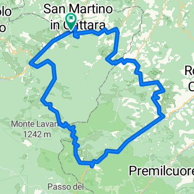
Übersicht
Über diese Route
An entire stage into the magical florests of the Casentino. From the second day we start to get serious With an altitude increase worthy of a half-mountain stage there will be little time to rest. The first climb of 7-8 km that takes us to Passo Carnevale will be among the sweetest of the whole day. From Marradi, taking to San Benedetto in Alpe the road returns to tighten and creeps into the equally narrow valley of the Rio Salto. From there Eremo and Peschiera with the Casentino forests as background. Arrival at the Acquacheta, now a place and destination of tourism, both for its literary value and for its naturalistic value. From here, a fast succession that runs along the Montone river up to Portico di Romagna to begin the ascent to Valico di Monte Sacco and Busca pass, relatively easy pass, 7.2 km at a 5.0% gradient, then, 6.5 km downhill to Tredozio where you will return to Tuscany passing through the small fraction of Lutirano. This is an insidious part with steep slopes, therefore arriving at Sant Adriano where turning left along the road 302 for 5 km you will arrive at Marradi. We are almost at the end of the day, the first 4 very long kilometers develop at the edge of the narrow valley of the Collecchio ditch, an endless series of curves and counter-curves with a slope that oscillates continuously between 8 and 10%. Now, 6km all downhill to reach Palazzuolo.
- 47 min
- Dauer
- 6,6 km
- Distanz
- 583 m
- Aufstieg
- 217 m
- Abstieg
- 8,4 km/h
- Ø-Tempo
- 695 m
- Max. Höhe

Routenqualität
Wegtypen und Untergründe entlang der Route
Wegtypen
Vielbefahrene Straße
6,6 km
(100 %)
Untergründe
Befestigt
6,6 km
(100 %)
Asphalt
6,6 km
(100 %)
Weiter mit Bikemap
Diese Radroute verwenden, bearbeiten oder herunterladen
Du möchtest salita da Marradi al passo carnevale fahren oder sie für deine eigene Reise anpassen? Folgendes kannst du mit dieser Bikemap-Route machen:
Gratis Funktionen
- Speichere diese Route als Favorit oder in einer Sammlung
- Kopiere & plane deine eigene Version dieser Route
- Synchronisiere deine Route mit Garmin oder Wahoo
Premium-Funktionen
Kostenlose Testversion für 3 Tage oder einmalige Zahlung. Mehr über Bikemap Premium.
- Navigiere diese Route auf iOS & Android
- Exportiere eine GPX / KML-Datei dieser Route
- Erstelle deinen individuellen Ausdruck (Jetzt kostenlos ausprobieren)
- Lade diese Route für die Offline-Navigation herunter
Entdecke weitere Premium-Funktionen.
Bikemap Premium aktivierenVon unserer Community
Marradi: Andere beliebte Routen, die hier beginnen
 Crespino del Lamone - Montepiano
- Distanz
- 59,5 km
- Aufstieg
- 1.300 m
- Abstieg
- 1.144 m
- Standort
- Marradi, Toskana, Italien
 Crespino del Lamone - Montepiano
- Distanz
- 59,5 km
- Aufstieg
- 1.300 m
- Abstieg
- 1.144 m
- Standort
- Marradi, Toskana, Italien
 S.Andrea-Tredozio-Portico-S.Benedetto in Alpe-Marradi06/ago/2015
- Distanz
- 66,9 km
- Aufstieg
- 1.498 m
- Abstieg
- 1.501 m
- Standort
- Marradi, Toskana, Italien
 S.Adriano-Lutirano-Tredozio-S.Benedetto-Marradi
- Distanz
- 66,8 km
- Aufstieg
- 1.467 m
- Abstieg
- 1.469 m
- Standort
- Marradi, Toskana, Italien
 Marradi-San Benedetto in Alpe-Corniolo
- Distanz
- 53,1 km
- Aufstieg
- 1.697 m
- Abstieg
- 1.441 m
- Standort
- Marradi, Toskana, Italien
 4 tappa da Marradi – a Spinello
- Distanz
- 74,5 km
- Aufstieg
- 1.779 m
- Abstieg
- 1.303 m
- Standort
- Marradi, Toskana, Italien
 Marradi mortal Trail
- Distanz
- 56,8 km
- Aufstieg
- 2.181 m
- Abstieg
- 1.990 m
- Standort
- Marradi, Toskana, Italien
 Via Fabroni 58, Marradi nach Castello di Valenzano 97, Subbiano
- Distanz
- 109,6 km
- Aufstieg
- 3.084 m
- Abstieg
- 2.878 m
- Standort
- Marradi, Toskana, Italien
In der App öffnen