
Blackalls Park Public School to West Wallsend Swimming Centre
Eine Fahrradroute, die in Fennell Bay, New South Wales, Australia beginnt.
Übersicht
Über diese Route
Blackalls Park Public School to West Wallsend Swimming Centre (and return)
-
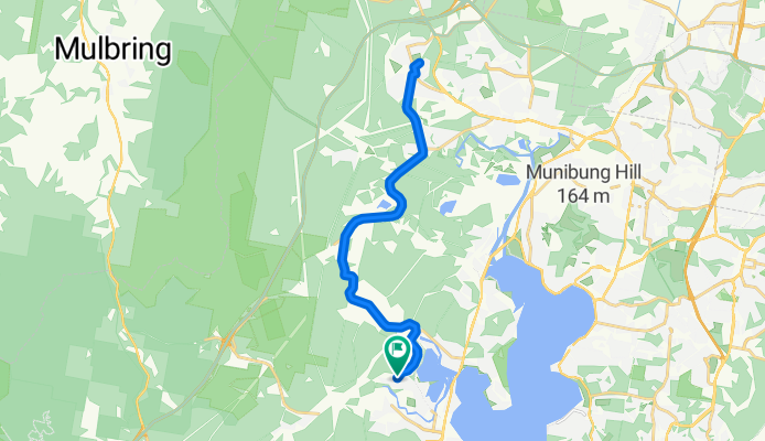
Leave Blackalls Park PS entrance at cnr Todd and Rupert Streets. travelling NE on Rupert.
-
Turn LEFT onto the MAIN ROAD (Fassifern Street) and travel about 1300m (past Fassifern Railway Station and UNDER the viaduct) until you reach Fassifern Public School road crossing.
-
Turn LEFT into Miller Road and proceed to the intersection with Wakefield Road ... approximately 4.9km.
-
Turn RIGHT onto Wakefield Road, the Main Road to West Wallsend from here.
-
Stay on Wakefield Road to travel the next 4.65km to the Barnsley roundabout.
-
Travel "straight ahead" through the roundabout onto Appletree Road for 2.6km through Holmesville and past West Wallsend High School. You will arrive at Withers Street.
6. TURN LEFT onto Withers Street and travel NORTH just 230 metres downhill to the intersection with Edden Street.
-
Turn RIGHT into Edden Street. The West Wallsend Swimming Centre is about 200 metres EAST from the intersection.
-
Once your swim/visit is complete, you can retrace your route home by reversing these instructions.
- -:--
- Dauer
- 29,3 km
- Distanz
- 341 m
- Aufstieg
- 341 m
- Abstieg
- ---
- Ø-Tempo
- ---
- Ø-Tempo

Routenqualität
Wegtypen und Untergründe entlang der Route
Wegtypen
Vielbefahrene Straße
28 km
(96 %)
Ruhige Straße
1,2 km
(4 %)
Untergründe
Befestigt
29,2 km
(100 %)
Asphalt
28,7 km
(98 %)
Befestigt (undefiniert)
0,5 km
(2 %)
Undefiniert
0,1 km
(<1 %)
Weiter mit Bikemap
Diese Radroute verwenden, bearbeiten oder herunterladen
Du möchtest Blackalls Park Public School to West Wallsend Swimming Centre fahren oder sie für deine eigene Reise anpassen? Folgendes kannst du mit dieser Bikemap-Route machen:
Gratis Funktionen
- Speichere diese Route als Favorit oder in einer Sammlung
- Kopiere & plane deine eigene Version dieser Route
- Synchronisiere deine Route mit Garmin oder Wahoo
Premium-Funktionen
Kostenlose Testversion für 3 Tage oder einmalige Zahlung. Mehr über Bikemap Premium.
- Navigiere diese Route auf iOS & Android
- Exportiere eine GPX / KML-Datei dieser Route
- Erstelle deinen individuellen Ausdruck (Jetzt kostenlos ausprobieren)
- Lade diese Route für die Offline-Navigation herunter
Entdecke weitere Premium-Funktionen.
Bikemap Premium aktivierenVon unserer Community
Fennell Bay: Andere beliebte Routen, die hier beginnen
 Lapped Fennell Bay & Edmunds Bay + Toronto Shops
- Distanz
- 11,2 km
- Aufstieg
- 87 m
- Abstieg
- 85 m
- Standort
- Fennell Bay, New South Wales, Australien
 Blackalls Park - THS - Toronto - home - 10.5km
- Distanz
- 10,7 km
- Aufstieg
- 81 m
- Abstieg
- 80 m
- Standort
- Fennell Bay, New South Wales, Australien
 Bay Lap and Lunch at McCafe TOR
- Distanz
- 13 km
- Aufstieg
- 84 m
- Abstieg
- 81 m
- Standort
- Fennell Bay, New South Wales, Australien
 13.5km plus Suburban Run
- Distanz
- 14,2 km
- Aufstieg
- 80 m
- Abstieg
- 83 m
- Standort
- Fennell Bay, New South Wales, Australien
 Around Fennell Bay & connected suburbs
- Distanz
- 13,2 km
- Aufstieg
- 82 m
- Abstieg
- 94 m
- Standort
- Fennell Bay, New South Wales, Australien
 Toronto High School, Coles, home
- Distanz
- 16,7 km
- Aufstieg
- 84 m
- Abstieg
- 88 m
- Standort
- Fennell Bay, New South Wales, Australien
 Blackalls Park to North Toronto Industrial Estate then home through Fassifern
- Distanz
- 8,5 km
- Aufstieg
- 74 m
- Abstieg
- 48 m
- Standort
- Fennell Bay, New South Wales, Australien
 Toronto Pool (short) + Back Home (long)
- Distanz
- 12,1 km
- Aufstieg
- 109 m
- Abstieg
- 106 m
- Standort
- Fennell Bay, New South Wales, Australien
In der App öffnen