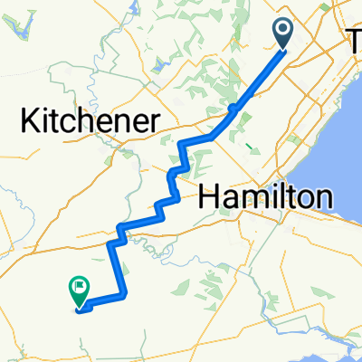
Shroom Zorp Bike
- 26,8 km
- 321 m
- 190 m
- Brampton, Ontario, Kanada
Eine Fahrradroute, die in Brampton, Ontario, Kanada beginnt.
Übersicht
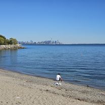
Ein schöner Wochenendausflug nach Toronto! Zwei Ziele: die Chethenham Badlands und den Forks of the Credit Park (über einen Bahnradweg). Rückfahrt über das charmante Glen Williams.
Eine Mischung aus Straße und Schotter, also fahrt mit einem Touring-Bike!
Samstag / Sonntag GO Busfahrplan: Union: 08 50 09 50 ... Plsnt.: 09 45 10 45 Georg. 16 53 17 53 ... 22 53 Plsnt.: 17 10 18 10 .. 23 10
Erstellt vor 15 Jahren
Highlights der Route
Badlands!
Watch out, it's easy to get lost in this mountain biking trail network. Stay with the Bruce trail to the right.
Park entrance - cycling allowed!
Falls and bridge
Rail Trail!
Weiter mit Bikemap
Du möchtest Forks of the Credit by GO Bus fahren oder sie für deine eigene Reise anpassen? Folgendes kannst du mit dieser Bikemap-Route machen:
Kostenlose Testversion für 3 Tage oder einmalige Zahlung. Mehr über Bikemap Premium.
Entdecke weitere Premium-Funktionen.
Bikemap Premium aktivierenVon unserer Community
In der App öffnen