

AIB2019 loop A: Sightseeing
Eine Fahrradroute, die in Christianshavn, Capital Region, Denmark beginnt.
Übersicht
Über diese Route
I built this route for the AIB conference. Two pieces of general advice for cycling in Denmark: 1) Stay on the right side of the cycle path to allow overtaking and 2) Use your hands to indicate you want to stop or change directions.
Loop A starts at Nyhavn. Go through Kongens Nytorv (the main square in Copenhagen). Then go straight ahead on Gothersgade, passing Rosenborg Slot and the botanical gardens. At the end you reach the lakes. Turn right on Øster Søgade. At the traffic lights go left over the lake and follow Fredensgade, turning right into Nørre Alle. You then turn right to enter Fælledparken (biggest park in Copenhagen proper) at Edel Sauntes Alle. Turn right at Øster Allee, passing the National and FC Copenhagen Football stadium. At Trianglen continue into Østerbrogade, soon followed by a left into Slagelsegade (take care when crossing here). Turn right at Livjægergade, then a left at Kastelsvej, followed by a right at Fridtjf Nansens Plads. Here you use the cycle bridge to go over the railway line. Continue straight ahead on Langelinie. At the end you rearch the famous little Mermaid. Take a right here and then go past the headquarters of Mærsk, Denmark's largest company into Amaliegade. Turn left to go into Toldbodgade, passing the Queen's castle (Amalienborg). Continue straight ahead to get back to Nyhavn.
- -:--
- Dauer
- 9,4 km
- Distanz
- 48 m
- Aufstieg
- 45 m
- Abstieg
- ---
- Ø-Tempo
- ---
- Ø-Tempo

Routenqualität
Wegtypen und Untergründe entlang der Route
Wegtypen
Straße
4,1 km
(44 %)
Ruhige Straße
3,1 km
(33 %)
Untergründe
Befestigt
9,3 km
(98 %)
Asphalt
9 km
(96 %)
Pflastersteine
0,2 km
(2 %)
Undefiniert
0,2 km
(2 %)
Weiter mit Bikemap
Diese Radroute verwenden, bearbeiten oder herunterladen
Du möchtest AIB2019 loop A: Sightseeing fahren oder sie für deine eigene Reise anpassen? Folgendes kannst du mit dieser Bikemap-Route machen:
Gratis Funktionen
- Speichere diese Route als Favorit oder in einer Sammlung
- Kopiere & plane deine eigene Version dieser Route
- Synchronisiere deine Route mit Garmin oder Wahoo
Premium-Funktionen
Kostenlose Testversion für 3 Tage oder einmalige Zahlung. Mehr über Bikemap Premium.
- Navigiere diese Route auf iOS & Android
- Exportiere eine GPX / KML-Datei dieser Route
- Erstelle deinen individuellen Ausdruck (Jetzt kostenlos ausprobieren)
- Lade diese Route für die Offline-Navigation herunter
Entdecke weitere Premium-Funktionen.
Bikemap Premium aktivierenVon unserer Community
Christianshavn: Andere beliebte Routen, die hier beginnen
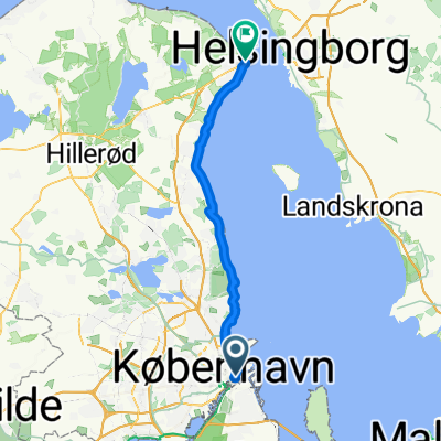 Copenhagen-Helsingør 48km ENG 2025
- Distanz
- 49,9 km
- Aufstieg
- 180 m
- Abstieg
- 179 m
- Standort
- Christianshavn, Capital Region, Dänemark
 Dänemark 2017 - CPH Loop
- Distanz
- 305,9 km
- Aufstieg
- 325 m
- Abstieg
- 326 m
- Standort
- Christianshavn, Capital Region, Dänemark
 N9+ Elsinore-Copenhagen Improved Route
- Distanz
- 41 km
- Aufstieg
- 99 m
- Abstieg
- 100 m
- Standort
- Christianshavn, Capital Region, Dänemark
![Amager tour [mod]](https://media.bikemap.net/routes/7385546/staticmaps/in_610f8787-eccb-4f5a-b036-385b311fe608_400x400_bikemap-2021-3D-static.png) Amager tour [mod]
Amager tour [mod]- Distanz
- 39,9 km
- Aufstieg
- 24 m
- Abstieg
- 23 m
- Standort
- Christianshavn, Capital Region, Dänemark
 Copenhagen e la costa svedese
- Distanz
- 374,8 km
- Aufstieg
- 373 m
- Abstieg
- 373 m
- Standort
- Christianshavn, Capital Region, Dänemark
 Halvmarton
- Distanz
- 21,7 km
- Aufstieg
- 52 m
- Abstieg
- 53 m
- Standort
- Christianshavn, Capital Region, Dänemark
 Projeto Vikings
- Distanz
- 5.965,9 km
- Aufstieg
- 5.040 m
- Abstieg
- 5.040 m
- Standort
- Christianshavn, Capital Region, Dänemark
 1st day: Anjos in CPH
- Distanz
- 21,5 km
- Aufstieg
- 53 m
- Abstieg
- 53 m
- Standort
- Christianshavn, Capital Region, Dänemark
In der App öffnen