Dunoon to Lochgoilhead
Eine Fahrradroute, die in Dunoon, Schottland, Vereinigtes Königreich beginnt.
Übersicht
Über diese Route
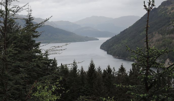
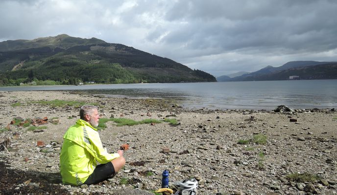
Day 4 exploring the Clyde, this route uses forestry road and a single track to connect up Ardentinny with Lochgoilhead without going all the way to Strachur and Loch Fyne on busy roads. Its clearly a "thing" we met others doing the same in the opposite direction as well as plenty on Strava. From Dunoon we took a diversion to Pucks Glen for a walk before riding along the road to Ardentinny. There's qutie a bit of traffic on the A815 so this short section was not all that pleasant. However the A880 gets increasingly quiet past Strone and it was a lovely easy ride to Ardentinny. There we took a steep forestry road up the hill, down to shore level again then back up. We missed the turnoff to the single track section and climber further than necessary but were rewarded by a great view. On loaded touring bikes, we took the single track carefully with a bit of pushing on steep sections and hrough fallen trees. However, its a fun little ride and a great link to Lochgoilhead.
- -:--
- Dauer
- 39,6 km
- Distanz
- 505 m
- Aufstieg
- 507 m
- Abstieg
- ---
- Ø-Tempo
- 162 m
- Max. Höhe
Fotos von der Route
Routenqualität
Wegtypen und Untergründe entlang der Route
Wegtypen
Straße
13,9 km
(35 %)
Forst- / Feldweg
10,7 km
(27 %)
Untergründe
Befestigt
1,6 km
(4 %)
Unbefestigt
9,1 km
(23 %)
Schotter
8,7 km
(22 %)
Asphalt
1,6 km
(4 %)
Weiter mit Bikemap
Diese Radroute verwenden, bearbeiten oder herunterladen
Du möchtest Dunoon to Lochgoilhead fahren oder sie für deine eigene Reise anpassen? Folgendes kannst du mit dieser Bikemap-Route machen:
Gratis Funktionen
- Speichere diese Route als Favorit oder in einer Sammlung
- Kopiere & plane deine eigene Version dieser Route
- Synchronisiere deine Route mit Garmin oder Wahoo
Premium-Funktionen
Kostenlose Testversion für 3 Tage oder einmalige Zahlung. Mehr über Bikemap Premium.
- Navigiere diese Route auf iOS & Android
- Exportiere eine GPX / KML-Datei dieser Route
- Erstelle deinen individuellen Ausdruck (Jetzt kostenlos ausprobieren)
- Lade diese Route für die Offline-Navigation herunter
Entdecke weitere Premium-Funktionen.
Bikemap Premium aktivierenVon unserer Community
Dunoon: Andere beliebte Routen, die hier beginnen
 Dunoon to Crear
- Distanz
- 80,5 km
- Aufstieg
- 736 m
- Abstieg
- 677 m
- Standort
- Dunoon, Schottland, Vereinigtes Königreich
 Dunoon to Crear
- Distanz
- 80,5 km
- Aufstieg
- 736 m
- Abstieg
- 677 m
- Standort
- Dunoon, Schottland, Vereinigtes Königreich
 West Bay, Dunoon to above Loch Tarsan, into Glen Massan, to Kilmun
- Distanz
- 35 km
- Aufstieg
- 341 m
- Abstieg
- 344 m
- Standort
- Dunoon, Schottland, Vereinigtes Königreich
 RUTA A: Dunoon - Fort William
- Distanz
- 194,5 km
- Aufstieg
- 1.957 m
- Abstieg
- 1.961 m
- Standort
- Dunoon, Schottland, Vereinigtes Königreich
 Steady ride in United Kingdom
- Distanz
- 103 km
- Aufstieg
- 2.298 m
- Abstieg
- 2.240 m
- Standort
- Dunoon, Schottland, Vereinigtes Königreich
 GBBR_Glen Finart & Loch Fyne
- Distanz
- 119,5 km
- Aufstieg
- 920 m
- Abstieg
- 920 m
- Standort
- Dunoon, Schottland, Vereinigtes Königreich
 Dunoon to Cardross
- Distanz
- 115,3 km
- Aufstieg
- 925 m
- Abstieg
- 925 m
- Standort
- Dunoon, Schottland, Vereinigtes Königreich
 Inveraray
- Distanz
- 60,9 km
- Aufstieg
- 640 m
- Abstieg
- 644 m
- Standort
- Dunoon, Schottland, Vereinigtes Königreich
In der App öffnen


