
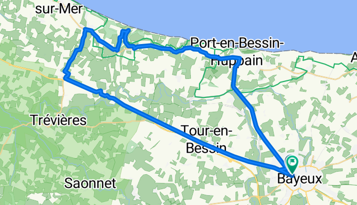
Normandy D-Day American Cemetery
Eine Fahrradroute, die in Bayeux, Normandy, Frankreich beginnt.
Übersicht
Über diese Route
This is the route that my sweetheart and I took to get to the D-Day American Cemetery. The bike ride to the cemetery isn't very difficult. The hills aren't very steep and it's mostly flat. On the way back however, there are many hills and some of them are pretty steep. We did this route with hefty winds, so it might be easier on a less windy day. Lovely views of the countryside, wonderful little towns to go through. Normandy by bike is a beautiful way to go.
- -:--
- Dauer
- 41 km
- Distanz
- 201 m
- Aufstieg
- 202 m
- Abstieg
- ---
- Ø-Tempo
- ---
- Max. Höhe
Routenqualität
Wegtypen und Untergründe entlang der Route
Wegtypen
Vielbefahrene Straße
14,5 km
(35 %)
Radweg
7,9 km
(19 %)
Untergründe
Befestigt
27,7 km
(68 %)
Asphalt
27,5 km
(67 %)
Befestigt (undefiniert)
0,2 km
(<1 %)
Undefiniert
13,3 km
(32 %)
Weiter mit Bikemap
Diese Radroute verwenden, bearbeiten oder herunterladen
Du möchtest Normandy D-Day American Cemetery fahren oder sie für deine eigene Reise anpassen? Folgendes kannst du mit dieser Bikemap-Route machen:
Gratis Funktionen
- Speichere diese Route als Favorit oder in einer Sammlung
- Kopiere & plane deine eigene Version dieser Route
- Synchronisiere deine Route mit Garmin oder Wahoo
Premium-Funktionen
Kostenlose Testversion für 3 Tage oder einmalige Zahlung. Mehr über Bikemap Premium.
- Navigiere diese Route auf iOS & Android
- Exportiere eine GPX / KML-Datei dieser Route
- Erstelle deinen individuellen Ausdruck (Jetzt kostenlos ausprobieren)
- Lade diese Route für die Offline-Navigation herunter
Entdecke weitere Premium-Funktionen.
Bikemap Premium aktivierenVon unserer Community
Bayeux: Andere beliebte Routen, die hier beginnen
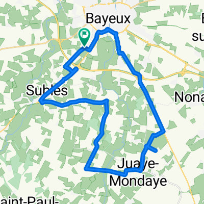
 BAYEUX - Autour de Juaye Mondaye
- Distanz
- 32,7 km
- Aufstieg
- 202 m
- Abstieg
- 201 m
- Standort
- Bayeux, Normandy, Frankreich
 Bayeux - Vers Port en Bessin - Variante 01
- Distanz
- 34,5 km
- Aufstieg
- 186 m
- Abstieg
- 187 m
- Standort
- Bayeux, Normandy, Frankreich
 Bayeux Sud - Juaye Mondaye
- Distanz
- 27,1 km
- Aufstieg
- 104 m
- Abstieg
- 102 m
- Standort
- Bayeux, Normandy, Frankreich
 Bayeux Route 2
- Distanz
- 49,1 km
- Aufstieg
- 216 m
- Abstieg
- 225 m
- Standort
- Bayeux, Normandy, Frankreich
 Par Trévières - 01
- Distanz
- 36,1 km
- Aufstieg
- 185 m
- Abstieg
- 187 m
- Standort
- Bayeux, Normandy, Frankreich
 Bayeux Nord Ouest - Cimetière US St Laurent
- Distanz
- 54,9 km
- Aufstieg
- 253 m
- Abstieg
- 252 m
- Standort
- Bayeux, Normandy, Frankreich
 Bayeux Est Variante 01
- Distanz
- 28,7 km
- Aufstieg
- 150 m
- Abstieg
- 150 m
- Standort
- Bayeux, Normandy, Frankreich
 Bayeux to Lion-sur-Mer
- Distanz
- 45,1 km
- Aufstieg
- 192 m
- Abstieg
- 229 m
- Standort
- Bayeux, Normandy, Frankreich
In der App öffnen