

Rice Terrace & The Village of Living Water Tour
Eine Fahrradroute, die in Kitahama, Präfektur Shiga, Japan beginnt.
Übersicht
Über diese Route
Rice Terrace & The Village of Living Water Tour
- -:--
- Dauer
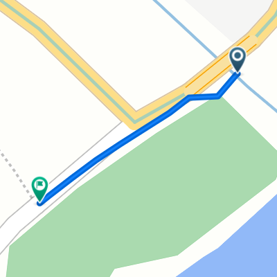
- 63,6 km
- Distanz
- 244 m
- Aufstieg
- 244 m
- Abstieg
- ---
- Ø-Tempo
- ---
- Max. Höhe

Routenqualität
Wegtypen und Untergründe entlang der Route
Wegtypen
Ruhige Straße
19,7 km
(31 %)
Radweg
8,3 km
(13 %)
Untergründe
Befestigt
9,5 km
(15 %)
Befestigt (undefiniert)
6,4 km
(10 %)
Asphalt
3,2 km
(5 %)
Undefiniert
54,1 km
(85 %)
Highlights der Route
POIs entlang der Route

Foto nach 8,4 km
白鬚神社 Shirahige Shrine This shrine is famous for the large vermilion-lacquered torii (gateway) standing in the lake and is responsive to prayer’s request for longevity, matchmaking, having a baby, better luck and prosperous business. The main hall is designated as a national important cultural property.

Foto nach 8,9 km
鵜川四十八体石仏群 A group of Amida Buddha statues enshrined at the foot of the mountains about 500m north of Shirahige Shrine. The stone Buddha sit quietly facing east and vary slightly in height and their postures are also slightly different, with benevolence-filled faces, innocent faces, etc.

Foto nach 10,2 km
乙女ヶ池 Otomegaike Pond The vicinity of Otomegaike was known as the "Katori no Umi" during the seventh century Manyo period, and formed an inlet into Lake Biwa at the foot of the mountains. Today Otomegaike Pond is a lake with a surface area of 8.6ha and an average depth of 1.6m, and is home to fish such as crucian carp and black bass. There is a fishing pier on the lake that has attracted many black bass lovers in recent years.

Foto nach 22,2 km
畑の棚田 Rice terrace in Hata District

Foto nach 40,1 km
針江 生水の郷 anholes) Shiga Guide Search SHIGA One Week of Weather Access Transport Network Information Rent-a-Car & Rent-a-Cycle Tourist Information Locations Tax-Free Shop Information Wi-Fi Spots Recommended Courses For Travel Agency Some Simple Requests From Us Japan Heritage We Love SHIGA BIWAKO Harie Shozu no Sato Kabata (Artistic Manholes) ENJOY Harie, located in Shin-asahi-cho in Takashima City, is a region so rich in spring water that it is called the "Shozu no Sato", "village of pure water." You can take a tour of the waterways that snake through the village and the riverbanks alongside them. (Prior reservation required). There are also manhole covers with windmill designs to be found
Weiter mit Bikemap
Diese Radroute verwenden, bearbeiten oder herunterladen
Du möchtest Rice Terrace & The Village of Living Water Tour fahren oder sie für deine eigene Reise anpassen? Folgendes kannst du mit dieser Bikemap-Route machen:
Gratis Funktionen
- Speichere diese Route als Favorit oder in einer Sammlung
- Kopiere & plane deine eigene Version dieser Route
- Synchronisiere deine Route mit Garmin oder Wahoo
Premium-Funktionen
Kostenlose Testversion für 3 Tage oder einmalige Zahlung. Mehr über Bikemap Premium.
- Navigiere diese Route auf iOS & Android
- Exportiere eine GPX / KML-Datei dieser Route
- Erstelle deinen individuellen Ausdruck (Jetzt kostenlos ausprobieren)
- Lade diese Route für die Offline-Navigation herunter
Entdecke weitere Premium-Funktionen.
Bikemap Premium aktivierenVon unserer Community
Kitahama: Andere beliebte Routen, die hier beginnen
 From hostel to Shirahige Shrine
- Distanz
- 8 km
- Aufstieg
- 21 m
- Abstieg
- 20 m
- Standort
- Kitahama, Präfektur Shiga, Japan
 Biwa Part 1
- Distanz
- 150,9 km
- Aufstieg
- 242 m
- Abstieg
- 227 m
- Standort
- Kitahama, Präfektur Shiga, Japan
 Biwa Part 1
- Distanz
- 75,7 km
- Aufstieg
- 204 m
- Abstieg
- 203 m
- Standort
- Kitahama, Präfektur Shiga, Japan
 lake biwa
- Distanz
- 72,1 km
- Aufstieg
- 187 m
- Abstieg
- 155 m
- Standort
- Kitahama, Präfektur Shiga, Japan
 Katsuno, Takashima to Biwaichi, Takashima
- Distanz
- 0,5 km
- Aufstieg
- 11 m
- Abstieg
- 11 m
- Standort
- Kitahama, Präfektur Shiga, Japan
 志賀駅, 大津市 to 志賀駅, 大津市
- Distanz
- 148,3 km
- Aufstieg
- 131 m
- Abstieg
- 168 m
- Standort
- Kitahama, Präfektur Shiga, Japan
 水保町1369-1, 守山市 to 江頭町627-9, 近江八幡市
- Distanz
- 15,5 km
- Aufstieg
- 119 m
- Abstieg
- 120 m
- Standort
- Kitahama, Präfektur Shiga, Japan
 道路, 守山市 to 2丁目 18, 大津市
- Distanz
- 114,9 km
- Aufstieg
- 39 m
- Abstieg
- 59 m
- Standort
- Kitahama, Präfektur Shiga, Japan
In der App öffnen