

TCT Alternative Route Fernie to Sparwood
Eine Fahrradroute, die in Fernie, British Columbia, Kanada beginnt.
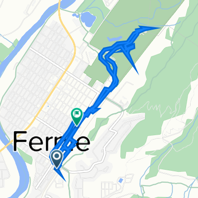
Übersicht
Über diese Route
This Route utilizes for the most part the powerline road that forms the backbone of the Coal Discovery Trail. The Coal Discovery Trail weaves in and out alongside the PWL Road. The CDT itself is well signed. Fernie to Hosmer to is quite hilly(not recommended for loaded cyclists) but flattens out after Hosmer. North of Hosmer the land is managed by the Nature Conservancy of Canada who may at times restrict public access to this route.
For more information on this segment refer to Bruce Obee's official guide book -The Trans Canada Trail-BC the Baynes Lake to Sparwood section pages 325,322,323
book mileage start-52.9 km 2nd Highway 3 Bridge
book mileage end-80.9 entrance to Mountain Shadows Campground
- -:--
- Dauer
- 29,5 km
- Distanz
- 465 m
- Aufstieg
- 351 m
- Abstieg
- ---
- Ø-Tempo
- ---
- Max. Höhe

Weiter mit Bikemap
Diese Radroute verwenden, bearbeiten oder herunterladen
Du möchtest TCT Alternative Route Fernie to Sparwood fahren oder sie für deine eigene Reise anpassen? Folgendes kannst du mit dieser Bikemap-Route machen:
Gratis Funktionen
- Speichere diese Route als Favorit oder in einer Sammlung
- Kopiere & plane deine eigene Version dieser Route
- Synchronisiere deine Route mit Garmin oder Wahoo
Premium-Funktionen
Kostenlose Testversion für 3 Tage oder einmalige Zahlung. Mehr über Bikemap Premium.
- Navigiere diese Route auf iOS & Android
- Exportiere eine GPX / KML-Datei dieser Route
- Erstelle deinen individuellen Ausdruck (Jetzt kostenlos ausprobieren)
- Lade diese Route für die Offline-Navigation herunter
Entdecke weitere Premium-Funktionen.
Bikemap Premium aktivierenVon unserer Community
Fernie: Andere beliebte Routen, die hier beginnen
 Glacier-Waterton Loop D3
- Distanz
- 68,7 km
- Aufstieg
- 622 m
- Abstieg
- 265 m
- Standort
- Fernie, British Columbia, Kanada
 Fernie to Gray Creek
- Distanz
- 198,7 km
- Aufstieg
- 1.630 m
- Abstieg
- 2.055 m
- Standort
- Fernie, British Columbia, Kanada
 airport via Bull River and Kimberley
- Distanz
- 159,8 km
- Aufstieg
- 1.123 m
- Abstieg
- 1.171 m
- Standort
- Fernie, British Columbia, Kanada
 Fernie-Cranbrook
- Distanz
- 106,1 km
- Aufstieg
- 399 m
- Abstieg
- 496 m
- Standort
- Fernie, British Columbia, Kanada
 Highline 100k route, Fernie's Century Raod Ride
- Distanz
- 97,2 km
- Aufstieg
- 627 m
- Abstieg
- 933 m
- Standort
- Fernie, British Columbia, Kanada
 341 First Ave, Fernie to 802 Second Ave, Fernie
- Distanz
- 6,7 km
- Aufstieg
- 1.293 m
- Abstieg
- 1.293 m
- Standort
- Fernie, British Columbia, Kanada
 Fernie to Gray Creek
- Distanz
- 209,8 km
- Aufstieg
- 2.042 m
- Abstieg
- 2.467 m
- Standort
- Fernie, British Columbia, Kanada
 Canada Day 17: Fernie to Cranbrook
- Distanz
- 97,1 km
- Aufstieg
- 386 m
- Abstieg
- 461 m
- Standort
- Fernie, British Columbia, Kanada
In der App öffnen