

Polar Bear Ride @ Coney Island
Eine Fahrradroute, die in New York City, New York, Vereinigte Staaten beginnt.
Übersicht
Über diese Route
A leisurely ride to the coast.
- -:--
- Dauer
- 19,2 km
- Distanz
- 130 m
- Aufstieg
- 148 m
- Abstieg
- ---
- Ø-Tempo
- ---
- Max. Höhe

Routenqualität
Wegtypen und Untergründe entlang der Route
Wegtypen
Ruhige Straße
9,6 km
(50 %)
Radweg
3,3 km
(17 %)
Untergründe
Befestigt
15,7 km
(82 %)
Asphalt
14,4 km
(75 %)
Befestigt (undefiniert)
0,8 km
(4 %)
Highlights der Route
POIs entlang der Route
Interessanter Ort nach 0 km
Meet up is at 10 AM, City Hall, across from the Brooklyn Bridge, on Park Row.
Interessanter Ort nach 4,6 km
Mazzola's Bakery stop @ 10:45a.
Interessanter Ort nach 5,9 km
Bathroom stop at the McDonald's-Mobil station.
Interessanter Ort nach 12,8 km
2nd bathroom stop
Interessanter Ort nach 15,7 km
GRAVSEND TRIANGLE:is named for the first English settlement in New York, Gravesend. Founded in 1645 by Lady Deborah Moody (c.1583-1659), neighbor to Brooklyn’s five Dutch towns, Gravesend developed an air of self-sufficiency that lasted until 1894 when it was finally annexed by the City of Brooklyn. Lady Deborah Moody, a wealthy protestant widow, left England for America in 1639. She and her assemblage of Anabaptists landed in New England, but received a cold welcome from the Puritans who controlled the region. In 1643, she moved to New Amsterdam and, on December 19, 1645, the Dutch governor granted Moody the first town charter written in English in the New World. With that charter, she founded the first English settlement in New York, at the southern end of Brooklyn. An innovative city planner, Moody designed the town after Kent, England, founding its town hall government, starting its first school, and establishing the first church. Gravesend’s design was one of the earliest in the New World to employ a block grid system. The crossroads of the old foursquare town (16 acres) lies just a few blocks to the west, at Gravesend Neck Road and McDonald Avenue. Lady Moody died in 1659. Her grave is located on Gravesend Neck Road between Van Sicklen Street and McDonald Avenue.
Interessanter Ort nach 18,5 km
TRUMP VILLAGE: The apartment complex was built in 1963–1964 by Fred Trump, the father of Donald Trump. The complex, built on the site of the former Culver Shuttle terminal, . It is the only Trump building complex named for Fred Trump rather than his son Donald.
Interessanter Ort nach 19,2 km
We should arrive around 12:30. The plunge takes place at 1p., Anyone can take a dip; but to be official, you can sign up (for a donation).
Weiter mit Bikemap
Diese Radroute verwenden, bearbeiten oder herunterladen
Du möchtest Polar Bear Ride @ Coney Island fahren oder sie für deine eigene Reise anpassen? Folgendes kannst du mit dieser Bikemap-Route machen:
Gratis Funktionen
- Speichere diese Route als Favorit oder in einer Sammlung
- Kopiere & plane deine eigene Version dieser Route
- Synchronisiere deine Route mit Garmin oder Wahoo
Premium-Funktionen
Kostenlose Testversion für 3 Tage oder einmalige Zahlung. Mehr über Bikemap Premium.
- Navigiere diese Route auf iOS & Android
- Exportiere eine GPX / KML-Datei dieser Route
- Erstelle deinen individuellen Ausdruck (Jetzt kostenlos ausprobieren)
- Lade diese Route für die Offline-Navigation herunter
Entdecke weitere Premium-Funktionen.
Bikemap Premium aktivierenVon unserer Community
New York City: Andere beliebte Routen, die hier beginnen
 Big Apple to Newport via Long Island
- Distanz
- 384,5 km
- Aufstieg
- 403 m
- Abstieg
- 424 m
- Standort
- New York City, New York, Vereinigte Staaten
 ZEPPELIN2010_New York
- Distanz
- 80,1 km
- Aufstieg
- 247 m
- Abstieg
- 263 m
- Standort
- New York City, New York, Vereinigte Staaten
 DTBK to Coney Island
- Distanz
- 31,5 km
- Aufstieg
- 162 m
- Abstieg
- 164 m
- Standort
- New York City, New York, Vereinigte Staaten
 tratre
- Distanz
- 65,2 km
- Aufstieg
- 201 m
- Abstieg
- 203 m
- Standort
- New York City, New York, Vereinigte Staaten
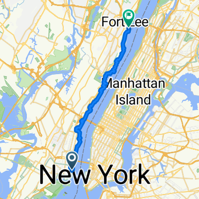 JC to Fort Lee Palisades
- Distanz
- 22,8 km
- Aufstieg
- 292 m
- Abstieg
- 261 m
- Standort
- New York City, New York, Vereinigte Staaten
 New York - Downtown (Tour #1)
- Distanz
- 7,6 km
- Aufstieg
- 99 m
- Abstieg
- 111 m
- Standort
- New York City, New York, Vereinigte Staaten
 200–212 Mulberry St, New York to 209 Mulberry St, New York
- Distanz
- 18,2 km
- Aufstieg
- 6 m
- Abstieg
- 17 m
- Standort
- New York City, New York, Vereinigte Staaten
 Last long ride before the big day.
- Distanz
- 52,8 km
- Aufstieg
- 255 m
- Abstieg
- 261 m
- Standort
- New York City, New York, Vereinigte Staaten
In der App öffnen