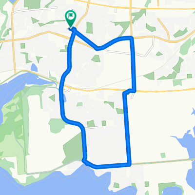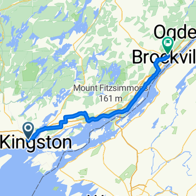
De Road à Leander Street
- 39,4 km
- 84 m
- 57 m
- Kingston, Ontario, Kanada
Eine Fahrradroute, die in Kingston, Ontario, Kanada beginnt.
Übersicht
Erstellt vor 15 Jahren
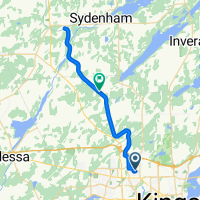
Highlights der Route
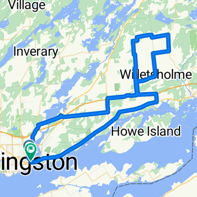
Tiny section of singletrack, with switchback. About 30 meters long. Leads up to foot of North St.
Take this route for lighter traffic.
Heavy traffic continues here.
Paved shoulders. Watch out for overtaking vehicles coming at you in your lane. Most often happens during the morning and afternoon drag-races to/from work.
Steep little hill through interesting rock-cut. Queen's University geology students visit here in first-year class.
Whip-poor-whills live in woods here. They call at night.
South end of gravel road.
North end of gravel road.
Good gravel climb. Fairly steep for this area.
4th Concession: rolling hills, smooth pavement, light traffic.
Look for a donkey here, also: sheep and black pigs.
Deceptively tough little hill.
At dusk: almost certain to see deer in this huge field.
Going eastbound, a long, steady hill, with false crest. Good workout. Not steep.
Osprey nest on top of huge wooden pole.
Heavy traffic on this highway - careful crossing it.
Wooden one-lane bridge. May be slippery when wet.
If swing bridge open [common in summer], portage bike over the doors of one of the locks. This is permitted. Be careful. It's a long way down and the water is deep. There are railings.
Steel-grate swing bridge. Take care when wet.
Coolest spot on the whole ride of doing it in evening or at night.
Significant hill here. Not too steep, and a good workout.
Careful here - traffic can be heavy.
South of 401, Montreal street is wide and fairly safe. Beware of pavement cracks, esp. in southbound lane.
Nice high-speed dip in road here. Watch for left and right-turning vehicles. Take the lane and be seen.
Railway St. lightly travelled compared to Montreal St.
Patrick St. Good alternative to Montreal St. Much less traffic.
"Skelton Park". Thousands of [old] graves here.
"Urban Wormhole" here. Steep, and sometimes a bit muddy.
Steel-grate lift-bridge. Slippery when wet. Very high traffic volume. Alternate: walk on south-side sidewalk.
Weiter mit Bikemap
Du möchtest Cell-phone tower loop. fahren oder sie für deine eigene Reise anpassen? Folgendes kannst du mit dieser Bikemap-Route machen:
Kostenlose Testversion für 3 Tage oder einmalige Zahlung. Mehr über Bikemap Premium.
Entdecke weitere Premium-Funktionen.
Bikemap Premium aktivierenVon unserer Community
In der App öffnen