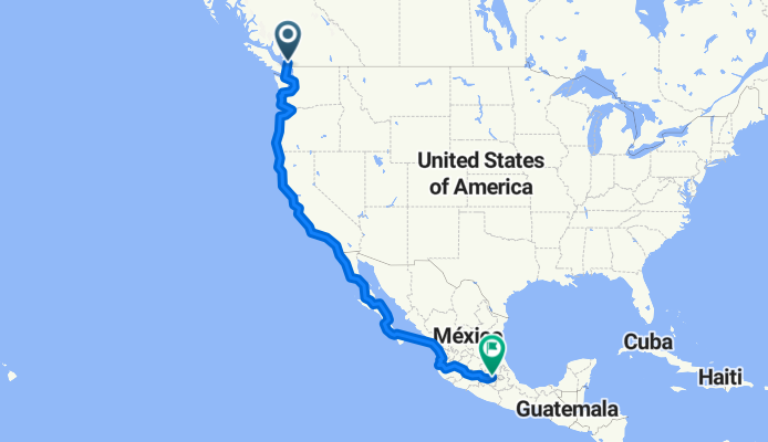
Radroute in Vancouver, British Columbia, Kanada
Vancouver, BC to Mexico City

Diese Route in Bikemap Web öffnen
Distanz
Aufstieg
Abstieg
Dauer
ø-Tempo
Max. Höhe
Radroute in Vancouver, British Columbia, Kanada

Diese Route in Bikemap Web öffnen
Tentative route for a crazy ride we'll do in November 2010 from Vancouver, BC to Mexico City along the West Coast, Baja, across the Sea of Cortez, and onwards through central Mexico.
Total distance is off due to the map wanting to join the route across the water from the ferry rides =) On google earth I calculated it closer to 5,770 km.
Some portions of the trek were copied (ahem... ripped off) from other trips I found either here on in other websites (like all of the trek in Baja), so thanks to those who've shared their rides online!

Du kannst diese Route als Vorlage in unserem Fahrrad-Routenplaner verwenden, damit du nicht bei Null anfangen musst. Passe sie nach deinen Bedürfnissen an, um deine perfekte Radtour zu planen.