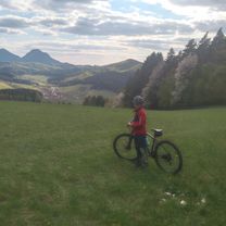
Kotešova Bitarova Paština Bytča - Kotešová
Eine Fahrradroute, die in Bytča, Žilinský kraj, Slovak Republic beginnt.
Übersicht
Über diese Route
- -:--
- Dauer
- 35,2 km
- Distanz
- 285 m
- Aufstieg
- 285 m
- Abstieg
- ---
- Ø-Tempo
- ---
- Ø-Tempo
Fotos von der Route
Routenqualität
Wegtypen und Untergründe entlang der Route
Wegtypen
Straße
10,6 km
(30 %)
Vielbefahrene Straße
9,8 km
(28 %)
Untergründe
Befestigt
26 km
(74 %)
Unbefestigt
2,5 km
(7 %)
Asphalt
24,4 km
(69 %)
Befestigt (undefiniert)
1,6 km
(4 %)
Weiter mit Bikemap
Diese Radroute verwenden, bearbeiten oder herunterladen
Du möchtest Kotešova Bitarova Paština Bytča - Kotešová fahren oder sie für deine eigene Reise anpassen? Folgendes kannst du mit dieser Bikemap-Route machen:
Gratis Funktionen
- Speichere diese Route als Favorit oder in einer Sammlung
- Kopiere & plane deine eigene Version dieser Route
- Synchronisiere deine Route mit Garmin oder Wahoo
Premium-Funktionen
Kostenlose Testversion für 3 Tage oder einmalige Zahlung. Mehr über Bikemap Premium.
- Navigiere diese Route auf iOS & Android
- Exportiere eine GPX / KML-Datei dieser Route
- Erstelle deinen individuellen Ausdruck (Jetzt kostenlos ausprobieren)
- Lade diese Route für die Offline-Navigation herunter
Entdecke weitere Premium-Funktionen.
Bikemap Premium aktivierenVon unserer Community
Bytča: Andere beliebte Routen, die hier beginnen
- MTB Sulov (05_2013) - Hradna - Bodina - Tepla - Hrabove - Hricov - Bitarova - Lietavska Zavadka
- Distanz
- 59,6 km
- Aufstieg
- 1.395 m
- Abstieg
- 1.391 m
- Standort
- Bytča, Žilinský kraj, Slowakei (Slowakische Republik)
- Podjavorník-Stratenec-Malý Javorník-Stolečné-P.Podhradie 13.5.2018
- Distanz
- 42,6 km
- Aufstieg
- 497 m
- Abstieg
- 810 m
- Standort
- Bytča, Žilinský kraj, Slowakei (Slowakische Republik)
- Považská 12hodinovka 18.6.2016
- Distanz
- 100,3 km
- Aufstieg
- 842 m
- Abstieg
- 850 m
- Standort
- Bytča, Žilinský kraj, Slowakei (Slowakische Republik)
- Bytča - Považská Bystrica
- Distanz
- 17 km
- Aufstieg
- 62 m
- Abstieg
- 71 m
- Standort
- Bytča, Žilinský kraj, Slowakei (Slowakische Republik)
- Bytca-3 kopce-Bytca
- Distanz
- 30,9 km
- Aufstieg
- 578 m
- Abstieg
- 585 m
- Standort
- Bytča, Žilinský kraj, Slowakei (Slowakische Republik)
- Zárieč-Keblov, Svederník až K cintorínu, Žilina
- Distanz
- 15,6 km
- Aufstieg
- 81 m
- Abstieg
- 49 m
- Standort
- Bytča, Žilinský kraj, Slowakei (Slowakische Republik)
- Bytča- Kotešová- Svederník- v.n. Hričov - Žilina
- Distanz
- 19,8 km
- Aufstieg
- 99 m
- Abstieg
- 77 m
- Standort
- Bytča, Žilinský kraj, Slowakei (Slowakische Republik)
- Bytca-Setechov-Stiavnik-Bytca
- Distanz
- 17,3 km
- Aufstieg
- 316 m
- Abstieg
- 261 m
- Standort
- Bytča, Žilinský kraj, Slowakei (Slowakische Republik)
In der App öffnen