Sawtell to Bellingen loop
Eine Fahrradroute, die in Sawtell, New South Wales, Australien beginnt.
Übersicht
Über diese Route
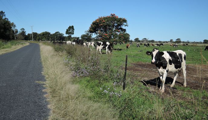
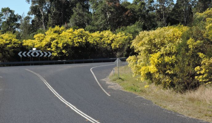
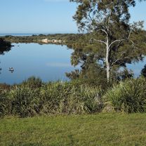
We rode out of our accommodation at Sawtell caravan park on a still and cloudless morning, following Lyons Rd over the new Motorway and onto the old highway Pine creek way. There are multiple alternative backroad routes to Bellingen from Sawtell. We chose to go up Gleniffer Rd. After we passed the semi-rural housing blocks and businesses most of this was a pleasant shady ride through the forest. Soon we were riding past the colony of grey-headed flying fox on the island and across the Bellinger river into Bellingen for obligatory coffee and cake stop. from Bellingen we took Bowraville road, a moderately steep climb but quite rideable and very quiet, traffic wise. After dropping down towards the Kalang river, we then turned onto South Arm Rd, a tiny narrow rd that has some pretence at being sealed. All of a sudden there was a large roar and a giant logging truck was headed towards us as we climbed a steep section. Fortunately this was on a wider, straighter section of the road so we got passed without heading for the ditch.I don't think we saw any other traffic until we got back down to the Kalang river flat. We could have headed straight back up the old highway, but I thought it would be nice to head down into the edge of Urunga and up a loop of the Bellinger river. This was extremely pleasant. From Raleigh, we then took the old highway back to the start.
- -:--
- Dauer
- 80,2 km
- Distanz
- 476 m
- Aufstieg
- 476 m
- Abstieg
- ---
- Ø-Tempo
- ---
- Max. Höhe
Fotos von der Route
Routenqualität
Wegtypen und Untergründe entlang der Route
Wegtypen
Straße
62,6 km
(78 %)
Vielbefahrene Straße
15,5 km
(19 %)
Untergründe
Befestigt
76,2 km
(95 %)
Unbefestigt
4 km
(5 %)
Asphalt
64,5 km
(80 %)
Befestigt (undefiniert)
10,8 km
(13 %)
Weiter mit Bikemap
Diese Radroute verwenden, bearbeiten oder herunterladen
Du möchtest Sawtell to Bellingen loop fahren oder sie für deine eigene Reise anpassen? Folgendes kannst du mit dieser Bikemap-Route machen:
Gratis Funktionen
- Speichere diese Route als Favorit oder in einer Sammlung
- Kopiere & plane deine eigene Version dieser Route
- Teile sie in Etappen ein, um eine mehrtägige Tour zu erstellen
- Synchronisiere deine Route mit Garmin oder Wahoo
Premium-Funktionen
Kostenlose Testversion für 3 Tage oder einmalige Zahlung. Mehr über Bikemap Premium.
- Navigiere diese Route auf iOS & Android
- Exportiere eine GPX / KML-Datei dieser Route
- Erstelle deinen individuellen Ausdruck (Jetzt kostenlos ausprobieren)
- Lade diese Route für die Offline-Navigation herunter
Entdecke weitere Premium-Funktionen.
Bikemap Premium aktivierenVon unserer Community
Sawtell: Andere beliebte Routen, die hier beginnen
 Day 7 - Sawtell - Grafton
- Distanz
- 102,3 km
- Aufstieg
- 1.246 m
- Abstieg
- 1.259 m
- Standort
- Sawtell, New South Wales, Australien
 Kookaburra Rd, Sawtell to Magpie Pde, Sawtell
- Distanz
- 28,1 km
- Aufstieg
- 181 m
- Abstieg
- 183 m
- Standort
- Sawtell, New South Wales, Australien
 Route from 16–30 First Ave, Sawtell
- Distanz
- 3,6 km
- Aufstieg
- 30 m
- Abstieg
- 30 m
- Standort
- Sawtell, New South Wales, Australien
 First Avenue 133, Sawtell to Hulberts Lane 3, Toormina
- Distanz
- 1,9 km
- Aufstieg
- 18 m
- Abstieg
- 15 m
- Standort
- Sawtell, New South Wales, Australien
 Recovered Route
- Distanz
- 4,9 km
- Aufstieg
- 36 m
- Abstieg
- 37 m
- Standort
- Sawtell, New South Wales, Australien
 Sawtell to Bellingen loop
- Distanz
- 80,2 km
- Aufstieg
- 476 m
- Abstieg
- 476 m
- Standort
- Sawtell, New South Wales, Australien
 Heron Place 2, Sawtell to Harbour Drive 396, Coffs Harbour
- Distanz
- 10,4 km
- Aufstieg
- 17 m
- Abstieg
- 28 m
- Standort
- Sawtell, New South Wales, Australien
 Kookaburra Rd, Sawtell to Magpie Pde, Sawtell
- Distanz
- 27,3 km
- Aufstieg
- 195 m
- Abstieg
- 194 m
- Standort
- Sawtell, New South Wales, Australien
In der App öffnen


