

SOUTH LAKE UNION - WESTLAKE - MAGNOLIA
Eine Fahrradroute, die in Seattle, Washington, Vereinigte Staaten beginnt.
Übersicht
Über diese Route
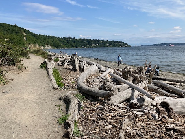
This is one of my all-time favorite rides! Starting at Denny Park downtown you go through South Lake Union on a brand-new protected bike lane, then onto the fabulous protected bike lane that runs along Westlake (which opened in 2016). Next is the flat, serene and lovely Ship Canal multi-use trail, which is much less hectic than the more famous Burke Gilman trail across the water. Continue on protected bike lanes all through Magnolia to the entrance for Discovery Park, which is currently a bicyclist’s paradise because park roads are mostly closed to car traffic due to the pandemic. The fairly steep ride to the top of the park is well worth the view.
- -:--
- Dauer
- 9,3 km
- Distanz
- 131 m
- Aufstieg
- 50 m
- Abstieg
- ---
- Ø-Tempo
- ---
- Max. Höhe

Routenqualität
Wegtypen und Untergründe entlang der Route
Wegtypen
Radweg
5,4 km
(58 %)
Ruhige Straße
1,3 km
(14 %)
Untergründe
Befestigt
9,2 km
(99 %)
Asphalt
6,2 km
(66 %)
Beton
2,3 km
(25 %)
Weiter mit Bikemap
Diese Radroute verwenden, bearbeiten oder herunterladen
Du möchtest SOUTH LAKE UNION - WESTLAKE - MAGNOLIA fahren oder sie für deine eigene Reise anpassen? Folgendes kannst du mit dieser Bikemap-Route machen:
Gratis Funktionen
- Speichere diese Route als Favorit oder in einer Sammlung
- Kopiere & plane deine eigene Version dieser Route
- Synchronisiere deine Route mit Garmin oder Wahoo
Premium-Funktionen
Kostenlose Testversion für 3 Tage oder einmalige Zahlung. Mehr über Bikemap Premium.
- Navigiere diese Route auf iOS & Android
- Exportiere eine GPX / KML-Datei dieser Route
- Erstelle deinen individuellen Ausdruck (Jetzt kostenlos ausprobieren)
- Lade diese Route für die Offline-Navigation herunter
Entdecke weitere Premium-Funktionen.
Bikemap Premium aktivierenVon unserer Community
Seattle: Andere beliebte Routen, die hier beginnen
 Stop by work then get beer and drink beer in park loop
- Distanz
- 29,3 km
- Aufstieg
- 294 m
- Abstieg
- 295 m
- Standort
- Seattle, Washington, Vereinigte Staaten
 Bridge2Bridge
- Distanz
- 34,3 km
- Aufstieg
- 448 m
- Abstieg
- 449 m
- Standort
- Seattle, Washington, Vereinigte Staaten
 2802 NW 61st St, Seattle to 2811 NW 61st St, Seattle
- Distanz
- 61,5 km
- Aufstieg
- 6 m
- Abstieg
- 35 m
- Standort
- Seattle, Washington, Vereinigte Staaten
 Lake Washington Route
- Distanz
- 88,7 km
- Aufstieg
- 495 m
- Abstieg
- 512 m
- Standort
- Seattle, Washington, Vereinigte Staaten
 Cedar River Trail to Snoqualmie to Home
- Distanz
- 124,9 km
- Aufstieg
- 824 m
- Abstieg
- 839 m
- Standort
- Seattle, Washington, Vereinigte Staaten
 Magnolia/Discovery Park Hidden Areas and Great Climbs
- Distanz
- 34,9 km
- Aufstieg
- 530 m
- Abstieg
- 530 m
- Standort
- Seattle, Washington, Vereinigte Staaten
 Burke Gilman + Sammamish River
- Distanz
- 37,6 km
- Aufstieg
- 55 m
- Abstieg
- 76 m
- Standort
- Seattle, Washington, Vereinigte Staaten
 Snoqualmie Loop
- Distanz
- 117 km
- Aufstieg
- 824 m
- Abstieg
- 824 m
- Standort
- Seattle, Washington, Vereinigte Staaten
In der App öffnen