

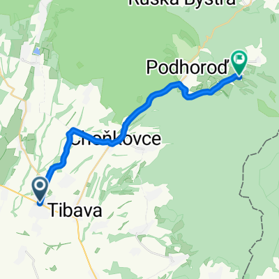
Sobrance-Tibava-Podhoroď-Beňatina-Inovce-Ruský Hrabovec-Podhoroď-Choňkovce-Baškovce-Sobrance
Eine Fahrradroute, die in Sobrance, Košický kraj, Slowakei beginnt.
Übersicht
Über diese Route
- -:--
- Dauer
- 46,4 km
- Distanz
- 542 m
- Aufstieg
- 542 m
- Abstieg
- ---
- Ø-Tempo
- ---
- Max. Höhe

Routenqualität
Wegtypen und Untergründe entlang der Route
Wegtypen
Straße
10,2 km
(22 %)
Ruhige Straße
8,8 km
(19 %)
Untergründe
Befestigt
3,7 km
(8 %)
Asphalt
3,7 km
(8 %)
Undefiniert
42,7 km
(92 %)
Highlights der Route
POIs entlang der Route
Interessanter Ort nach 17,8 km
Beňatina lom
Interessanter Ort nach 31,2 km
Podhoroď - hrad Tibava
Weiter mit Bikemap
Diese Radroute verwenden, bearbeiten oder herunterladen
Du möchtest Sobrance-Tibava-Podhoroď-Beňatina-Inovce-Ruský Hrabovec-Podhoroď-Choňkovce-Baškovce-Sobrance fahren oder sie für deine eigene Reise anpassen? Folgendes kannst du mit dieser Bikemap-Route machen:
Gratis Funktionen
- Speichere diese Route als Favorit oder in einer Sammlung
- Kopiere & plane deine eigene Version dieser Route
- Synchronisiere deine Route mit Garmin oder Wahoo
Premium-Funktionen
Kostenlose Testversion für 3 Tage oder einmalige Zahlung. Mehr über Bikemap Premium.
- Navigiere diese Route auf iOS & Android
- Exportiere eine GPX / KML-Datei dieser Route
- Erstelle deinen individuellen Ausdruck (Jetzt kostenlos ausprobieren)
- Lade diese Route für die Offline-Navigation herunter
Entdecke weitere Premium-Funktionen.
Bikemap Premium aktivierenVon unserer Community
Sobrance: Andere beliebte Routen, die hier beginnen
 Sobrance- Baškovce- Choňkovce- Beňatina
- Distanz
- 18,3 km
- Aufstieg
- 369 m
- Abstieg
- 25 m
- Standort
- Sobrance, Košický kraj, Slowakei
 Sobrance- Bl.Polianka- Senian. rybníky (pozorovateľne vtáctva)
- Distanz
- 24,7 km
- Aufstieg
- 4 m
- Abstieg
- 20 m
- Standort
- Sobrance, Košický kraj, Slowakei
 Sobrance-Tibava-Podhoroď-Beňatina-Inovce-Ruský Hrabovec-Podhoroď-Choňkovce-Baškovce-Sobrance
- Distanz
- 46,4 km
- Aufstieg
- 542 m
- Abstieg
- 542 m
- Standort
- Sobrance, Košický kraj, Slowakei
 Po lesných cestách I
- Distanz
- 69,3 km
- Aufstieg
- 987 m
- Abstieg
- 985 m
- Standort
- Sobrance, Košický kraj, Slowakei
 Slovensko1
- Distanz
- 366,7 km
- Aufstieg
- 2.063 m
- Abstieg
- 1.671 m
- Standort
- Sobrance, Košický kraj, Slowakei
 Sobrance- Choňkovce- Beňatina- Inovce
- Distanz
- 20,8 km
- Aufstieg
- 454 m
- Abstieg
- 85 m
- Standort
- Sobrance, Košický kraj, Slowakei
 Vihorlát Keleti oldal
- Distanz
- 89,3 km
- Aufstieg
- 907 m
- Abstieg
- 906 m
- Standort
- Sobrance, Košický kraj, Slowakei
 Podhoroď-Beňatina-Inovce-Ruský Hrabovec-Podhoroď
- Distanz
- 19,7 km
- Aufstieg
- 407 m
- Abstieg
- 407 m
- Standort
- Sobrance, Košický kraj, Slowakei
In der App öffnen