

Race report - Cycle To The Sun
Eine Fahrradroute, die in Paia, Hawaii, United States of America beginnt.
Übersicht
Über diese Route
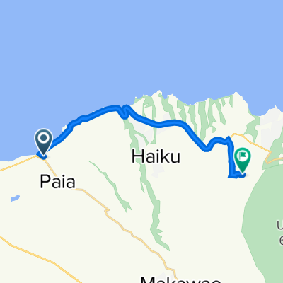
Cycle to the Sun is an annual race from the seaside town of Paia, Maui up to the Haleakala Crater at an altitude of 3,041 m, covering a distance of 58 km.
Whilst the locals know the course well, I had not had the opportunity to see the course let alone ride it, therefore my only point of reference was the GPS data I had uploaded to my GPS bike computer, providing me with a constant reminder of the distance and elevation that lay ahead.
he highest ride that I had done to date was Col du Galibier in the summer of 2009, rising 1,950 m over 50 km from and altitude of 700 m in Le Bourg-d’Oisans to top of the Galibier at 2,650 m. I was therefore in uncharted territory, unsure about how the altitude and distance will affect my performance.
The race started shortly after 6:30 am from Paia where the shimmering Volcano formed the backdrop and a gentle reminder of just how far and high we had to go. The pace was very fast right from the start, creating breaks that formed small groups with in the first 5 km. With the lead group disappearing quickly up the road I had settled into the 4th group with 12-15 riders. The pace was consistent for the first 20 km at around 20 km/h with a gradient of 3-5%.
The plan was to stay with a strong group for as long as possible in order to sustain a good average speed before the gradient rises further. The plan only lasted 25 km at 1,100 m elevation when I was dropped. From there onwards it would largely be a solo ride to the top, except for the occasional rider dropped from the fragmented groups up the road, and riders coming up from behind.
The gradient continued to rise and the constant grind on my 34/25 was enough to keep my heart rate well above 150 bpm most of the way. It was difficult to ignore the beautiful scenery along the course. Rising from sea level in Paia, with the course cutting through some scenic forests before gradually transforming into the barren lunar landscape of the volcano above the clouds.
Fellow NeilPryde rider Peter Slate from Maui was part of a 2-man relay team with Lorenzo Pedrini from Italy that completed the course in 3:49:25 for first place in the relay category, so we were fortunate to come away from the event with at least one trophy.
With the gradient kicking up to double digits in the last kilometer and the pedals rolling over in slow motion, any chance of achieving a sub 4 hour time was clearly just a distant dream with 3 km to go. My own result was a disappointing 4:15:12 at an average speed of 13.64 km/h. The winning time was an impressive 2:57:08 by Raik Huster from Colorado. Apparently Ryder Hesjedal (Garmin-Transitions) achieved a time of 02:32:51 on 6th January 2009 whilst training on Maui.
The ride itself includes some stunning scenery and arguably the most unique climbing challenge anywhere in the world. Therefore with my first Cycle to the Sun completed, I will hopefully come back next year, physically prepared and psychologically ready to challenge the Haleakala Volcano again.
- -:--
- Dauer
- 56,6 km
- Distanz
- 3.026 m
- Aufstieg
- 0 m
- Abstieg
- ---
- Ø-Tempo
- ---
- Ø-Tempo

Routenqualität
Wegtypen und Untergründe entlang der Route
Wegtypen
Straße
42,3 km
(75 %)
Vielbefahrene Straße
11,6 km
(21 %)
Untergründe
Befestigt
45,1 km
(80 %)
Asphalt
45,1 km
(80 %)
Undefiniert
11,4 km
(20 %)
Weiter mit Bikemap
Diese Radroute verwenden, bearbeiten oder herunterladen
Du möchtest Race report - Cycle To The Sun fahren oder sie für deine eigene Reise anpassen? Folgendes kannst du mit dieser Bikemap-Route machen:
Gratis Funktionen
- Speichere diese Route als Favorit oder in einer Sammlung
- Kopiere & plane deine eigene Version dieser Route
- Synchronisiere deine Route mit Garmin oder Wahoo
Premium-Funktionen
Kostenlose Testversion für 3 Tage oder einmalige Zahlung. Mehr über Bikemap Premium.
- Navigiere diese Route auf iOS & Android
- Exportiere eine GPX / KML-Datei dieser Route
- Erstelle deinen individuellen Ausdruck (Jetzt kostenlos ausprobieren)
- Lade diese Route für die Offline-Navigation herunter
Entdecke weitere Premium-Funktionen.
Bikemap Premium aktivierenVon unserer Community
Paia: Andere beliebte Routen, die hier beginnen
 Paia Vac
- Distanz
- 15,3 km
- Aufstieg
- 377 m
- Abstieg
- 124 m
- Standort
- Paia, Hawaii, USA
 Mount Haleakala Ride uphill
- Distanz
- 81 km
- Aufstieg
- 2.909 m
- Abstieg
- 2.909 m
- Standort
- Paia, Hawaii, USA
 2–18 Mahi Ko St, Paia to Alahao St, Paia
- Distanz
- 12,8 km
- Aufstieg
- 53 m
- Abstieg
- 114 m
- Standort
- Paia, Hawaii, USA
 Relaxed route in Paia
- Distanz
- 2,8 km
- Aufstieg
- 37 m
- Abstieg
- 49 m
- Standort
- Paia, Hawaii, USA
 Paia - Haleakala
- Distanz
- 114,1 km
- Aufstieg
- 3.038 m
- Abstieg
- 3.038 m
- Standort
- Paia, Hawaii, USA
 Paia - Kahului Airport
- Distanz
- 13,6 km
- Aufstieg
- 50 m
- Abstieg
- 53 m
- Standort
- Paia, Hawaii, USA
 Haleakala
- Distanz
- 117,6 km
- Aufstieg
- 3.086 m
- Abstieg
- 3.081 m
- Standort
- Paia, Hawaii, USA
 West Maui Loop from Paia
- Distanz
- 120,2 km
- Aufstieg
- 690 m
- Abstieg
- 691 m
- Standort
- Paia, Hawaii, USA
In der App öffnen