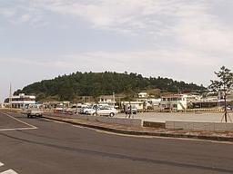
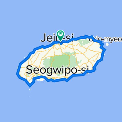
Jeju-Si<span> </span>- Hallim Center<br /> <span>Jeju-Do Bicycle Course Roadbooks sponsored by ASIANA
AIRLINES and </span><span>KTO </span><span>Korea Tourism Organisation </span>
<table border="0" cellspacing="0" cellpadding="0" width="283">
<tbody>
<tr style="height: 15pt;" height="20">
<td class="xl68" style="height: 15pt; width: 26pt;" width="35" height="20">Sum:</td>
<td class="xl68" style="width: 26pt;" width="34">Part:</td>
<td class="xl69" style="width: 161pt;" width="214"><br /></td>
</tr>
<tr style="height: 24pt;" height="32">
<td class="xl70" style="height: 24pt;" height="32">0</td>
<td class="xl70">0</td>
<td class="xl67" style="width: 161pt;" width="214">Start at RAMADA PLAZA HOTEL and
turn right Tab Dong Ro Street</td>
</tr>
<tr style="height: 24pt;" height="32">
<td class="xl70" style="height: 24pt;" height="32">0,1</td>
<td class="xl70">0,1</td>
<td class="xl67" style="width: 161pt;" width="214">turn left and follow Tab Dong Ro
Street<span> </span></td>
</tr>
<tr style="height: 24pt;" height="32">
<td class="xl70" style="height: 24pt;" height="32">0,3</td>
<td class="xl70">0,2</td>
<td class="xl67" style="width: 161pt;" width="214">turn right and cross (P) area
and follow Dong Han Du Gi Gil</td>
</tr>
<tr style="height: 24pt;" height="32">
<td class="xl70" style="height: 24pt;" height="32">0,4</td>
<td class="xl70">0,1</td>
<td class="xl67" style="width: 161pt;" width="214">at the park turn left and follow
foot path to the Yongyeon footbridge</td>
</tr>
<tr style="height: 24pt;" height="32">
<td class="xl70" style="height: 24pt;" height="32">0,5</td>
<td class="xl70">0,1</td>
<td class="xl67" style="width: 161pt;" width="214">turn right and cross the
Yongyeon footbridge to Yong Un Ro Street</td>
</tr>
<tr style="height: 36pt;" height="48">
<td class="xl70" style="height: 36pt;" height="48">0,6</td>
<td class="xl70">0,1</td>
<td class="xl67" style="width: 161pt;" width="214">turn right and follow Yong Un Ro
Street and then follow path at the shoreline</td>
</tr>
<tr style="height: 36pt;" height="48">
<td class="xl70" style="height: 36pt;" height="48">0,9</td>
<td class="xl70">0,3</td>
<td class="xl67" style="width: 161pt;" width="214">POI: Yongduam Rock (Dragonhead)
<br /> follow Yongduam Gil<br /> POI: Youngduam Rock (Dragonhead)</td>
</tr>
<tr style="height: 24pt;" height="32">
<td class="xl70" style="height: 24pt;" height="32">1</td>
<td class="xl70">0,1</td>
<td class="xl67" style="width: 161pt;" width="214">go straight on and follow Seo
Hae An Ro Coastal Road</td>
</tr>
<tr style="height: 24pt;" height="32">
<td class="xl70" style="height: 24pt;" height="32">2</td>
<td class="xl70">1</td>
<td class="xl67" style="width: 161pt;" width="214">turn right: keep following the
Seo Hae An Ro Coastal Road</td>
</tr>
<tr style="height: 15pt;" height="20">
<td class="xl70" style="height: 15pt;" height="20">5,7</td>
<td class="xl70">3,7</td>
<td class="xl67" style="width: 161pt;" width="214">POI: Mt. Dodubong</td>
</tr>
<tr style="height: 24pt;" height="32">
<td class="xl70" style="height: 24pt;" height="32">6,4</td>
<td class="xl70">0,7</td>
<td class="xl67" style="width: 161pt;" width="214">Do Du Dong Village: turn left
and follow Do Du Hang Ro Street</td>
</tr>
<tr style="height: 15pt;" height="20">
<td class="xl70" style="height: 15pt;" height="20">6,6</td>
<td class="xl70">0,2</td>
<td class="xl67" style="width: 161pt;" width="214">Reach Do Ri Ro Street and turn
right</td>
</tr>
<tr style="height: 15pt;" height="20">
<td class="xl70" style="height: 15pt;" height="20">7,8</td>
<td class="xl70">1,2</td>
<td class="xl67" style="width: 161pt;" width="214">POI: Iho Beach</td>
</tr>
<tr style="height: 15pt;" height="20">
<td class="xl70" style="height: 15pt;" height="20">8</td>
<td class="xl70">0,2</td>
<td class="xl67" style="width: 161pt;" width="214">reach N 1132 and follow to the
right</td>
</tr>
<tr style="height: 24pt;" height="32">
<td class="xl70" style="height: 24pt;" height="32">13,4</td>
<td class="xl70">5,4</td>
<td class="xl67" style="width: 161pt;" width="214">Leave N 1132 to the right and
follow Hagwi-Aewol Coastal Road</td>
</tr>
<tr style="height: 15pt;" height="20">
<td class="xl70" style="height: 15pt;" height="20">22,6</td>
<td class="xl70">9,2</td>
<td class="xl67" style="width: 161pt;" width="214">pass Aewol Harbour and turn left</td>
</tr>
<tr style="height: 48pt;" height="64">
<td class="xl70" style="height: 48pt;" height="64">22,9</td>
<td class="xl70">0,3</td>
<td class="xl67" style="width: 161pt;" width="214">turn right and follow road<br /> turn to one`s<span> </span>left and leave the (P)
Area and return to N 1132 City Road, turn right</td>
</tr>
<tr style="height: 15pt;" height="20">
<td class="xl70" style="height: 15pt;" height="20">24,1</td>
<td class="xl70">1,2</td>
<td class="xl67" style="width: 161pt;" width="214">Reach N 1132 and follow</td>
</tr>
<tr style="height: 36pt;" height="48">
<td class="xl70" style="height: 36pt;" height="48">25,4</td>
<td class="xl70">1,3</td>
<td class="xl67" style="width: 161pt;" width="214">pass 4-way-intersection<br /> Optional POI: turn right and visit Gwakji Beach</td>
</tr>
<tr style="height: 24pt;" height="32">
<td class="xl70" style="height: 24pt;" height="32">27,2</td>
<td class="xl70">1,8</td>
<td class="xl67" style="width: 161pt;" width="214">Leave N 1132 to the right and
follow Gwi Deog-Hallim Coastal Road</td>
</tr>
<tr style="height: 15pt;" height="20">
<td class="xl70" style="height: 15pt;" height="20">34,7</td>
<td class="xl70">7,5</td>
<td class="xl69">Reach Hallim Center</td>
</tr>
</tbody>
</table>