

Healthy Road へルーシロード
Eine Fahrradroute, die in Hatogaya-honchō, Präfektur Saitama, Japan beginnt.
Übersicht
Über diese Route
Dies ist eine sehr interessante Route mit vielen landschaftlich reizvollen Stellen. Man kann nicht anders, als anzuhalten, um schnell ein Foto vom entfernten Mt. Fuji oder den Toren der verschiedenen Tempel zu machen.
Die Strecke ist sehr flach und auch sehr beliebt, deshalb ist mit Fußgängerverkehr zu rechnen. Es gibt einige holprige Abschnitte, besonders um die 3-km-Marke und zwischen 5 und 6 km, aber es gibt alternative Straßen, die senkrecht zur Route verlaufen, wobei man allerdings auf die Aussicht etwas verzichten muss.
Ich habe die Route an einem Bahnübergang beendet, aber man kann noch weiterfahren. Man muss nur mit vielen schmalen Wegen und Stopps an Kreuzungen rechnen. Ich bin erst einmal an einem regnerischen Abend über den Übergang hinaus gefahren, da war es ziemlich verkehrsfrei. Ich kann mir aber vorstellen, dass es an einem sonnigen Tag sehr belebt ist und man dann nur im Schneckentempo fahren kann oder manche Fußgänger auf den engen Abschnitten stören könnte. Das ist also etwas, das man beachten sollte.
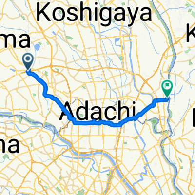
- 1 h 25 min
- Dauer
- 13,6 km
- Distanz
- 36 m
- Aufstieg
- 32 m
- Abstieg
- 9,6 km/h
- Ø-Tempo
- ---
- Max. Höhe
Routenqualität
Wegtypen und Untergründe entlang der Route
Wegtypen
Zufahrtsstraße
6,3 km
(46 %)
Radweg
3,3 km
(24 %)
Untergründe
Befestigt
0,7 km
(5 %)
Asphalt
0,7 km
(5 %)
Undefiniert
12,9 km
(95 %)
Weiter mit Bikemap
Diese Radroute verwenden, bearbeiten oder herunterladen
Du möchtest Healthy Road へルーシロード fahren oder sie für deine eigene Reise anpassen? Folgendes kannst du mit dieser Bikemap-Route machen:
Gratis Funktionen
- Speichere diese Route als Favorit oder in einer Sammlung
- Kopiere & plane deine eigene Version dieser Route
- Synchronisiere deine Route mit Garmin oder Wahoo
Premium-Funktionen
Kostenlose Testversion für 3 Tage oder einmalige Zahlung. Mehr über Bikemap Premium.
- Navigiere diese Route auf iOS & Android
- Exportiere eine GPX / KML-Datei dieser Route
- Erstelle deinen individuellen Ausdruck (Jetzt kostenlos ausprobieren)
- Lade diese Route für die Offline-Navigation herunter
Entdecke weitere Premium-Funktionen.
Bikemap Premium aktivierenVon unserer Community
Hatogaya-honchō: Andere beliebte Routen, die hier beginnen
 Hatogaya-honchō - Matsudo (1/2)
- Distanz
- 24,2 km
- Aufstieg
- 44 m
- Abstieg
- 49 m
- Standort
- Hatogaya-honchō, Präfektur Saitama, Japan
 30, Kawaguchi to 5-chōme 12, Kawaguchi
- Distanz
- 3 km
- Aufstieg
- 22 m
- Abstieg
- 23 m
- Standort
- Hatogaya-honchō, Präfektur Saitama, Japan
 2丁目 23, 川口市 to 2丁目 23, さいたま市
- Distanz
- 4,1 km
- Aufstieg
- 3 m
- Abstieg
- 0 m
- Standort
- Hatogaya-honchō, Präfektur Saitama, Japan
 18-17, Toneri 1-Chōme, Adachi to 9-7, Nakakasai 6-Chōme, Edogawa
- Distanz
- 22,7 km
- Aufstieg
- 106 m
- Abstieg
- 110 m
- Standort
- Hatogaya-honchō, Präfektur Saitama, Japan
 763−2, 川口市 to 1丁目 20, 秩父市
- Distanz
- 94 km
- Aufstieg
- 3.113 m
- Abstieg
- 2.878 m
- Standort
- Hatogaya-honchō, Präfektur Saitama, Japan
 BRM322-1
- Distanz
- 153,1 km
- Aufstieg
- 990 m
- Abstieg
- 366 m
- Standort
- Hatogaya-honchō, Präfektur Saitama, Japan
 芝川サイクリングロード〜見沼代用水東縁〜見沼自然公園〜〃西縁
- Distanz
- 31,6 km
- Aufstieg
- 78 m
- Abstieg
- 66 m
- Standort
- Hatogaya-honchō, Präfektur Saitama, Japan
 13 芝川で「農」を体感するルート
- Distanz
- 12,5 km
- Aufstieg
- 23 m
- Abstieg
- 25 m
- Standort
- Hatogaya-honchō, Präfektur Saitama, Japan
In der App öffnen